
Why Hurricane Erin Flooded the Jersey Shore Without Ever Coming Ashore
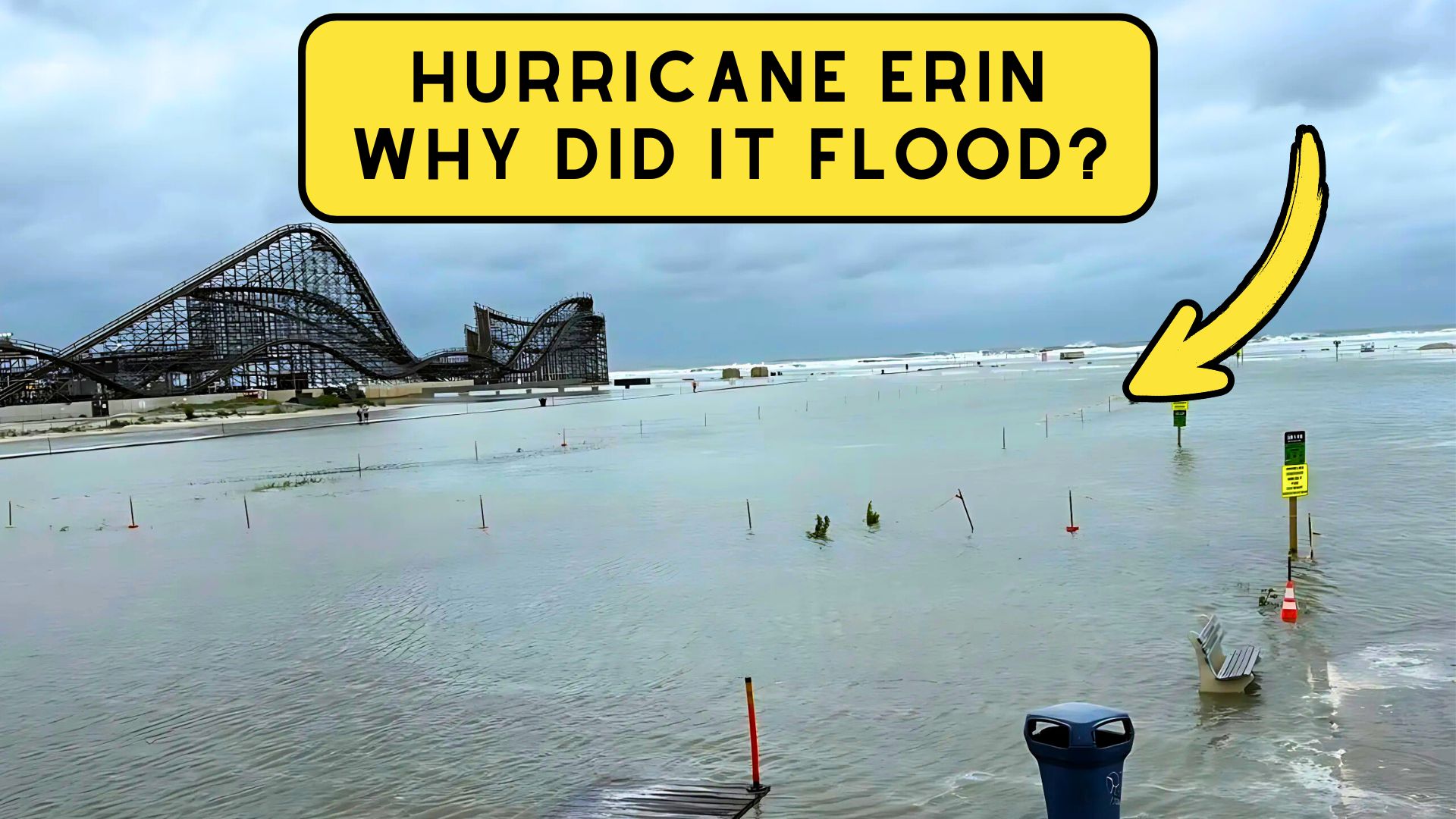
If you were in Wildwood, Cape May, or anywhere along the Jersey Shore this past week, you probably noticed the unusually high water levels, the rough surf, and even some beach erosion.
What made it surprising is that Hurricane Erin never came close to making landfall.
Why Hurricane Erin Flooded the Jersey Shore Without Ever Coming Ashore
So how did a storm sitting more than 350 miles offshore end up flooding our streets and closing our beaches?
The answer comes down to two big factors: Erin’s massive size and its slow movement up the coast. (Thank you to the National Weather Service for these Answers)
By Friday Erin had grown into one of the largest storms in recent memory.
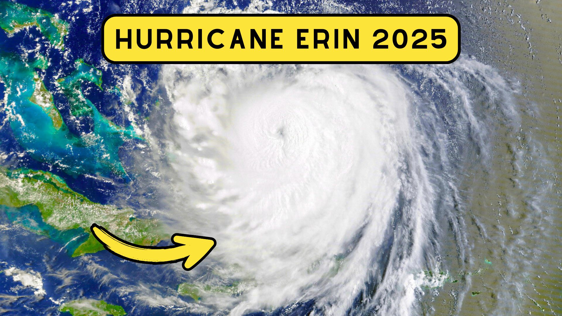 Its tropical-storm-force winds stretched nearly 600 miles across, putting it in the top 10 percent of storms ever measured in the North Atlantic.
Even though the eye of the storm stayed far out at sea, the outer wind field reached waters right off our coastline.
That wide circulation gave Erin the ability to churn the ocean like a massive paddle, sending its effects hundreds of miles away.
 Because Erin was moving so slowly, it had plenty of time to build up waves. Offshore buoys near the Outer Banks picked up seas as high as 45 feet.
Those massive waves didn’t just stay out there. They spread outward in the form of powerful, long-period swells that made their way straight for New Jersey.
Closer to home, buoys off Delaware and New Jersey measured waves between 10 and 17 feet.
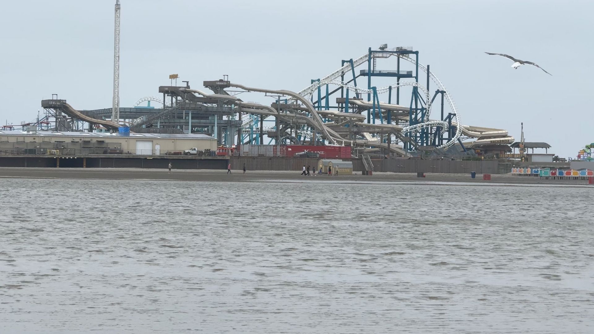
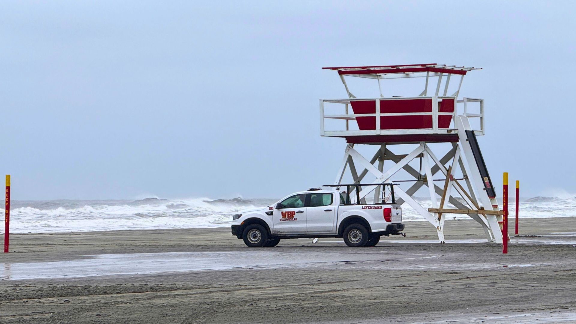
 If you walked the Wildwood Boardwalk or stopped by the seawall in North Wildwood this week, you probably saw it firsthand: waves slamming the shoreline, lifeguards waving people out of the surf, and beaches being carved back by the water.
As the Wildwood Video Archie was reporting on the ground, we noticed waves at least 10 feet.
Also See: Ocean City Council Blocks Wonderland Pier Hotel Plan; ICONA to Sell
It wasn’t just the waves. The timing of Erin’s swells lined up with a New Moon, which brings naturally higher tides.
That meant water levels were already elevated before the storm’s energy even reached us.
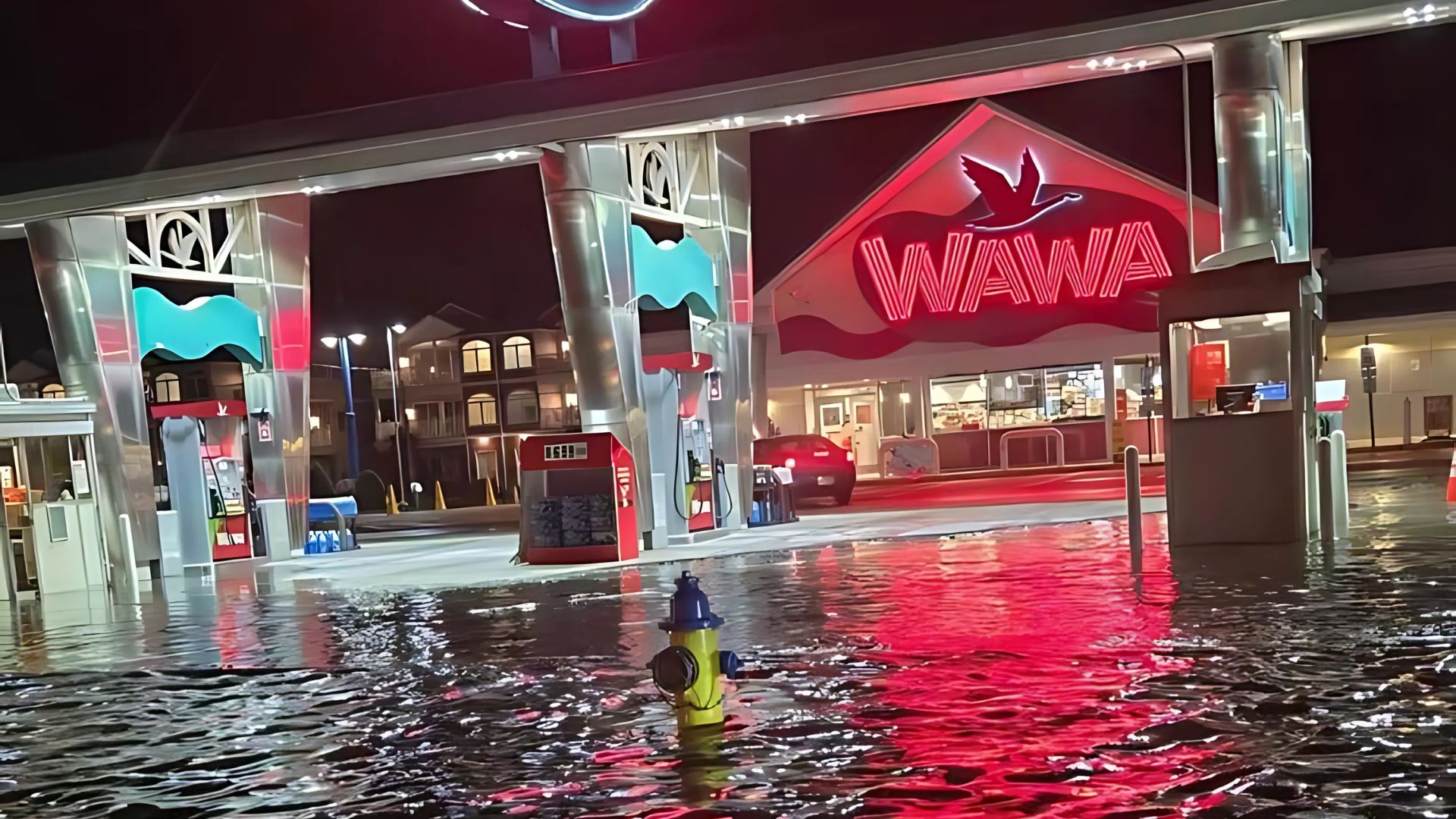
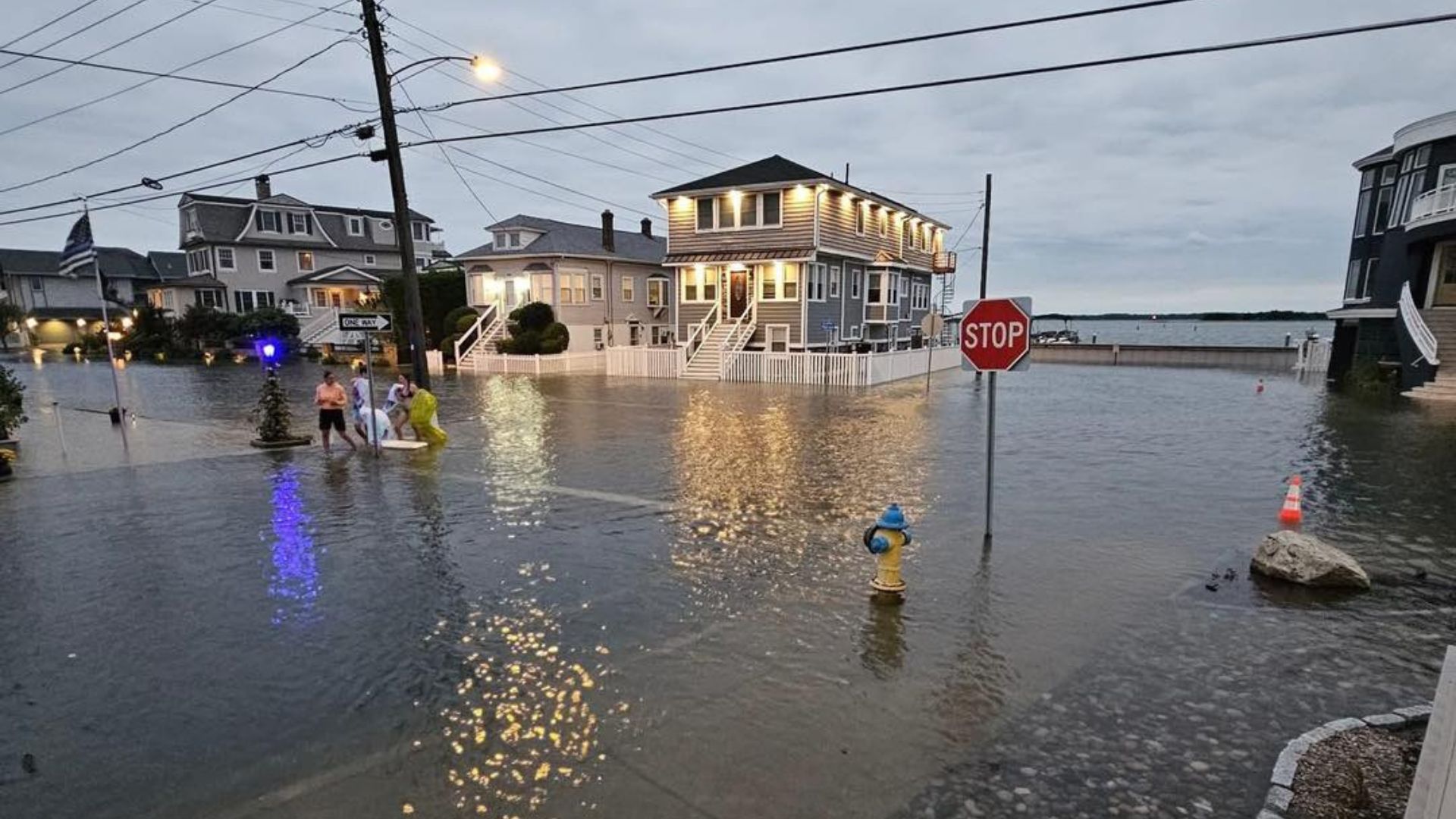
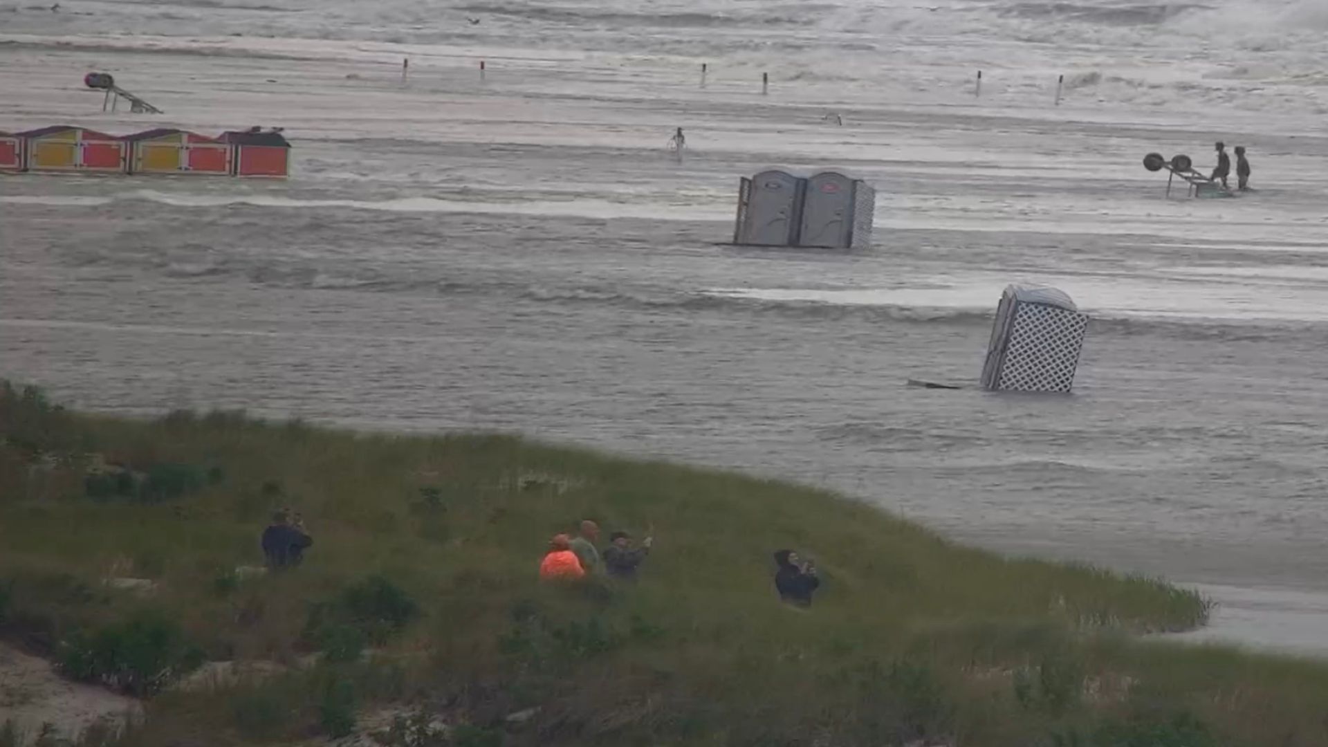 When Erin’s swells piled on top of those tides, it pushed an extra one to three feet of water into the coastline. Back-bay streets in places like North Wildwood, Stone Harbor, Ocean City, and Margate saw repeated flooding during high tide.
The bulk of this occurred at 8:01PM on the 21st when we experienced our high-tide. This created a messed in North Wildwood which placed several feet of water on Delaware Ave, Park Blvd and caused the closure of the George Redding Bridge.
In Margate, firefighters had to pull several people from stalled vehicles when water covered Amherst Avenue.
Unlike many coastal storms, local winds were not the biggest factor here. We didn’t really see much of a push of water on the shore via the winds, which helped us in a way.
 Why Wildwood’s Beaches Flooded So Quickly
One reason Wildwood felt these impacts so strongly is the flat, wide layout of the beaches. Unlike steeper beaches that create a natural barrier against waves, Wildwood’s flat shoreline allows water to travel farther inland once it overtops the berm.
That meant large sections of beach filled with ocean water, forcing lifeguards to keep people well back from the surf line. In some cases, the ocean water ran right up to the dune line and into beach entrances, creating scenes that visitors usually only see during a strong nor’easter.
This makes people ask the question, should an island-wide dune system be built to protect if we do have a direct hit of a hurricane.
Governor Phil Murphy declared a state of emergency for all of New Jersey on August 21, citing risks of waves up to 17 feet, winds near 50 mph, and widespread flooding. Beaches across Cape May and Atlantic counties closed to swimmers as lifeguards warned of life-threatening rip currents.
 Here in South Jersey, the impacts were clear:
- Flooded streets in Wildwood, Ocean City, Margate, and Sea Isle City
- Water rescues as people got stuck in rising water, or swept out to see (those who ignored the warnings)
- Beach erosion along stretches of the Wildwoods and other barrier islands
Hurricane Erin is proof that a storm doesn’t need to make landfall to leave its mark.
The combination of its size, slow movement, and bad timing with the moon’s cycle created dangerous conditions for the entire Jersey Shore.
For residents and visitors, it’s a reminder: even when a hurricane looks like it’s “safely offshore,” South Jersey can still feel the full force of the ocean.
Below is our article breaking down the info above. Before you watch please do consider subscribing.