
5 Inches or More Snow Possible in South Jersey – 7PM Update
A winter storm is expected to impact South Jersey beginning Saturday night and continuing through Sunday morning, bringing accumulating snow followed by a prolonged stretch of bitter cold temperatures, according to the National Weather Service office in Mount Holly.
Forecasters say conditions have worsened enough to prompt an upgrade from a Winter Weather Advisory to a Winter Storm Warning for Camden and Gloucester counties, along with portions of Burlington County.
Coastal and marine hazards have also increased, with gale warnings now in effect for the Atlantic coastal waters and Delaware Bay.
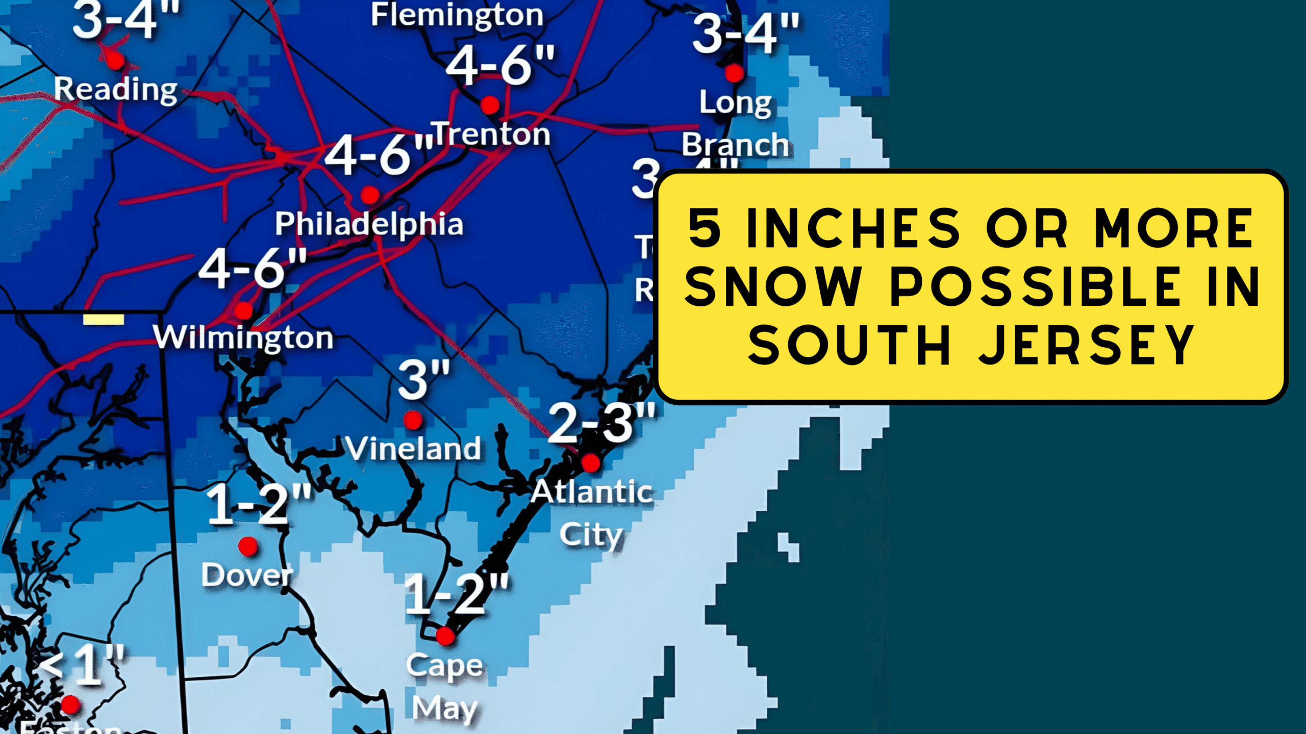
5 Inches or More Snow Possible in South Jersey
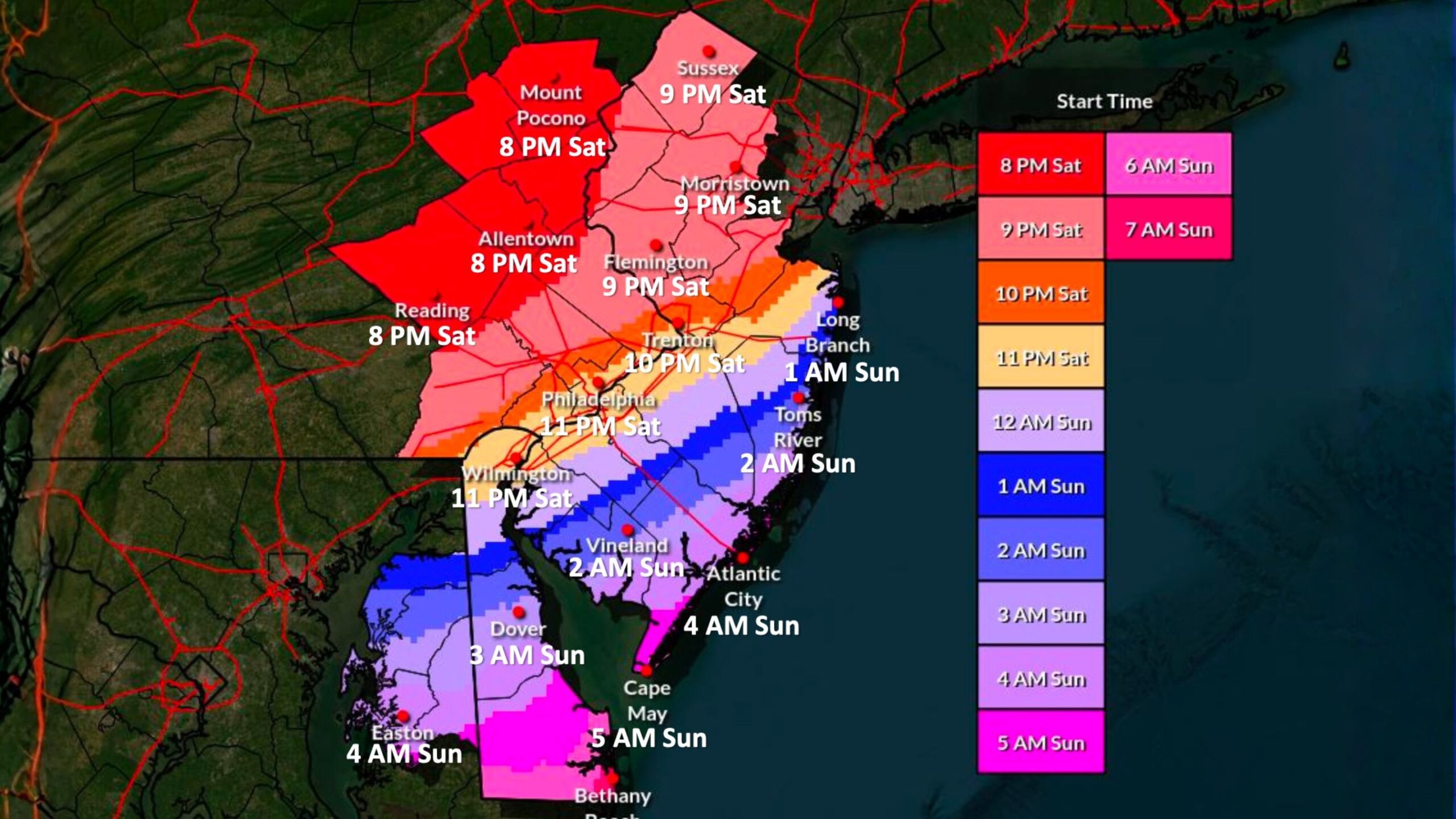
Snowfall Timeline for South Jersey
Precipitation is expected to begin Saturday evening as light rain or a rain and snow mix, especially near the coast and southeast of the I-95 corridor. As colder air moves in overnight, precipitation will transition to all snow.
For much of South Jersey, snow onset is expected between approximately 1 a.m. and 5 a.m. Sunday, with Cape May County seeing snow closer to daybreak Sunday morning. Snowfall intensity may briefly increase early Sunday, with periods of moderate snowfall possible.
 How Much Snow Is Expected
The National Weather Service is forecasting widespread snowfall totals of 1 to 5 inches across South Jersey, with a higher-end zone of 5 inches or more possible closer to the I-95 corridor and parts of Camden and Gloucester counties. Cape May County, Atlantic County could see 1-2 Inches of Snow.
Also See: New Park is Coming to Cape May County – County Park East
Farther south toward Atlantic City, Cape May, and coastal Cumberland County, snowfall totals are expected to be lower, generally in the 1 to 3 inch range. However, even modest accumulations could lead to slick and snow-covered roads, particularly during the Sunday morning hours
 Road and Travel Impacts
Snow-covered and slippery roads are expected across the region overnight into Sunday morning. The National Weather Service cautions that early rain may wash away road pretreatment before the changeover to snow, potentially worsening travel conditions.
As winds increase later Sunday, areas of blowing snow are possible, which could cause roads to become snow-covered again even after plowing and treatment operations begin
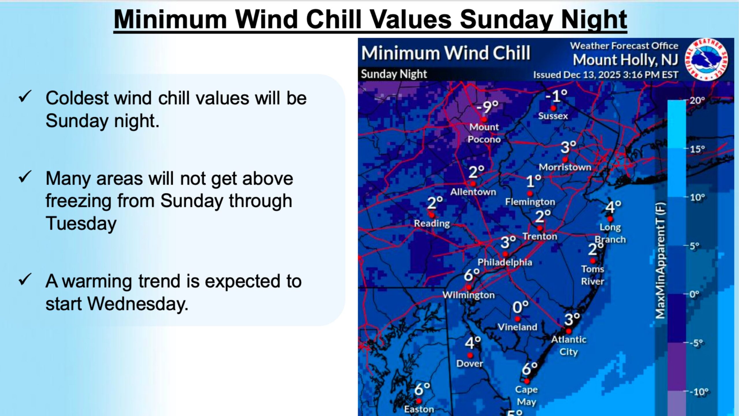 Bitter Cold and Dangerous Wind Chills
Behind the storm, a surge of Arctic air will bring dangerously cold temperatures from Sunday night through Tuesday. Many areas of South Jersey may struggle to rise above freezing for several days.
Wind chill values Sunday night into Monday morning are expected to fall into the single digits, with some locations near zero. Prolonged exposure could result in frostbite or hypothermia without proper cold-weather protection
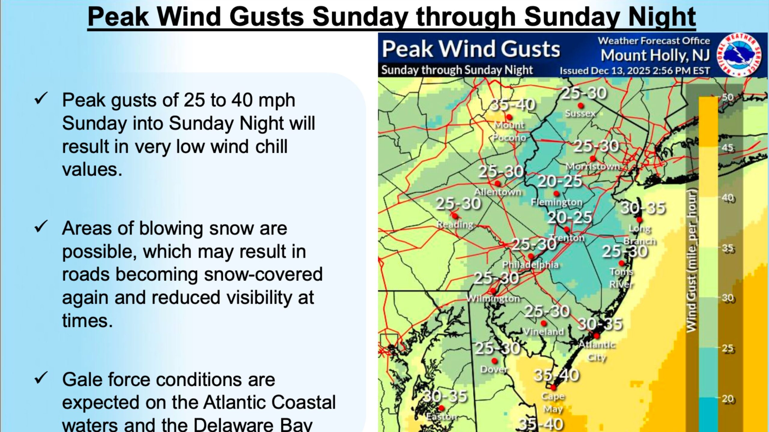
 Strong Winds and Coastal Hazards
West to northwest winds will strengthen Sunday into Sunday night, with peak gusts of 25 to 40 mph across the region. These winds will contribute to the dangerously low wind chills and may lead to additional blowing snow issues.
For marine interests, gale force winds and hazardous seas are expected on the Delaware Bay and Atlantic coastal waters adjacent to New Jersey. Freezing spray is also possible Sunday night into Monday, creating dangerous conditions for mariners
What to Expect Next
The National Weather Service notes moderate confidence in snowfall totals but emphasizes that impacts from wind and cold will linger well beyond the snow itself. A warming trend is not expected to begin until midweek.
Residents across South Jersey are urged to monitor forecasts closely, limit travel during periods of snowfall, dress appropriately for extreme cold, and use caution if heading out on the water