
National Weather Service Warns South Jersey and Philadelphia Could See 12 Inches of Snow This Weekend
The National Weather Service (NWS) office in Mount Holly, which oversees forecasts for South Jersey and the Philadelphia region, says confidence is increasing that a major winter storm could bring significant snowfall this weekend, with some areas now showing a high probability of at least 12 inches of snow.
South Jersey and Philadelphia Could See 12 Inches of Snow This Weekend
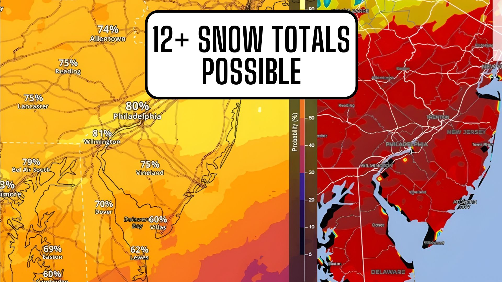
According to a new National Blend of Models probability chart released Wednesday evening, large portions of South Jersey and the Philadelphia metro area fall within zones showing a 60 to 80 percent chance of 12 inches or more of snow over a 72-hour period ending Monday evening.
The chart, issued at 5 p.m. Wednesday, highlights much of eastern Pennsylvania, southern New Jersey, and the Interstate 95 corridor as areas with the greatest risk for heavy snowfall.
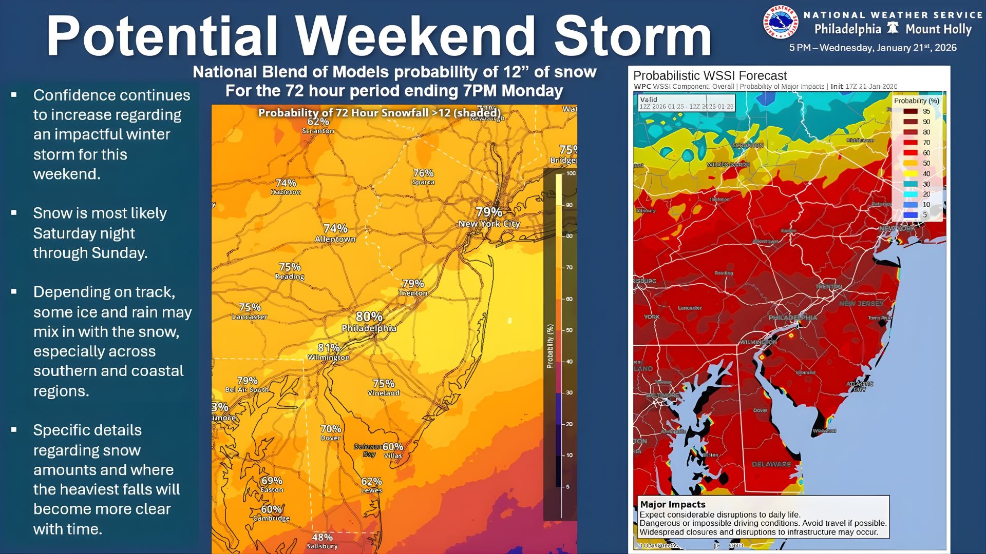 In its briefing, the National Weather Service stated that confidence continues to increase regarding an impactful winter storm, with snow most likely to begin late Saturday night and continue through Sunday.
Forecasters caution that this is a high-impact event, not just a nuisance snow, and that travel disruptions are likely across the region.
The NWS chart specifically shows Philadelphia, Camden County, Burlington County, Gloucester County, and Atlantic County within a zone where probabilities for a foot of snow are no longer considered low-end scenarios.
In Philadelphia itself, probabilities near 75 to 80 percent are displayed on the map, while inland areas of South Jersey show similar confidence levels.
 A separate Probabilistic Winter Storm Severity Index included in the same briefing places South Jersey and southeastern Pennsylvania in the “major impacts” category, meaning dangerous or impossible driving conditions are possible, along with widespread disruptions to daily life. The index warns that road conditions could deteriorate rapidly once snowfall intensifies.
Meteorologists say the primary uncertainty now lies in the exact track of the storm system, which will determine where the heaviest snow bands set up.
A slightly offshore track could still deliver heavy snow to South Jersey and Philadelphia, while a closer coastal track could enhance totals even further.
 The National Weather Service also notes that some mixing with sleet or rain is possible, especially closer to the southern New Jersey coastline, but colder air is expected to dominate for most of the event.
If current trends hold, snowfall rates could exceed one inch per hour at times on Sunday, particularly during the peak of the storm.
PLEASE, be prepared to stay in all day Sunday. We don’t need you on the road during that peak time of the snow storm.