
Major Winter Storm Targets New Jersey With Possible Foot Of Snow
Depending on where you get your weather news from, we’re either going to get 2 inches of snow this weekend or potentially 24 inches. But what are we actually going to be getting?
Well, we’re reaching out to the National Weather Service here at Mount Holly, and below is their latest briefing on the upcoming storm.
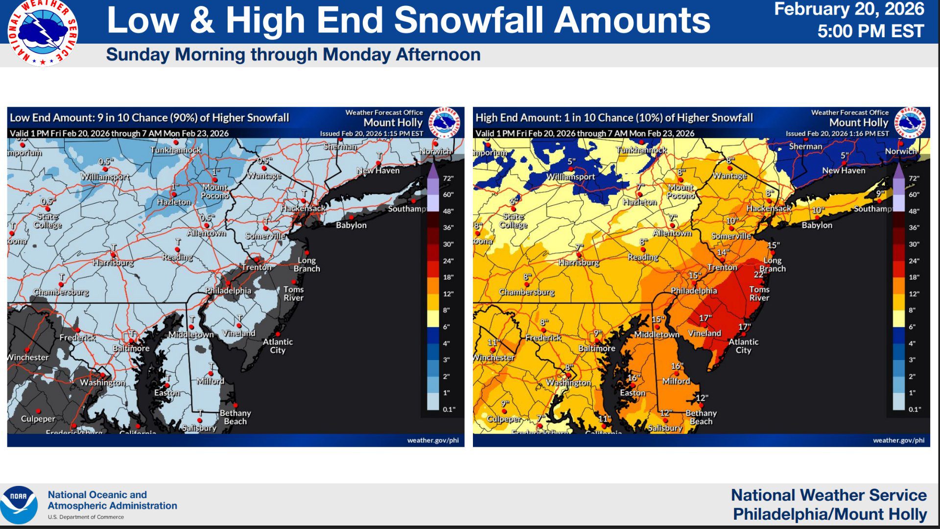
They’re looking at two different charts, and those charts are constantly changing. So everything I’m telling you right now is the latest they came out as of 5 p.m. Eastern time on Friday, February 20th.
 As a reminder, Lent is going on, so no meat tonight.
This will potentially be a significant winter storm that will impact eastern Pennsylvania, New Jersey and Delaware from Sunday through Monday. At this time, the NWA has issued a Winter Storm Watch across the entire region.
NWA says the system will bring moderate to potentially major impacts, including heavy snowfall, strong winds, and coastal flooding.
Also See: Navy Special Ops Boats Spotted In Jersey Back Bays
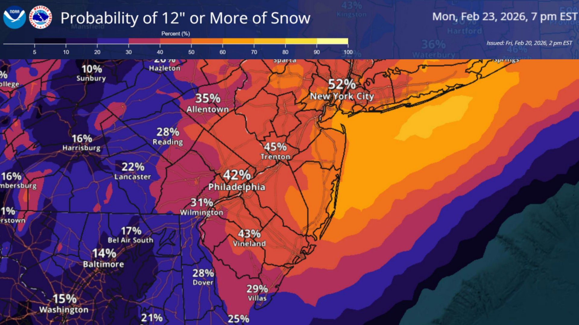
Snow totals exceeding six inches are expected in many locations, creating hazardous travel conditions and the possibility of widespread closures and infrastructure disruptions.
 Storm Timing and Precipitation Type
Precipitation is forecast to begin Sunday morning and continue through Monday afternoon, with the most intense conditions expected Sunday night into Monday morning.
Areas south of the I-78 corridor may initially see light rain Sunday afternoon before a gradual transition to snow moving from south to north. Communities north of I-78 are expected to remain all snow for the duration of the storm.
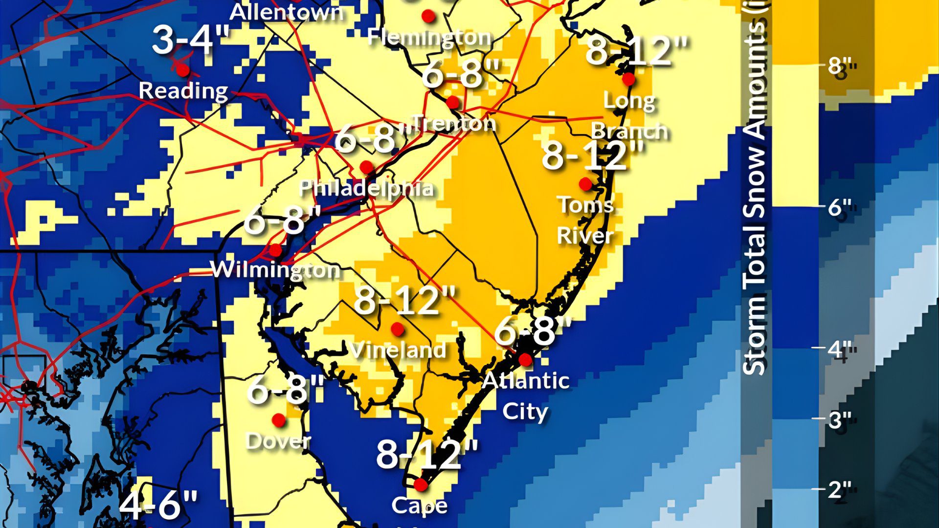
Snowfall Forecast and Totals
New snowfall projections show a clear coastal focus for the heaviest snow.
Southern and coastal New Jersey, including Cape May County, Atlantic County, Cumberland County, and parts of Ocean County, are forecast to receive between 8 and 12 inches of snow. This region sits within the storm’s primary heavy snow band where strong lift and colder air overlap, increasing the potential for higher accumulations.
 Central New Jersey and areas along the I-95 corridor are expected to see 6 to 8 inches of snow, while northern New Jersey totals also generally fall within the same range, though localized variations remain possible.
Snow totals gradually decrease farther west. Eastern Pennsylvania is projected to receive 3 to 6 inches, with lower amounts toward Reading and higher totals closer to the New Jersey border. Delaware and Maryland’s Eastern Shore are forecast to see 4 to 8 inches, with locally higher totals possible near coastal Delaware.
The map suggests a classic coastal storm setup, where proximity to the storm track enhances snowfall along southern New Jersey and coastal communities.
Travel and Snow Impacts
Significant snowfall and reduced visibility are likely to produce snow-covered roads and widespread travel disruptions, particularly during the Monday morning commute. Forecast probabilities indicate moderate impacts across much of the region, with lower but notable chances of major impacts south of the I-80 corridor.
Total precipitation is expected to range between 1 and 2 inches southeast of the I-95 corridor, with lower amounts between 0.5 and 1 inch northwest of I-95.
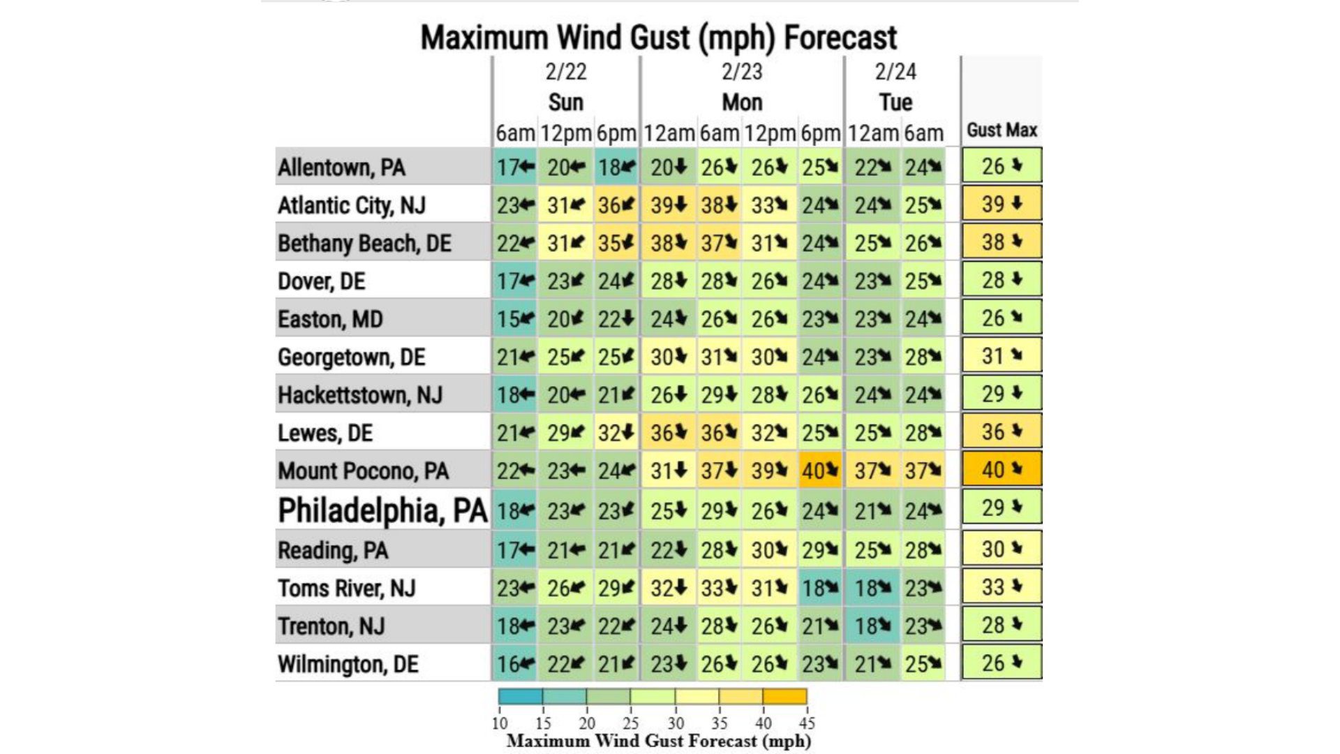 Wind and Blowing Snow Concerns
Gusty winds between 30 and 40 mph are possible Sunday afternoon through Monday afternoon. These winds could lead to blowing and drifting snow, especially in coastal areas, further reducing visibility and worsening travel conditions.
Gale Watches have been issued for Atlantic coastal waters from Sandy Hook, New Jersey, to Fenwick Island, Delaware, and for the Delaware Bay.
This could set things up to be a blizzard, which is fun.
 Coastal Flooding Threat
A Coastal Flood Watch is in effect from Sunday night into early Monday morning. Minor to moderate coastal flooding is possible, with potential inundation of one to two feet above ground level in vulnerable low-lying areas near shorelines and tidal waterways.
Moderate flooding could result in widespread roadway flooding in coastal and bayside communities, making some roads impassable and causing minor structural damage. Additional minor flooding may persist with high tide cycles on Monday.
Folks, stay home this weekend and it’s going to be a stormy one!