
Blizzard Warning Issued for Parts of New Jersey
The National Weather Service has upgraded alerts ahead of a powerful winter storm expected to impact New Jersey and surrounding regions from Sunday into Monday.
Blizzard Warnings have now been issued for Atlantic coastal areas of New Jersey and Delaware, while Winter Storm Warnings cover the remainder of New Jersey, Delaware, and portions of southeastern Pennsylvania.
Blizzard Warning Issued for Parts of New Jersey
Marine alerts have also intensified, with Gale Watches upgraded to Storm Watches for Atlantic coastal waters and the lower Delaware Bay. A Coastal Flood Watch remains in effect along the Atlantic coastline.
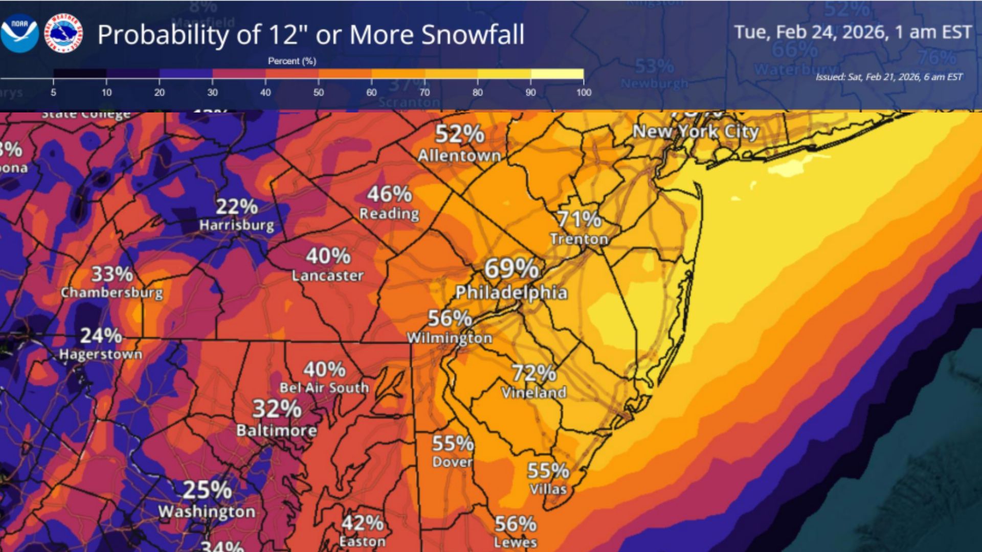
New forecast snowfall maps show a dramatic increase in projected totals across much of the region.
Also See: Navy Special Ops Boats Spotted In Jersey Back Bays
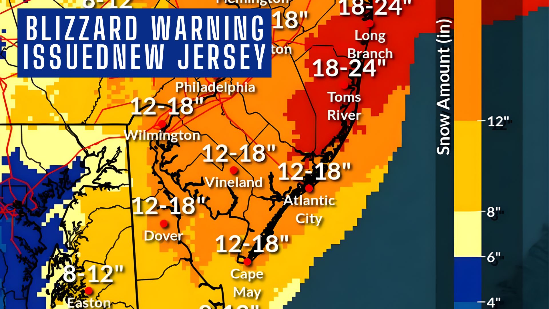
 The heaviest snow is expected across central and coastal New Jersey, where totals of 12 to 18 inches are forecast, with a localized jackpot zone of 18 to 24 inches centered near Ocean County, including areas around Toms River and Long Branch. Southern New Jersey, including Atlantic City, Vineland, and Cape May County, is forecast to receive 12 to 18 inches, though barrier island communities may see slightly lower totals around 8 to 12 inches due to coastal influences.
Inland areas of eastern Pennsylvania and northern Delaware are expected to see 8 to 12 inches, with locally higher amounts closer to New Jersey.
Something to keep in mind is that this storm is gonna start off with rain and then turn to snow, which definitely degrades some of the snow totals. So while you might be seeing 18 inches in some areas, it might actually be closer to about 10.
 Blizzard Conditions and Wind Threat
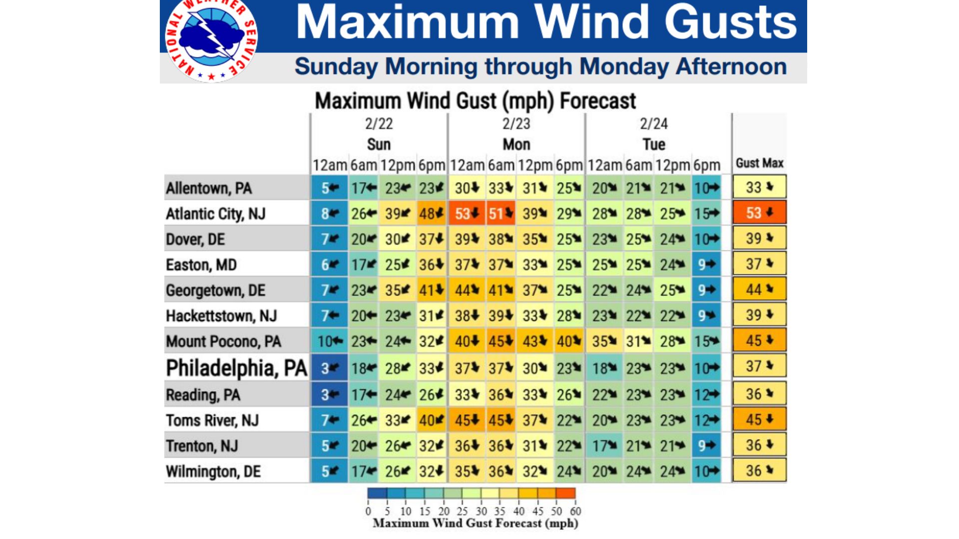
Blizzard conditions are expected along the Atlantic coast, where winds may gust up to 55 mph. These winds, combined with snowfall rates exceeding 2 inches per hour at times, will create blowing and drifting snow and periods of near-zero visibility, leading to extremely dangerous travel conditions.
Inland areas may still see wind gusts up to 40 mph, which could cause localized tree damage and scattered power outages.
Storm Timeline and Travel Impacts
Snow is expected to begin Sunday morning, potentially starting as rain near and south of I-78 before transitioning to snow. The heaviest snowfall is forecast from Sunday evening into Monday morning, with precipitation tapering by Monday afternoon.
Forecasters warn the storm will likely impact both the Monday morning and evening commutes, with very difficult to impossible travel conditions expected at peak intensity.
 Coastal Flooding Concerns
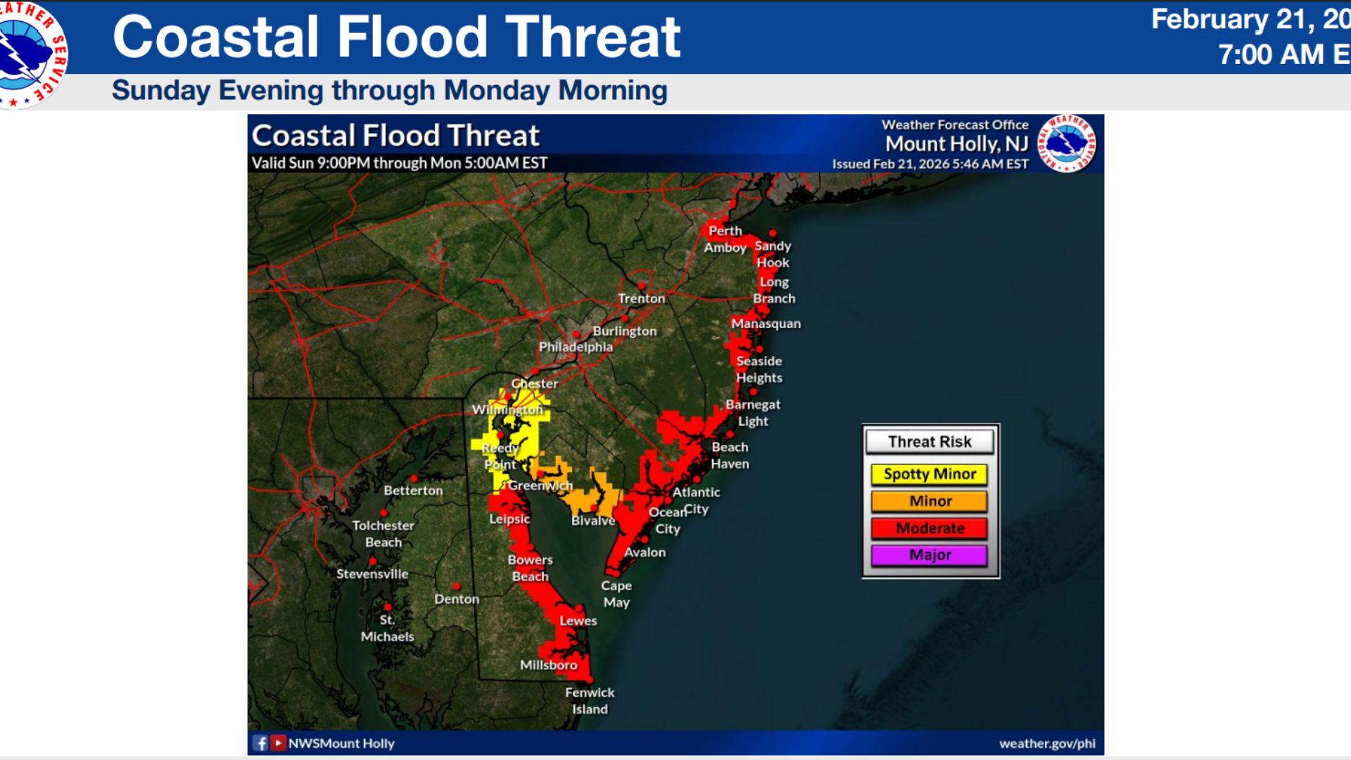
Minor to moderate coastal flooding is likely Sunday night into Monday morning, with the potential for localized major flooding in vulnerable areas.
Flooding of one to two feet above ground level is possible in low-lying coastal and bayside communities, potentially making roads impassable and causing minor structural damage.
Additional minor flooding may persist with subsequent high tide cycles on Monday.
 What This Means
Meteorologists say the combination of heavy snow, blizzard conditions, strong winds, and coastal flooding could lead to significant disruptions across New Jersey and neighboring states.
Widespread closures, infrastructure impacts, and dangerous travel conditions are increasingly likely as the storm approaches.
This means be prepared that Monday school will most likely be closed and many businesses will also be closed to try to shovel out after getting this much snow. Once again, it’s possible that a lot of the rain will degrade the snow totals.