
Forgotten History Resurfaces in Cape May Harbor
If you’ve ever walked the beaches or marshes of South Jersey, you know the shoreline is full of hidden relics, remnants of wars, shipwrecks, and government projects.
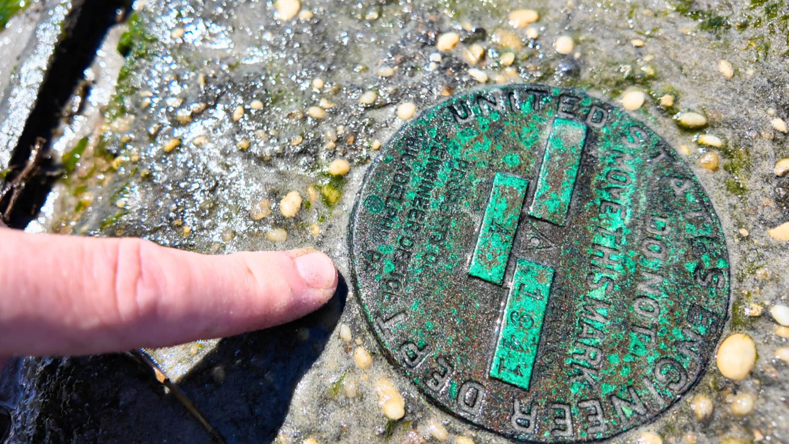
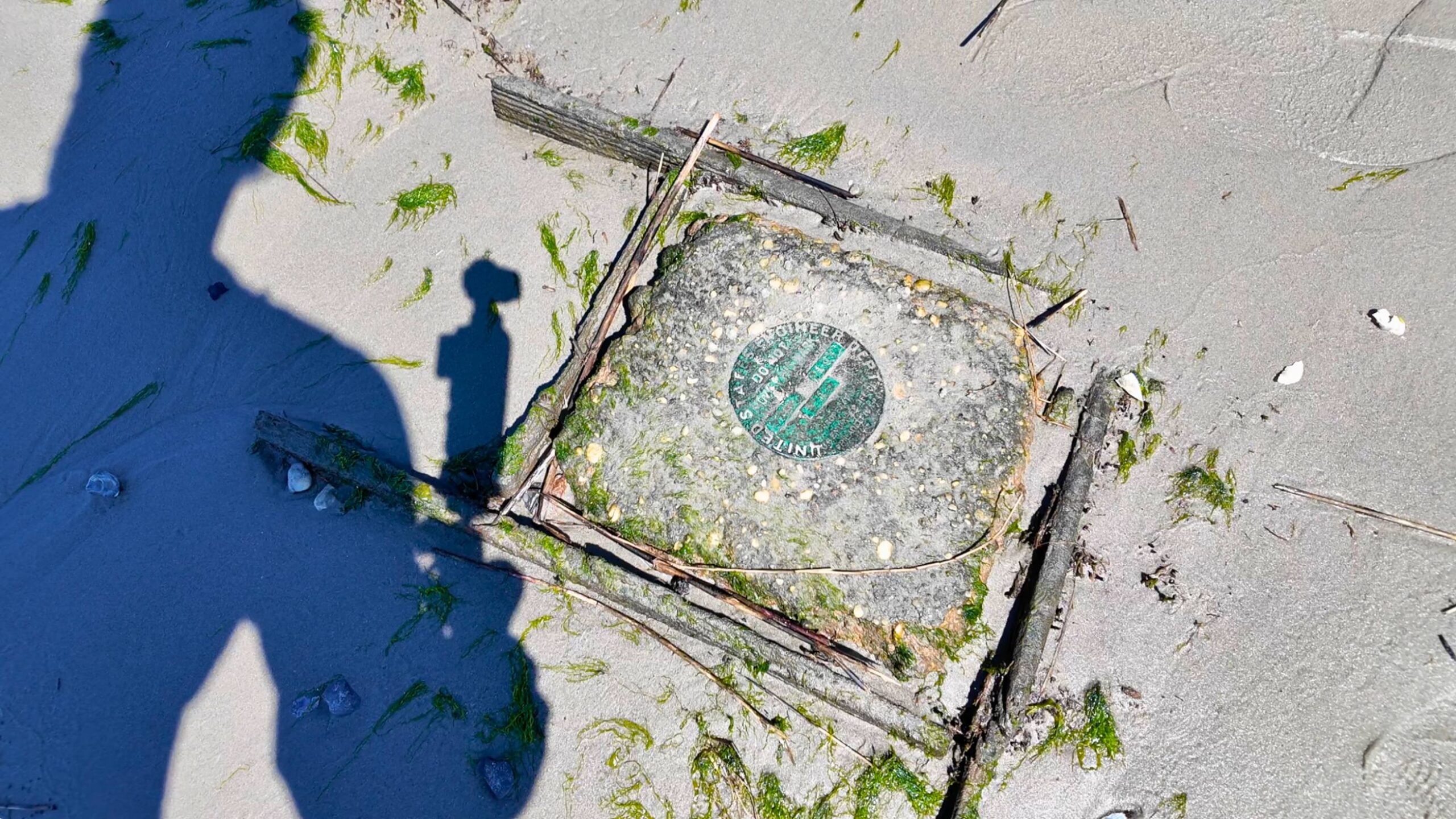
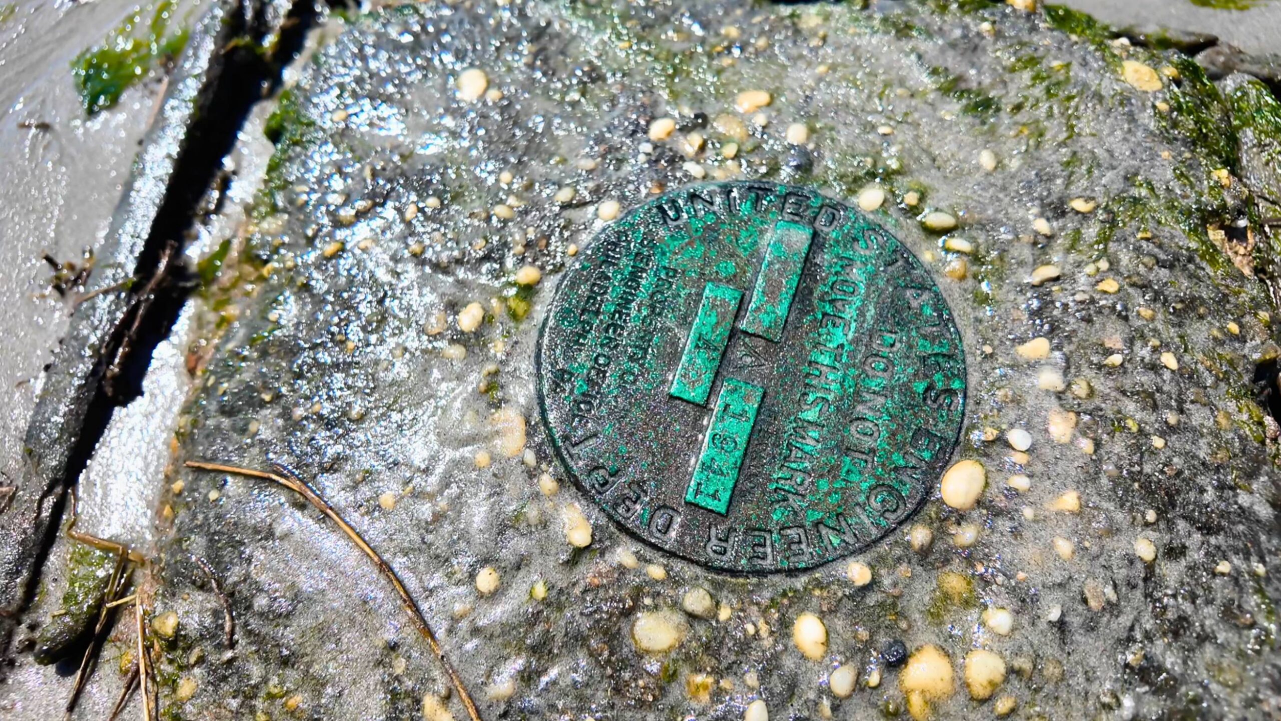
Recently, one such artifact was spotted in Cape May Harbor: a round bronze disk stamped with the words “United States Engineer Department – Do Not Move This Mark – 1941 A.”
At first glance, it looks like just another weathered piece of metal. But this small marker connects back to a larger story of the U.S. Army Corps of Engineers and their work on our waterways more than 80 years ago.
 What Is It?
The “United States Engineer Department” was the formal name used by the Army Corps of Engineers before it adopted the more familiar “USACE” branding. These bronze or brass survey disks were set into stone, concrete, bulkheads, or even bedrock as permanent reference points.
They weren’t decoration; they were vital. The Corps relied on them to measure elevations, align harbor improvements, monitor tidal movements, and control dredging projects.
Each disk was carefully stamped with the year of installation, sometimes with a letter or number (in this case, “1941 XXXX – A”) to differentiate it from companion marks nearby.
 Why 1941 Matters
The year stamped on the disk is striking: 1941. Just months before the United States entered World War II, Cape May and the Delaware Bay region were already buzzing with military activity
Fortifications were being strengthened, the Coast Guard was active, and the Army Corps of Engineers was expanding navigation channels and maintaining defenses.
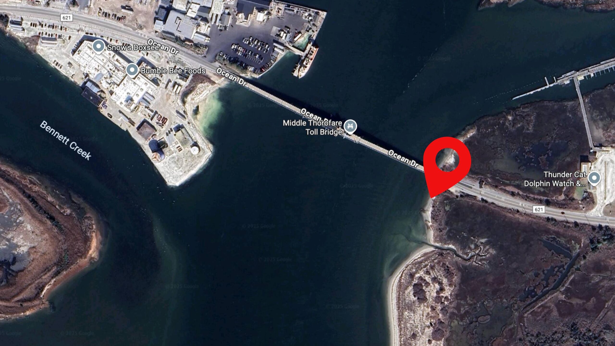
A disk like this could have been part of a tidal benchmark network, or a control line for dredging work in the Cape May Canal and surrounding bay.
 Also See: North Wildwood To Begin Full-Scale Reconstruction of Boardwalk
These survey marks allowed engineers to track long-term water levels and accurately position harbor improvements that, to this day, protect our shoreline and keep shipping lanes open.
The warning on the disk isn’t just for show. Under federal law (18 U.S.C. §1858), it’s illegal to disturb or destroy survey marks.
Even today, NOAA and the Army Corps rely on some of these very benchmarks to calibrate tide gauges, map coastlines, and ensure the accuracy of nautical charts.
 That means the marker in Cape May Bay isn’t just a relic, it could still hold scientific and navigational value.
The Wildwood Video Archive reached out to the US Army Corps of Engineers for more information about this particular marker, but they were unable to give more information.
If you stumble upon one of these disks, you can sometimes look up its record in the NOAA National Geodetic Survey database or through the Army Corps of Engineers Philadelphia District, which has overseen coastal projects in South Jersey for well over a century.
Many of these datasheets will list the exact location, installation date, and even the project it was tied to.
 For tidal stations, NOAA’s “Tides & Currents” website posts benchmark sheets that often include these old Engineer Department disks. It’s like opening a window into the coastal engineering history of the Wildwoods and Cape May.
While beachgoers flock to the Cape May shoreline for sun and surf, this little bronze disk is a reminder of another era, one where engineers, surveyors, and soldiers worked to safeguard our coasts during a time of looming global conflict.
The next time you’re walking the bayfront, keep an eye out. You never know when you’ll stumble upon a marker that connects our present-day shoreline to the long history of America’s defense and engineering along the Jersey coast.
You can see this marker in our video down below as we searched for buried treasure in Cape May County.