
Heavy Rain And Winds Again This Weekend in New Jersey
As the weekend approaches, the National Weather Service issues a forecast that warns of significant weather disturbances along the I-95 corridor and points to the south and east. According to meteorologists, a potent storm system is expected to bring a deluge of rain, gusty winds, and potential coastal flooding.
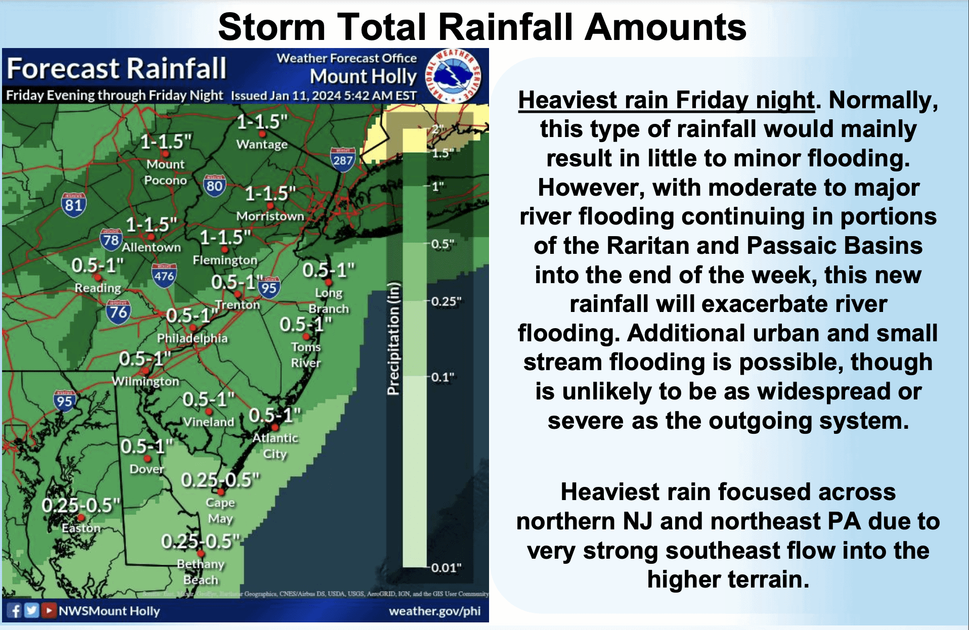
The forecast indicates that the I-95 corridor and areas to the south and east should brace for a half-inch to 1 inch of rain, while regions to the north and west of I-95 could see 1 to 1.5 inches of rain, with up to 2 inches possible in the heaviest rainfalls. This weather update was highlighted in the morning forecast, emphasizing the need for residents to prepare for adverse conditions.
Heavy Rain And Winds Again This Weekend in New Jersey
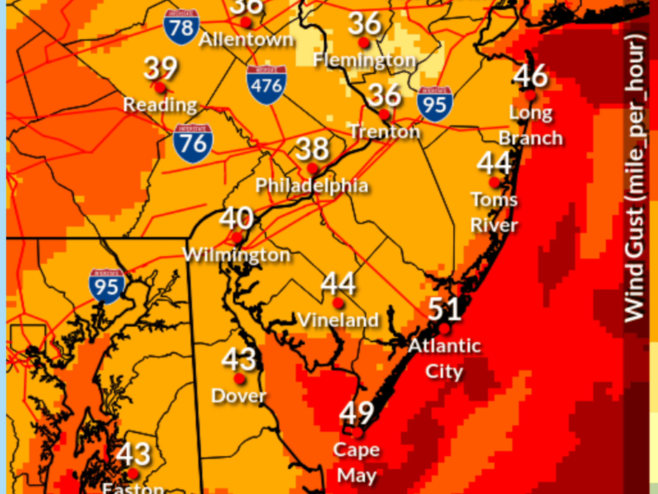
Winds are anticipated to be a significant factor in this weather event. Along the Jersey Shore, gusts could reach up to 50 to 60 mph, while inland areas may experience winds of 40 to 50 mph. Friday’s temperatures are expected to stay in the 40s, creating a chilly and blustery day.
The rain is forecasted to persist through Saturday morning, although the winds are expected to diminish by then. However, the potential for flooding remains a serious concern.
 The National Weather Service warns of flooding possibilities ranging from 0.5 to 1.5 inches of rainfall, with exacerbated flooding for rivers already in flood stage. Urban and small stream flooding is anticipated across the entire region, with northern New Jersey and southeast Pennsylvania facing the most significant river flooding potential.
The wind direction is expected to shift from southeast to south on Friday night, turning southwest to west into Saturday. This change may result in tree damage and power outages, especially along the coast.
Also See: Ocean Sands Motel Demolition Underway
 Inland areas may experience gusts of 40 to 50 mph, while coastal areas could see gusts of 50 to 60 mph. The strongest winds are predicted to occur Friday night, persisting into Saturday.
Marine conditions are also a cause for concern, with gale-force wind gusts and the potential for storm-force gusts near 50 knots. Dangerous seas are forecasted to build to 8 to 12 feet, particularly in Atlantic coastal waters off New Jersey and Delaware, including Delaware Bay.
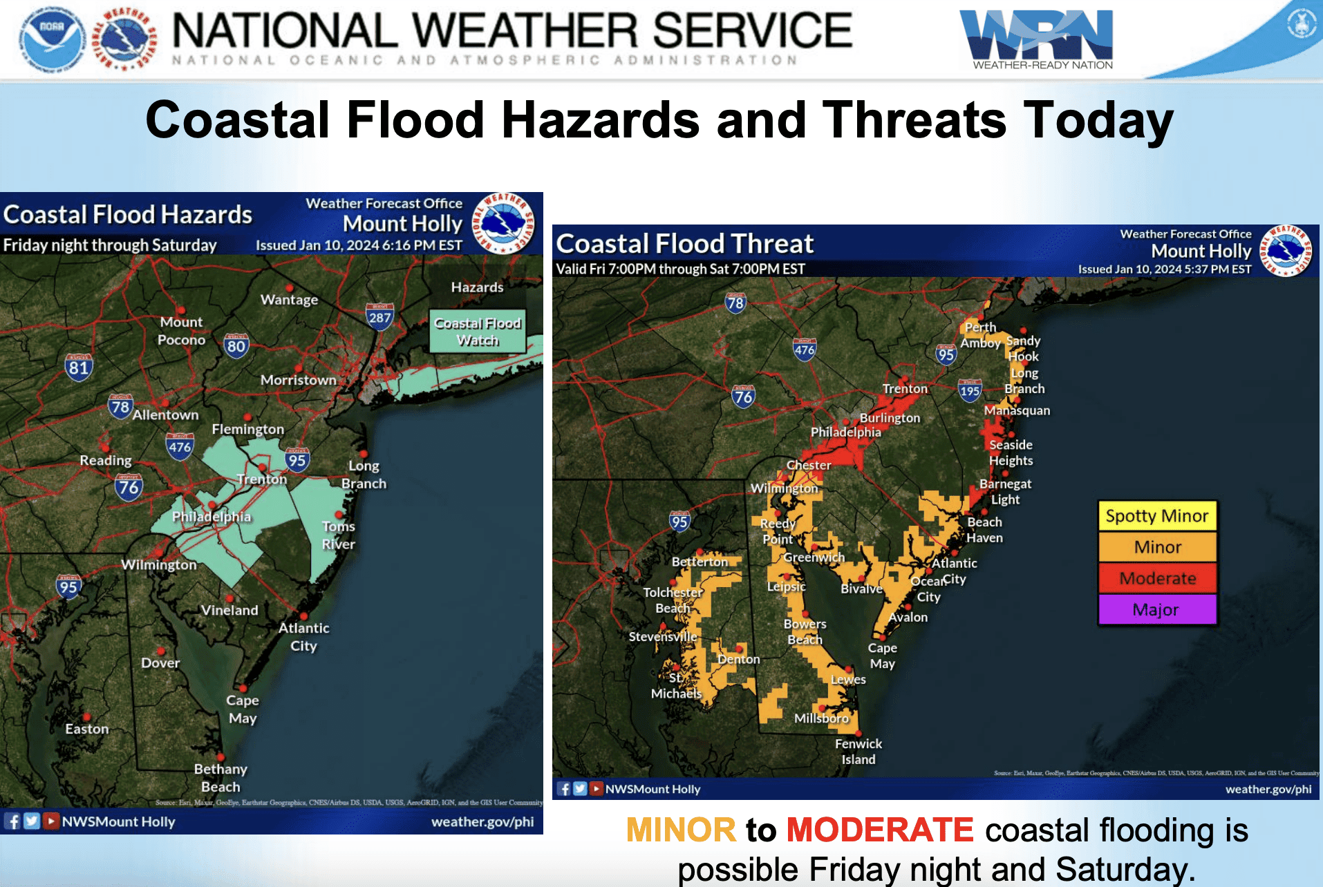
Coastal flooding is anticipated, ranging from minor to potentially moderate. The tidal Delaware River and Barnegat Bay are at the greatest risk for moderate coastal flooding. This threat is expected to persist through high tides on Friday and Saturday.
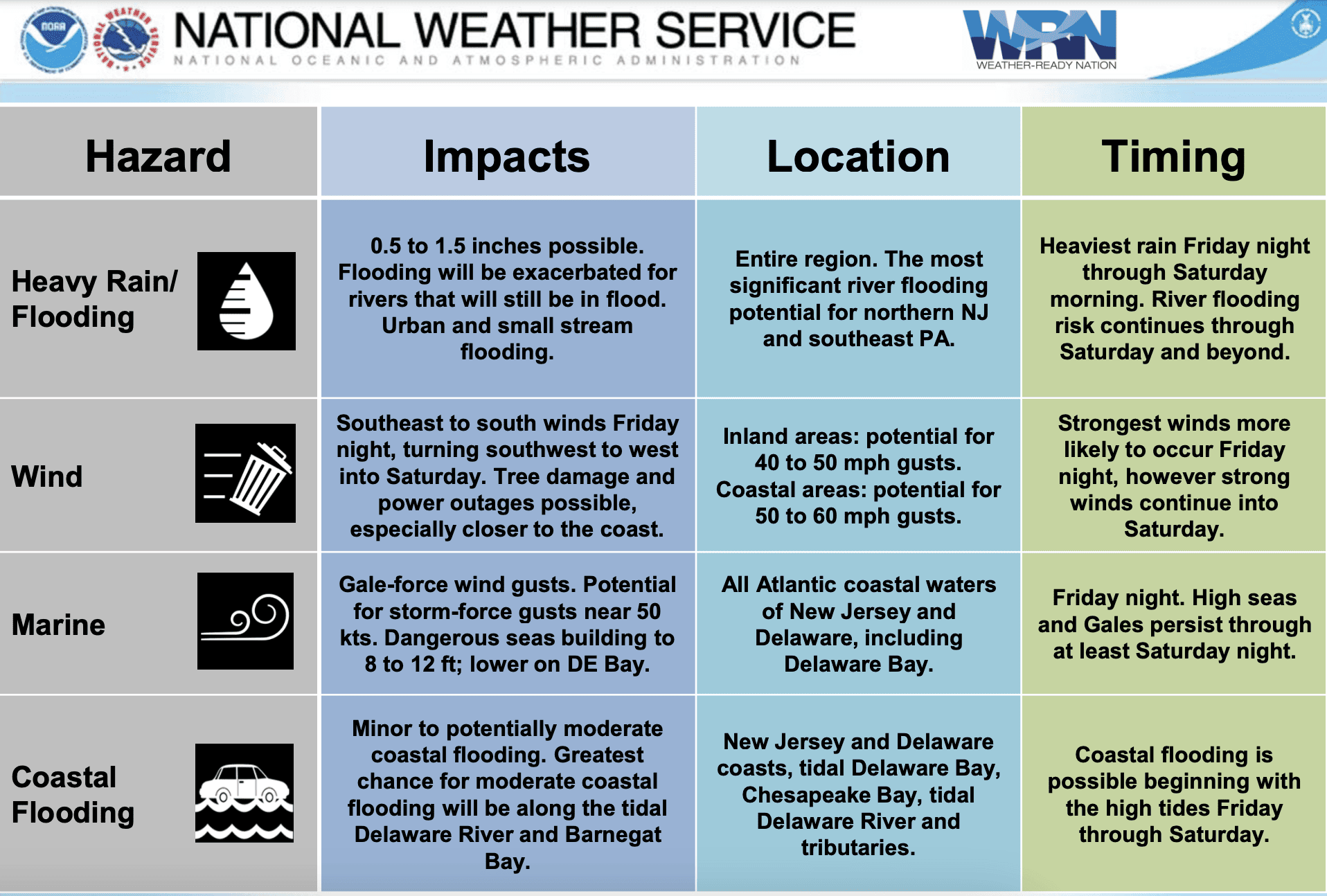 The storm’s focus on northern New Jersey and northeast Pennsylvania, driven by a strong southeast flow into higher terrain, is likely to result in challenging conditions, including strong winds and heavy rain. Residents in these areas are urged to stay informed and take necessary precautions as the storm unfolds.
Conditions could change before the storm starts.