
Historic Blizzard Targets New Jersey With Up to 24 Inches of Snow
The weather forecast is pretty much set in stone. In some areas, the rain already started to come down. And this afternoon, it’s going to start the largest snowfall we have seen in recent New Jersey history.
This is not a storm to be played with.
Historic Blizzard Targets New Jersey and Philadelphia With Up to 24 Inches of Snow
A state of emergency is starting in New Jersey at noon. You should not be out. In the overnight hours, the snow totals have shifted more.
More areas are now, according to the National Weather Service, we’re going to potentially see up to 24 inches of snow. Like we said in our articles yesterday, that number will be slightly lower because the first hours will be consistent of rain.
At some point, we’re going to be seeing snow come down at two inches an hour. And if you’re at the Jersey Shore, the tidal flooding is something to be extremely concerned about.
If you live at the shore and in an area which usually floods, do move your car to a higher area, as things could be very bad as you have snow coming down and tidal flooding.
Let’s break down the full forecast
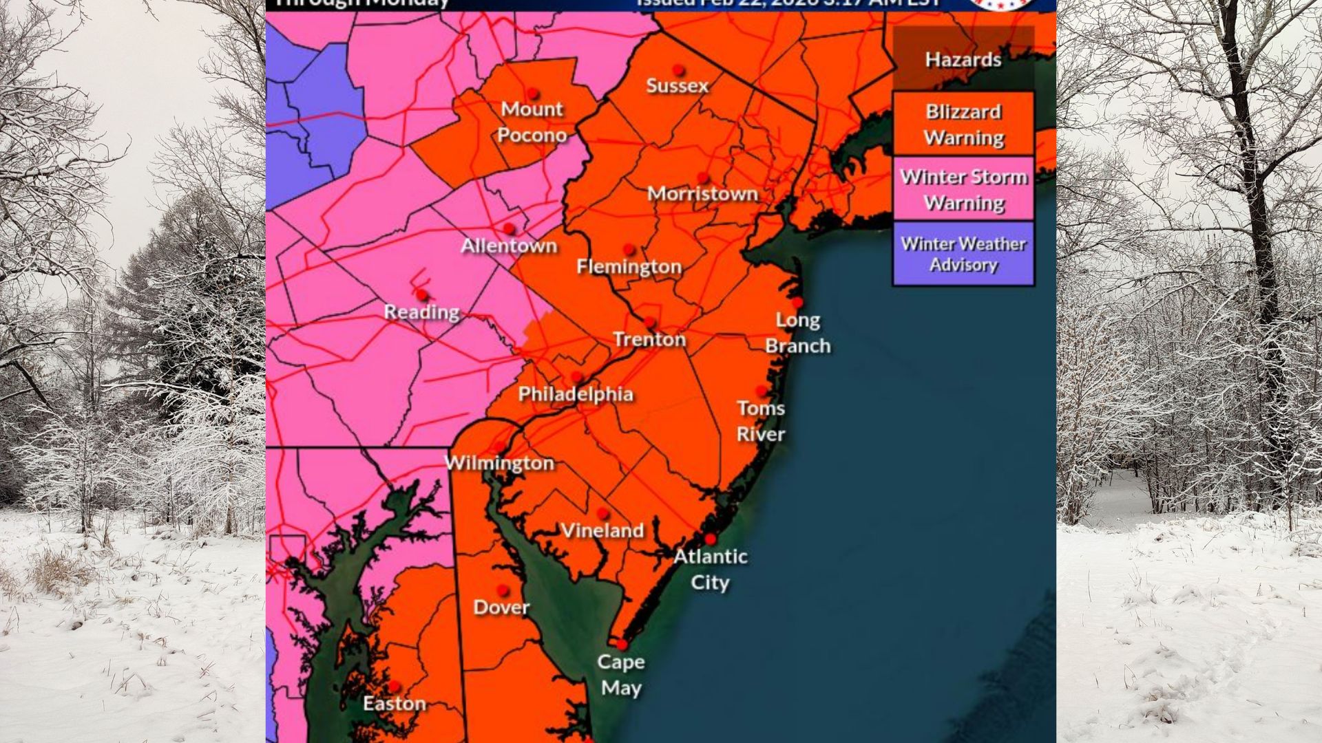 Blizzard Warnings have now been expanded to cover all of New Jersey, the Philadelphia metro and suburbs, all of Delaware, and Carbon and Monroe counties in Pennsylvania. Additional counties recently upgraded to Blizzard Warnings include Sussex, Warren, Hunterdon, and Salem in New Jersey; Bucks, Lower Montgomery, Philadelphia, and Delaware counties in Pennsylvania; New Castle County in Delaware; and Queen Anne’s County in Maryland.
Snow is expected to begin by midday Sunday, continuing through Monday afternoon, with the heaviest snowfall likely from Sunday evening into Monday morning.
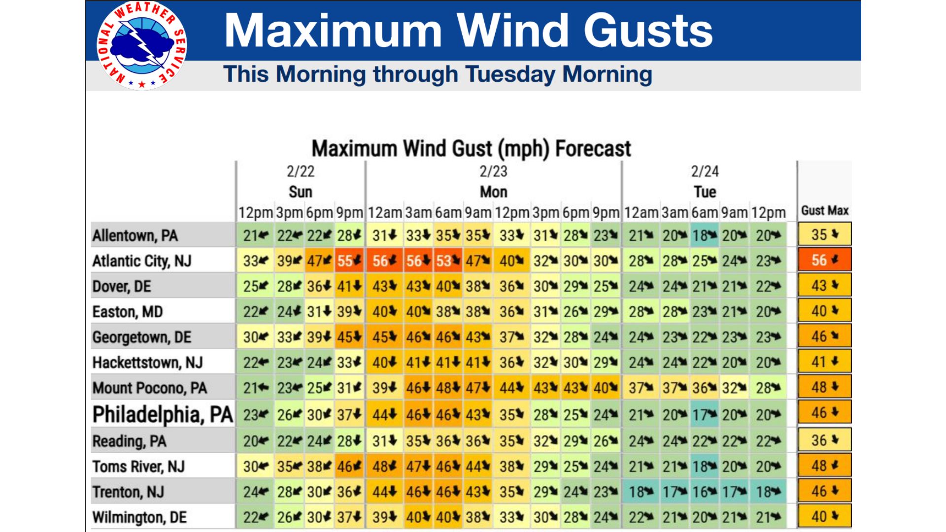
Snowfall rates could exceed two inches per hour during peak intensity, creating near whiteout conditions with blowing and drifting snow. Wind gusts may reach 60 mph in blizzard areas, reducing visibility to one quarter mile or less and making travel dangerous or impossible.
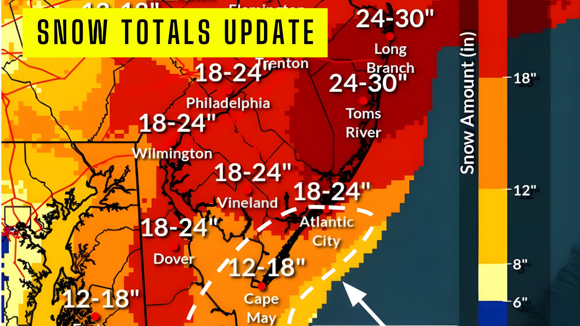
 Snow totals have also increased across the region.
Current projections show widespread 18 to 24 inches across much of inland New Jersey and the Philadelphia metro. The Jersey Shore is expected to see slightly lower totals due to the potential for mixing, with 12 to 18 inches forecast around Atlantic City and coastal Cape May County.
Far southern coastal areas, including Cape May and locations near Bethany Beach, could see 8 to 12 inches where rain mixes in at times before a changeover to snow.
 Realistically, due to the rain, these massive totals will be much lower.
Areas under Winter Storm Warnings, including the Lehigh Valley and portions of southeast Pennsylvania and Kent County, Maryland, could still see heavy snow and strong winds with gusts up to 40 mph, leading to significant travel disruptions.
Forecasters note precipitation may begin as rain or a rain-snow mix near and south of Interstate 78 before transitioning to all snow as colder air moves in. The storm is expected to heavily impact the Monday morning commute and potentially the evening commute as well.
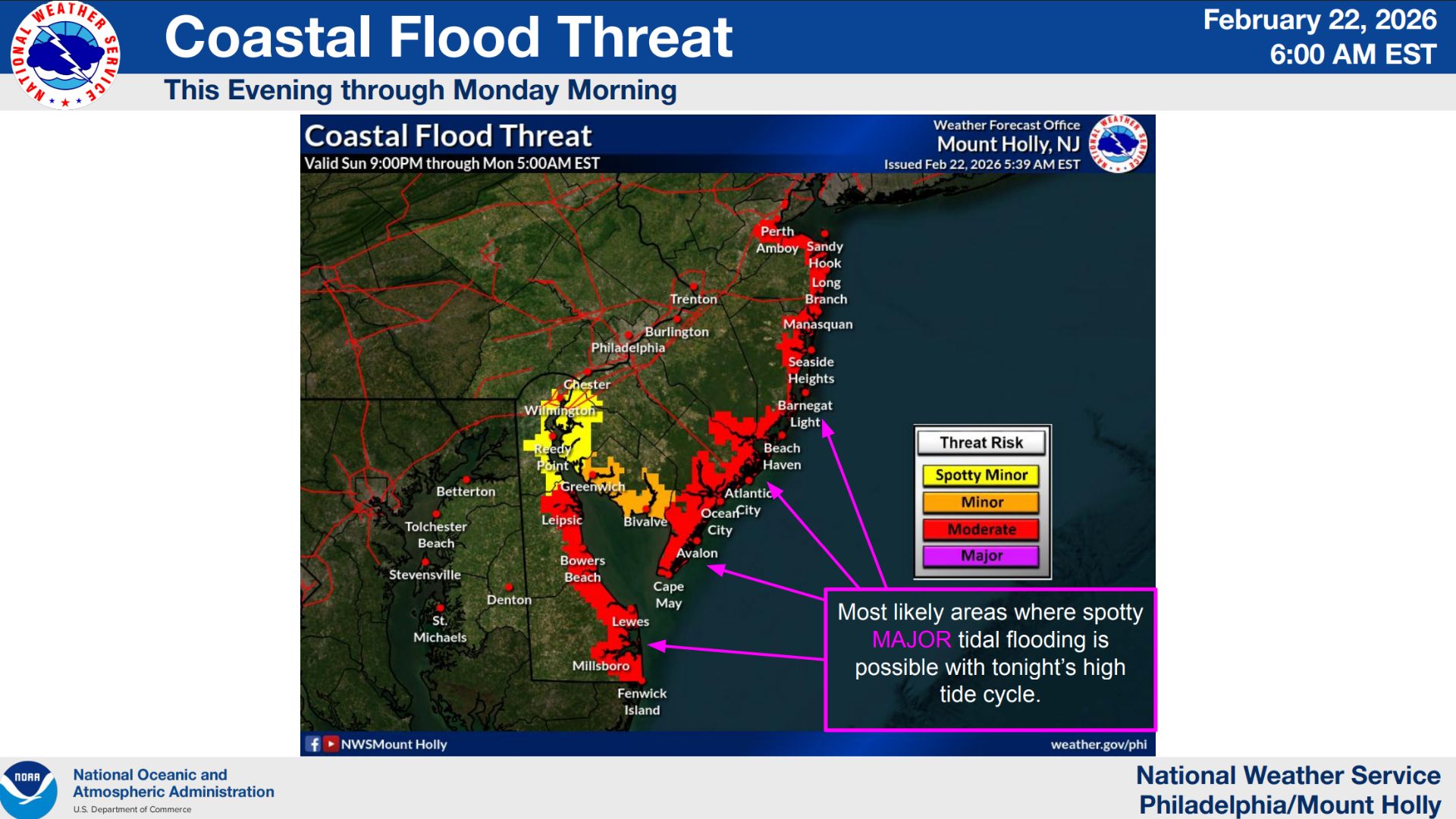
 Coastal flooding is also a major concern. Coastal Flood Warnings remain in effect for Middlesex, Monmouth, Ocean, southeast Burlington, Atlantic, and Cape May counties in New Jersey, as well as Kent and Sussex counties in Delaware. A Coastal Flood Advisory has been issued for Cumberland County.
If you live in those areas, be sure to move your car early afternoon.
Moderate coastal flooding is expected with Sunday night’s high tide, with spotty major flooding possible and additional flooding anticipated with Monday afternoon and evening high tides.