
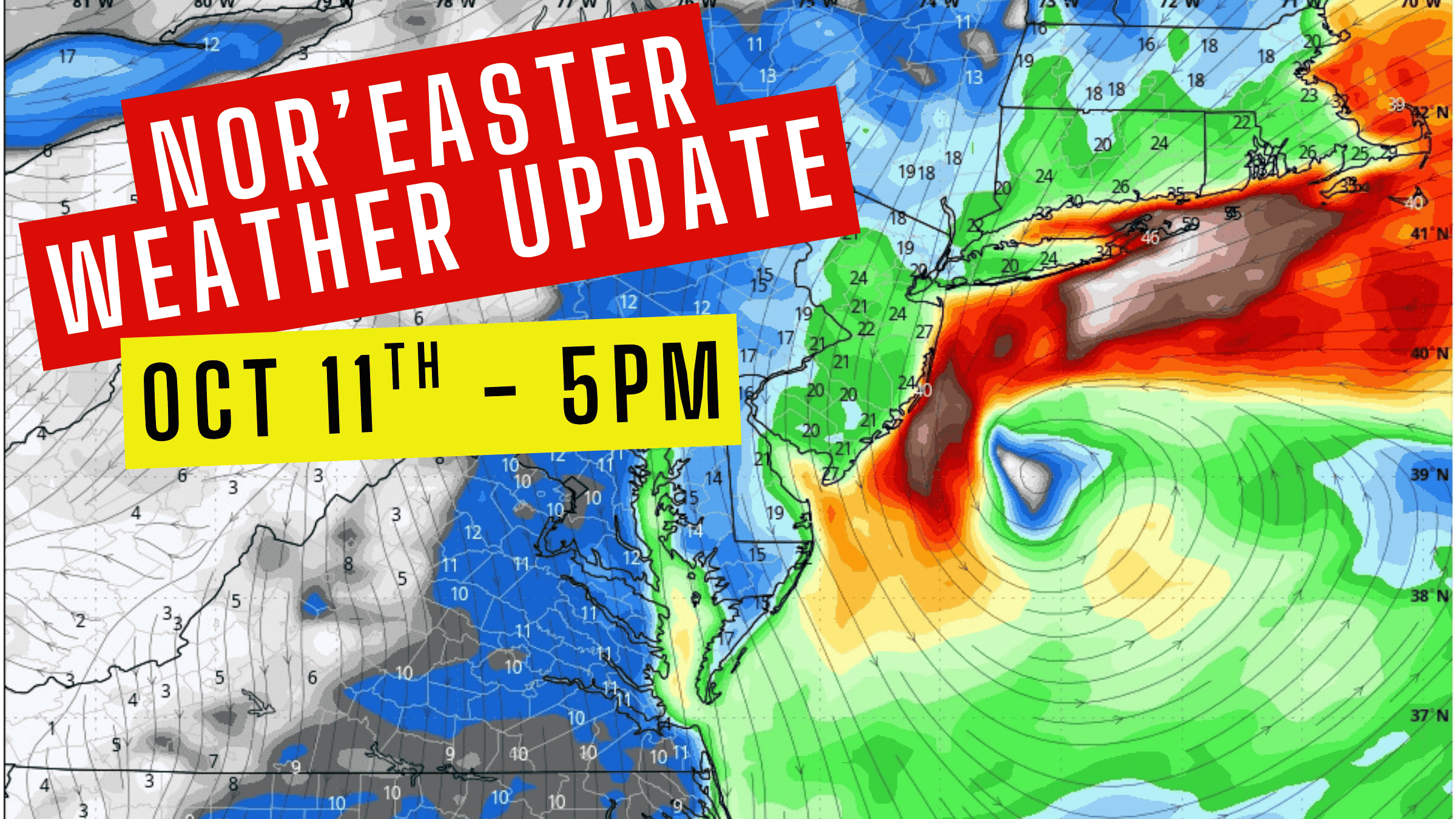
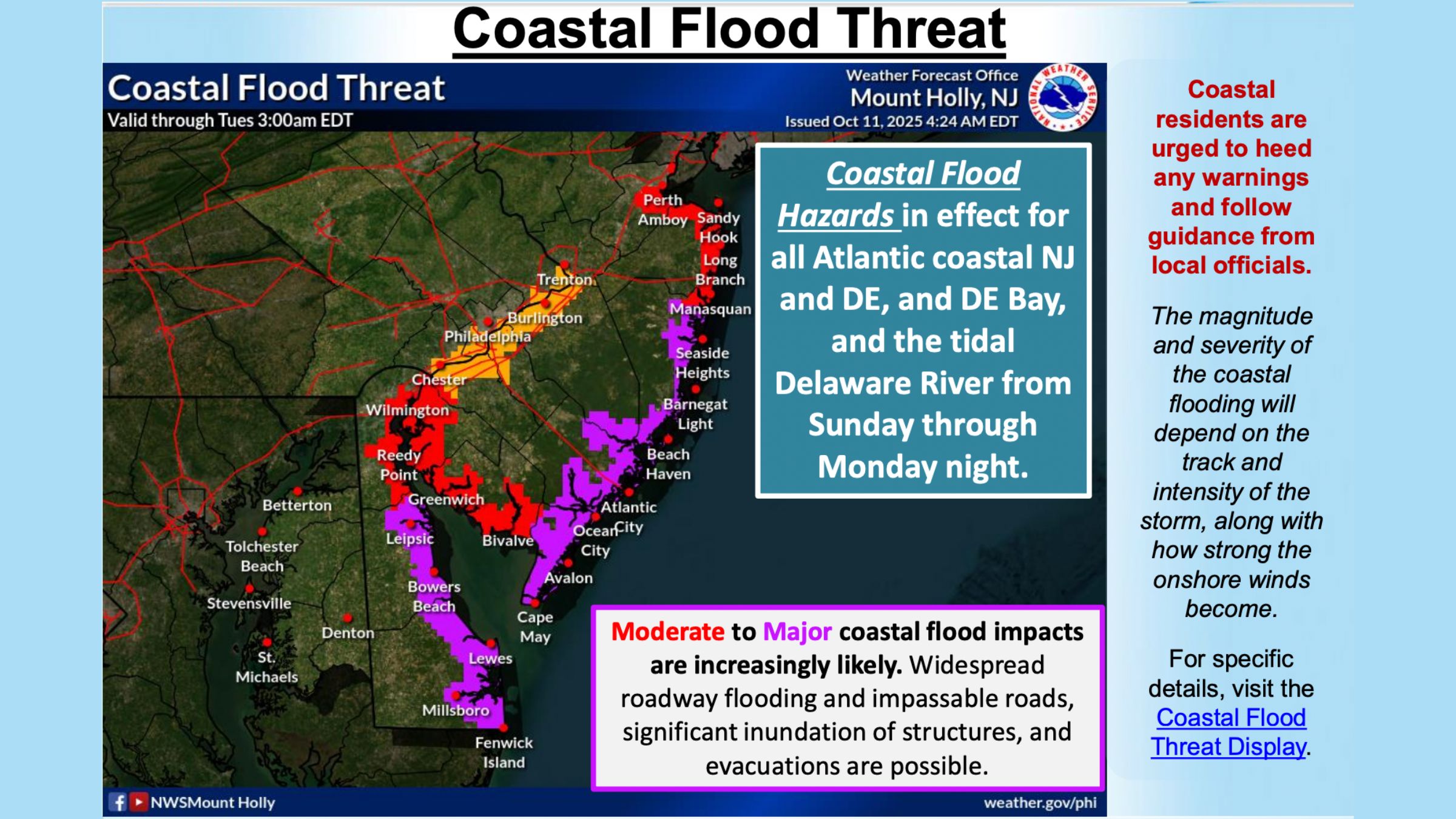
Nor’Easter Threatens New Jersey With Major Flooding and Damaging Winds – 5PM UPDATE
Forecasters are warning residents and visitors along the Jersey Shore to brace for what could be one of the most significant coastal storms of the season as a powerful system approaches on Sunday, October 12, and Monday, October 13. (news numbers coming from the National Weather Service)
Nor’Easter Threatens New Jersey With Major Flooding and Damaging Winds – 5PM UPDATE
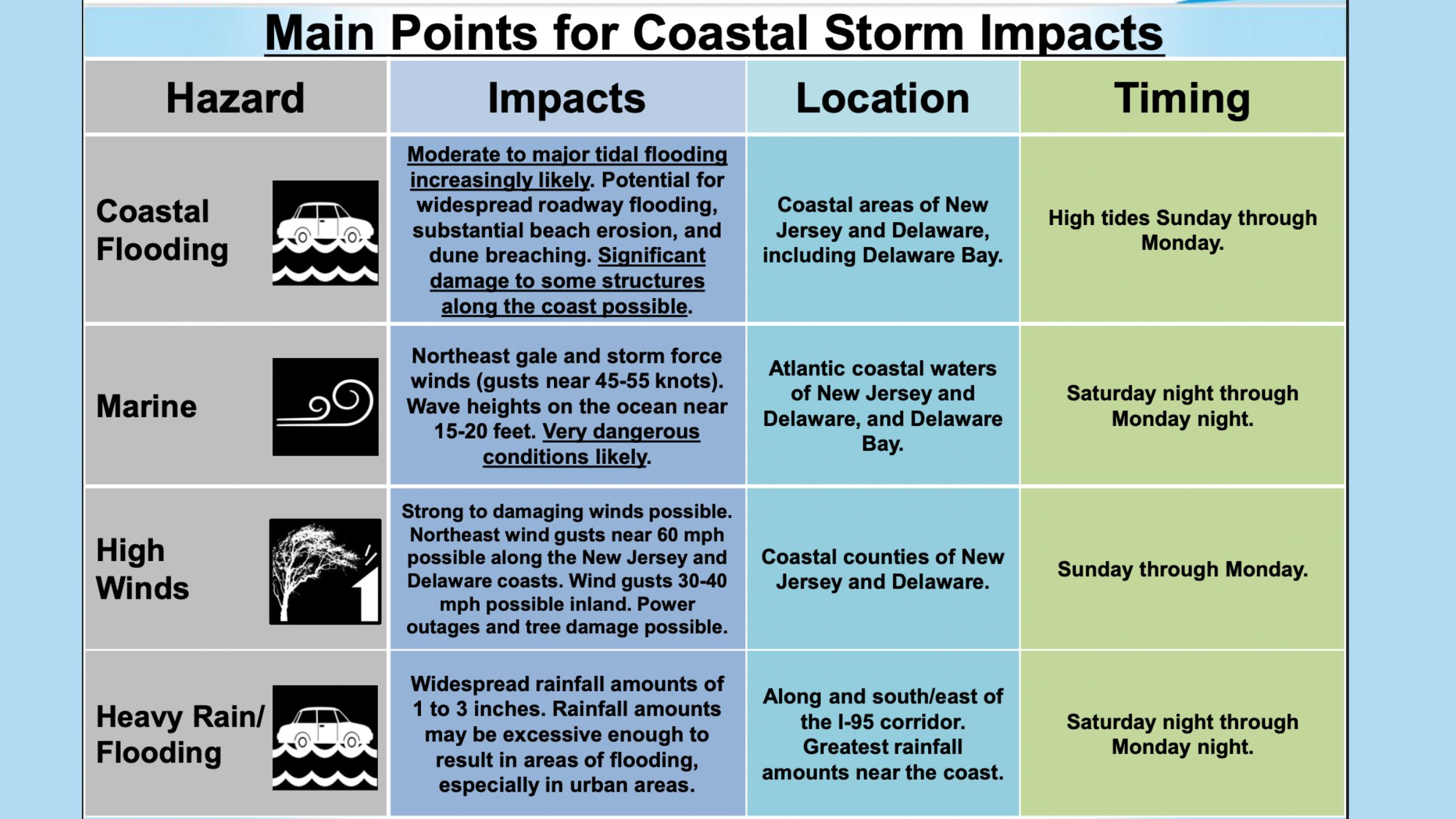
New Jersey officials are urging residents in flood-prone areas to prepare early as forecasts call for moderate to major coastal flooding, high winds, and heavy rain throughout the weekend and into Monday.
The approaching nor’easter is expected to bring conditions comparable to, and potentially worse than, the August 2025 flooding event that inundated parts of the island.
 Flooding Threat Along Bayside Streets
In Barrier islands, the flooding could become a major problem.
High tide cycles are expected to bring the most dangerous flooding to bayside neighborhoods, with peak tides projected at 8.2 feet on Sunday at 1:15 p.m., 7.6 feet early Monday at 1:59 a.m., and 7.9 feet again Monday at 2:21 p.m.
 Officials have asked residents to move vehicles to higher ground and secure outdoor belongings before the storm’s arrival.
Cities like North Wildwood had issued a firm warning to motorists: driving through flooded streets is prohibited.
Passing vehicles can create wakes that worsen property damage, and violators will face enforcement under the municipal code.
Also See: Splash Zone Waterpark in Wildwood Closes After 26 Years
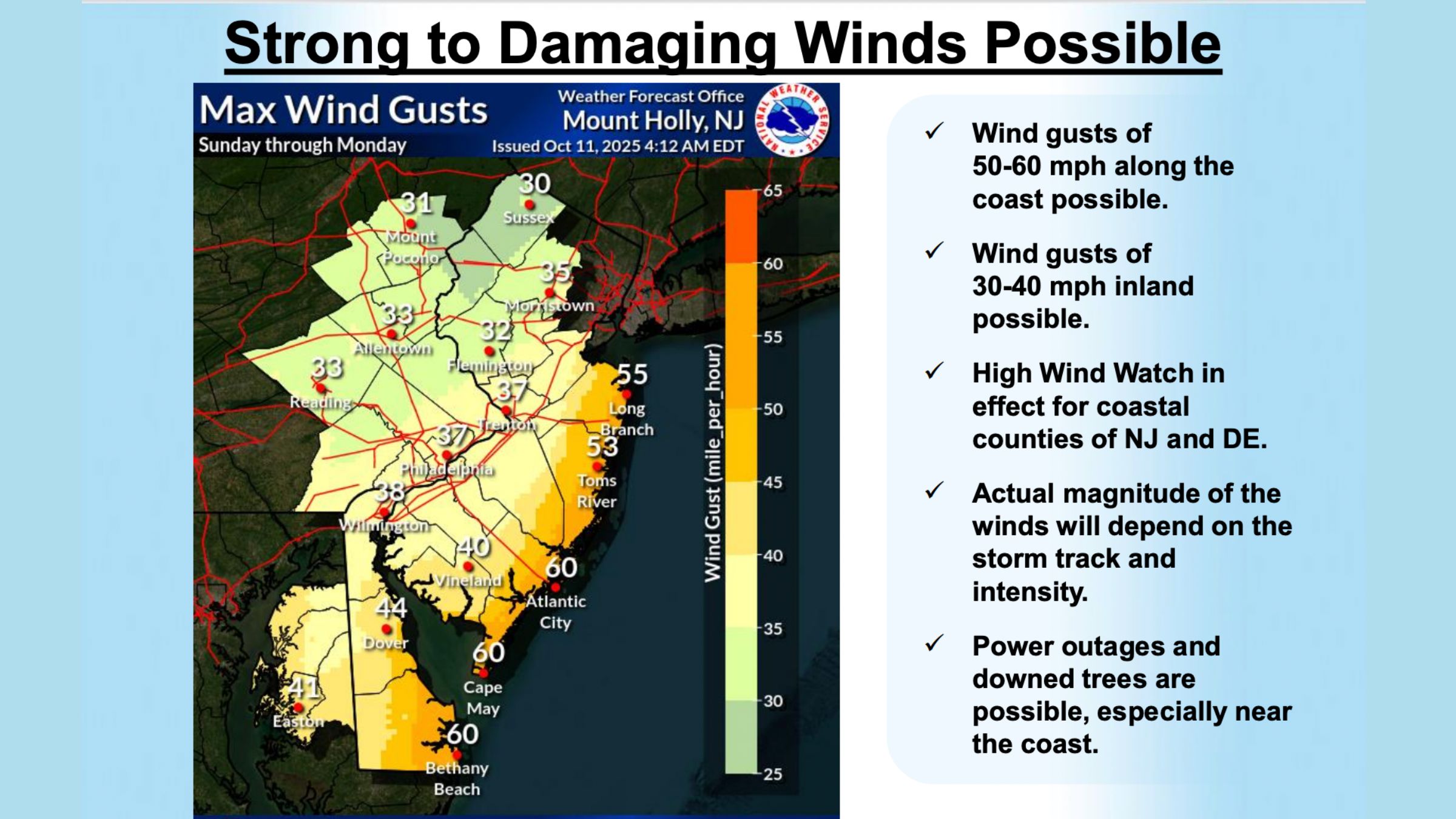
 Powerful Winds and Dangerous Seas
Forecast models predict sustained northeast winds of 35 to 45 miles per hour, with gusts reaching 60 mph, strong enough to cause tree damage and scattered power outages.
This means bring in your trash cans, take down tall Halloween decorations, and put away anything that could be blown away.
The National Weather Service is monitoring the potential for storm-force winds and waves as high as 15 to 20 feet in the coastal waters of New Jersey and Delaware.
This means that we will see not only the waves come crashing in, but the winds will push these waves even higher.
These conditions will be dangerous for both marine and coastal communities, and residents should avoid travel during periods of peak winds and flooding.
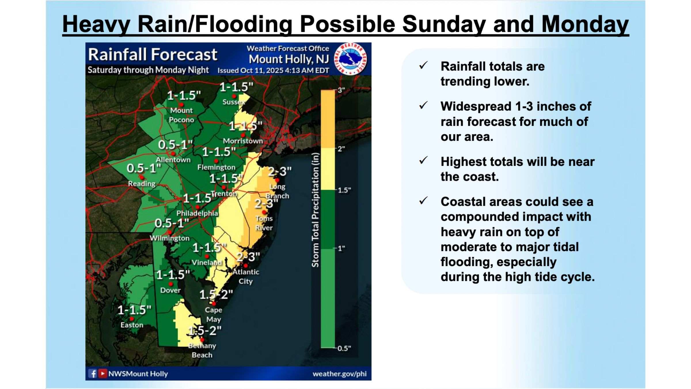
 Heavy Rain and Erosion Risks
Steady rain is expected throughout the event, with 1 to 3 inches of accumulation possible, particularly along the coast.
The combination of rainfall and tidal surge could result in significant roadway flooding and ponding in low-lying areas.
Beach erosion and dune weakening are also expected due to strong rip currents and high surf, which will persist through early Tuesday. Officials are urging the public to stay out of the ocean until conditions improve.
This is a serious event, folks so please take precautions now!!! Get your cars to higher ground now!