
Snow Expected to Impact South Jersey – Update
A winter storm is set to bring widespread accumulating snow to the region, creating hazardous travel conditions and impacting both the Tuesday evening and Wednesday morning commutes.
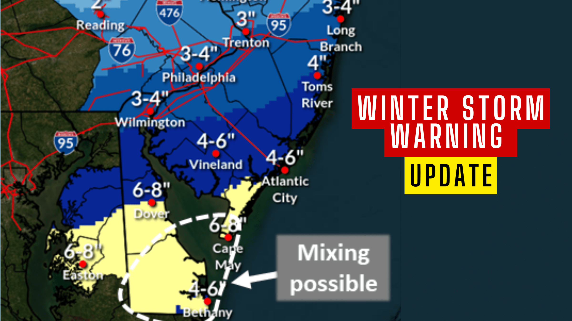
A Winter Storm Warning is in effect for Delmarva and southern New Jersey, where moderate to heavy snow is expected.
Snow Expected to Impact Southern New Jersey – Update
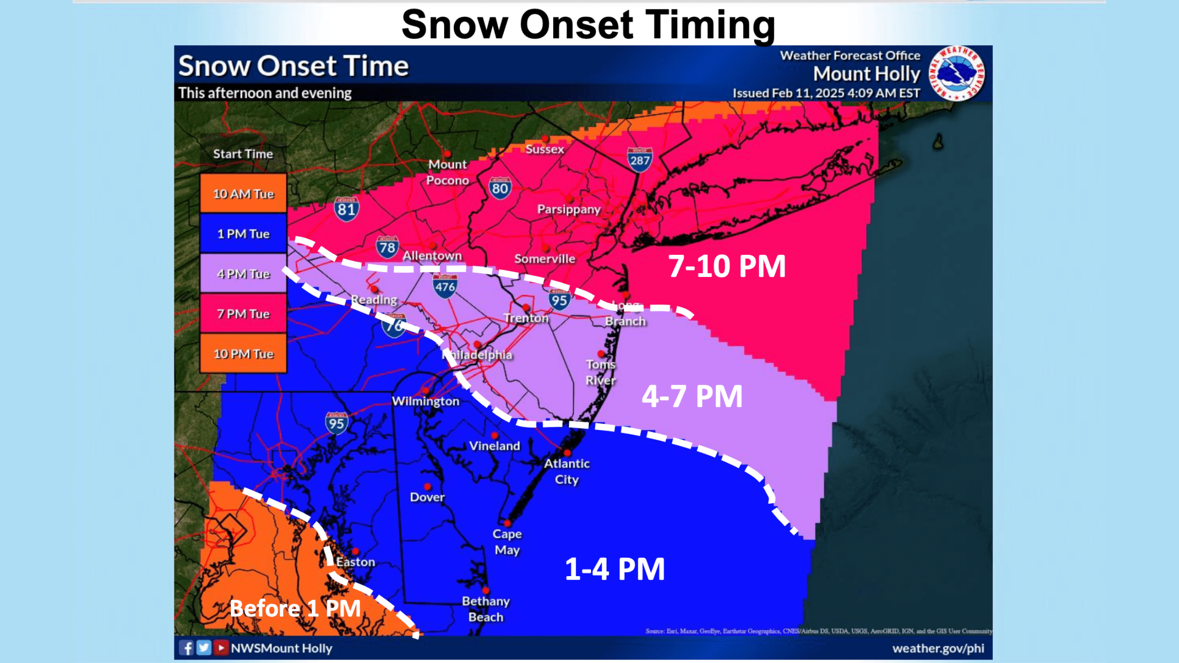
Snowfall could begin as early as Tuesday afternoon and continue through late Tuesday night or early Wednesday morning.
The heaviest snowfall is anticipated between 6 PM and 1 AM, with rates of up to one inch per hour in some areas.
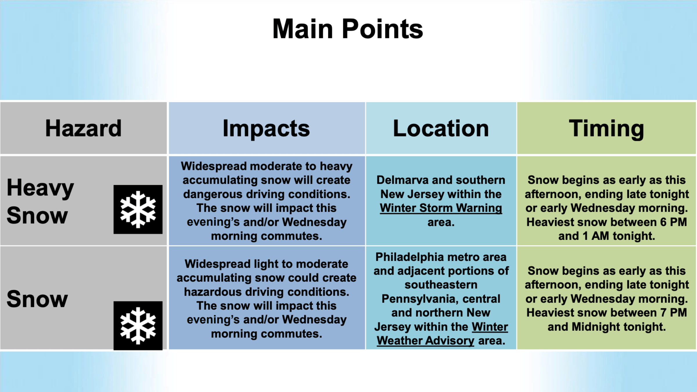 Snow may mix with sleet and rain in portions of southern Delaware and Cape May County, which could reduce overall snowfall totals. However, areas farther inland are likely to see significant accumulation.
A Winter Weather Advisory has been issued for the Philadelphia metro area, southeastern Pennsylvania, and central to northern New Jersey. These areas will see widespread light to moderate snow, which could still create hazardous driving conditions, particularly during peak travel times.
Snowfall will begin as early as Tuesday afternoon and taper off late Tuesday night or early Wednesday morning. The heaviest snowfall is expected between 7 PM and midnight.
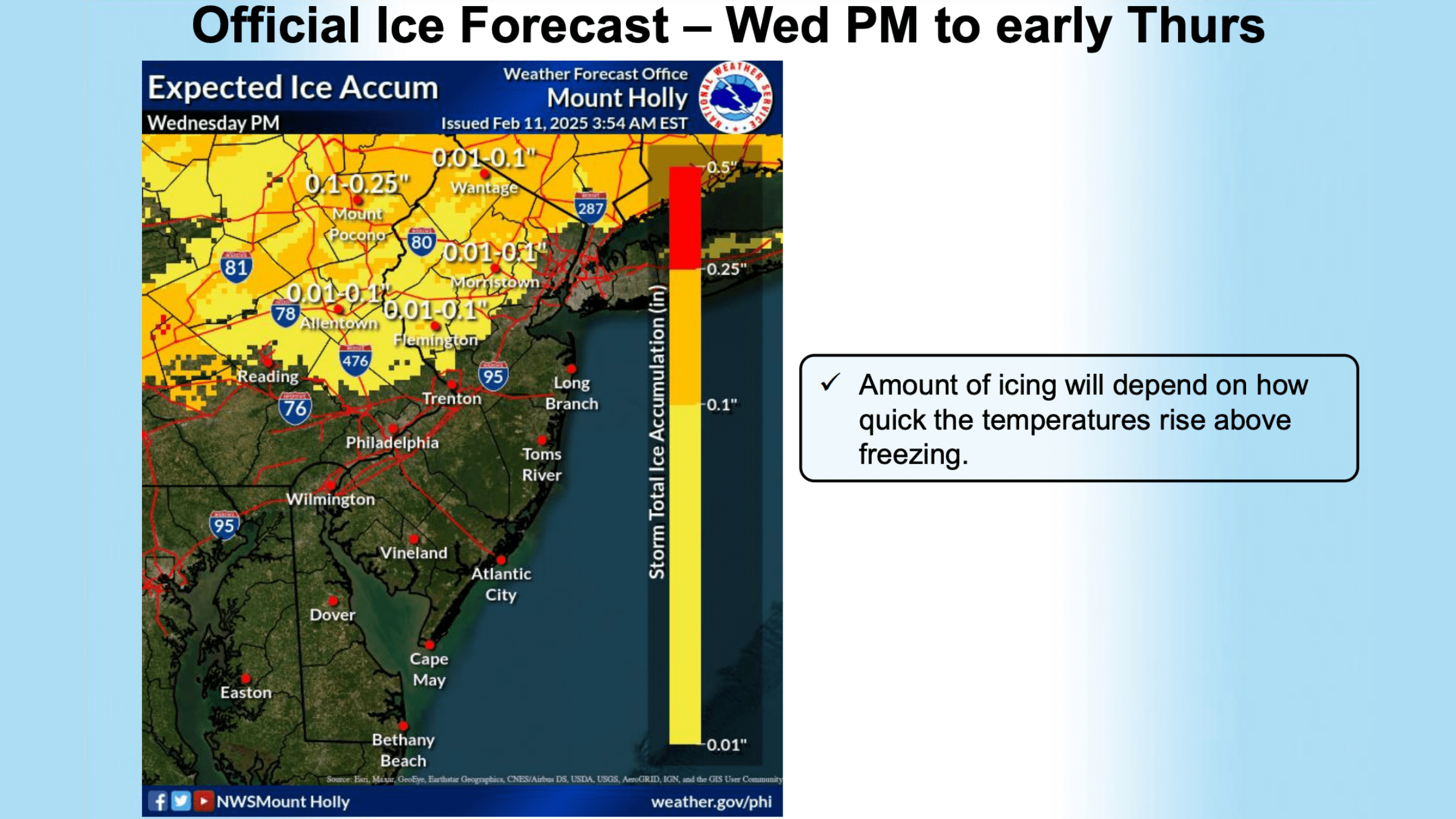
 While snowfall will largely end by Wednesday morning, another round of precipitation is expected by late Wednesday afternoon or early evening.
Areas near and north of the I-95 corridor will see snow transitioning to a wintry mix, including freezing rain, before changing to mostly rain as milder air moves in. This transition could impact the Wednesday evening commute.
Also See: New Airshow is Coming to Wildwood
The exact snowfall totals will depend on how quickly temperatures rise and how long precipitation remains snow before changing to a mix. A break in precipitation is expected during much of Wednesday before this second round of wintry weather moves in.
 Snow totals differ depending on which news you are looking at. According to the National Weather Service, Philadelphia and its surroundings will see 3-4 inches with those numbers going up the further you go down.
Vineland to Atlantic City will see 4-6 inches while Cape May County could see up to 8 inches (though it’s predicted to be much lower)
Drivers should plan for dangerous road conditions and allow extra time for travel. Stay tuned for further updates as the storm progresses.