
Snow Possible in South Jersey This Weekend as New Forecasts Update
South Jersey may see its first touch of winter this weekend as new forecasts issued within the past two hours now show an increased chance for light snow across the region.
While totals will remain modest, the timing of the system could create slick spots early Sunday, especially before sunrise.
If you are looking for a major snowstorm, this is not that.

Snow Possible in South Jersey This Weekend as New Forecasts Update
Latest Forecast Update for Cape May County and the Shore
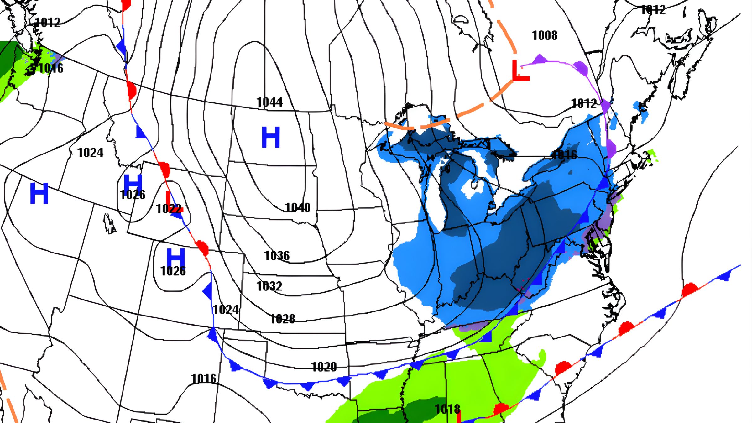
Meteorologists are tracking a quick-moving system expected to arrive late Saturday evening. Throughout the day Saturday, clouds will build across Cape May County before snow begins developing closer to midnight. With temperatures dropping sharply after dark, most of the precipitation is expected to fall as light snow.
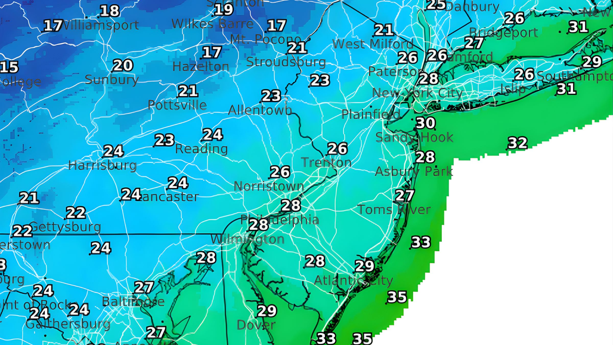
The newest projections show a coating to one inch along the immediate coast, including Wildwood, Wildwood Crest, and North Wildwood.
 Also See: Help Preserve One of Wildwood’s Most Iconic Tram Cars
Inland areas of South Jersey may pick up slightly higher totals approaching two inches, although this remains dependent on the storm’s track and intensity. This area includes Camden County, Gloucester County and Philadelphia.
Even small accumulations can create slippery roads, especially on bridges, untreated streets, and elevated surfaces. Anyone heading out early Sunday morning should use caution.
 What Residents of the Jersey Shore Should Expect
For the Jersey Shore, this is shaping up to be a minor event but one that still brings a brief taste of winter.
Snowfall is expected to be light, and temperatures may rise enough Sunday afternoon to melt much of what falls.
 However, the brief overnight window of snow could leave a thin coating on the beaches, boardwalk, and dunes before the warmer daytime air takes hold.
Winds will shift and strengthen behind the system, ushering in colder air that will settle over South Jersey for the remainder of the weekend.
Cold Air Becomes the Main Story
Even though snowfall amounts will stay light, the real headline for South Jersey may be the arrival of significantly colder air on Sunday and Monday. Forecasters are calling for temperatures to drop into the lower twenties along the shore and even colder inland.
 This colder pattern is expected to linger into early next week, reinforcing the winter feel even after the snow stops.
If you are hoping to see larger snow totals, we may need to wait until after the New Year. In the meantime, if you are going to the Philadelphia Game on Sunday, you might be able to see some of this snow on the field.
Below is our latest YouTube video on the Wildwood Boardwalk Reconstruction Project in North Wildwood. Before you watch, please consider subscribing