
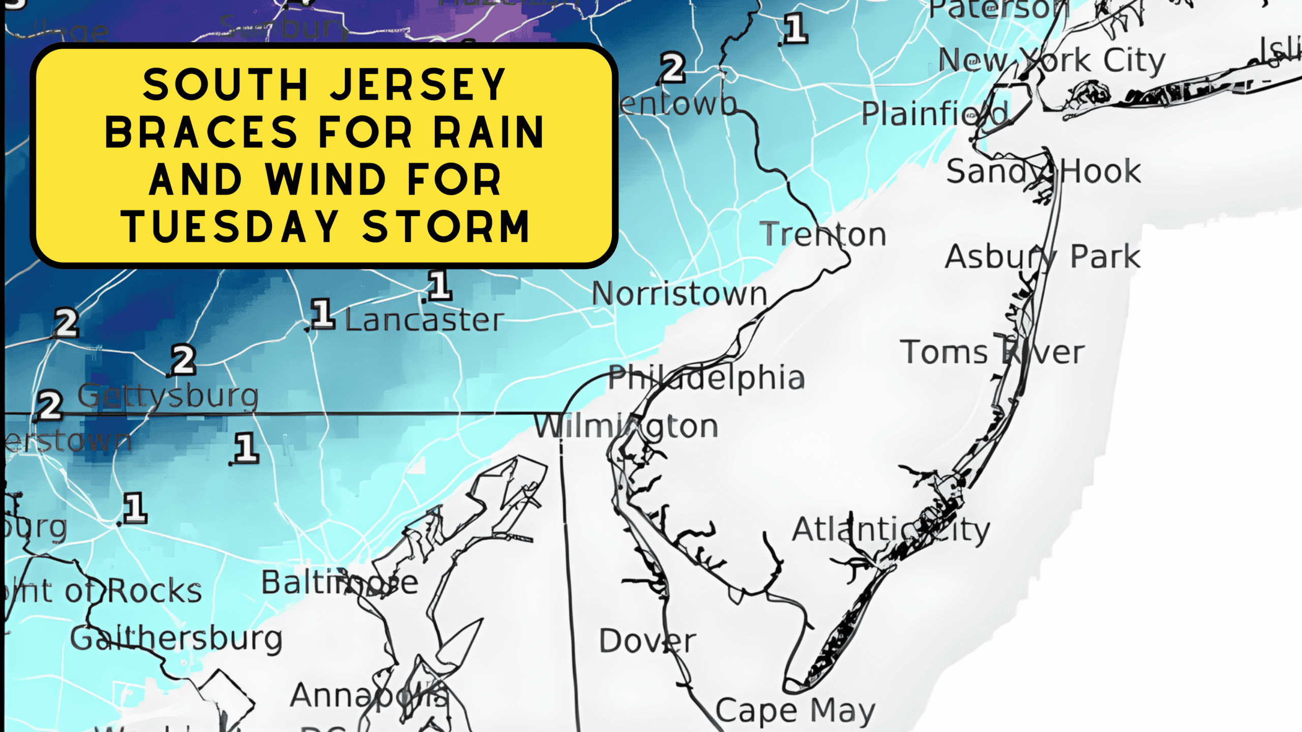
South Jersey Braces for Rain, Wind For Tuesday Storm
South Jersey is gearing up for a messy early December storm on Tuesday, December 2, bringing a mix of rain, gusty winds, and even a few flakes at the start.
While this isn’t shaping up to be a major winter event for South Jersey, the system will have very different impacts depending on where you are in the region.
The National Weather Service in Mount Holly released its latest briefing late Monday afternoon, outlining what to expect as the storm moves in.
South Jersey Braces for Rain And Wind For Tuesday Storm
What South Jersey Can Expect
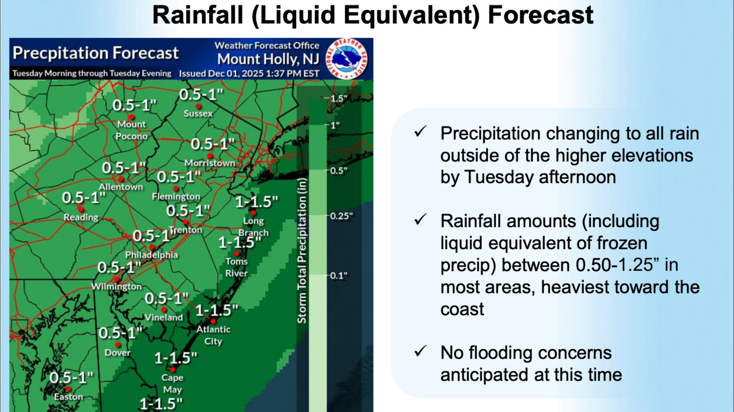
Along the southern New Jersey coast, including Wildwood, Cape May, Ocean City, and Atlantic City, Tuesday will be mostly a rain event.
Any snow that briefly pops up at the very beginning of the storm will change to rain almost immediately after daybreak.
Coastal communities should expect a cold, soaking rain through Tuesday afternoon with rainfall totals between 0.75 and 1.25 inches.
Winds will also pick up through the afternoon and into the evening. By Tuesday night, gusts along the beaches may reach 20–30 knots, with seas building to 5 to 8 feet offshore.
 A Small Craft Advisory is in effect, and conditions will be hazardous for smaller vessels
Importantly, there are no flooding concerns for South Jersey at this time.
Areas Seeing Snow is North and West of South Jersey
Also See: Massive New Bar & Restaurant Coming to North Wildwood
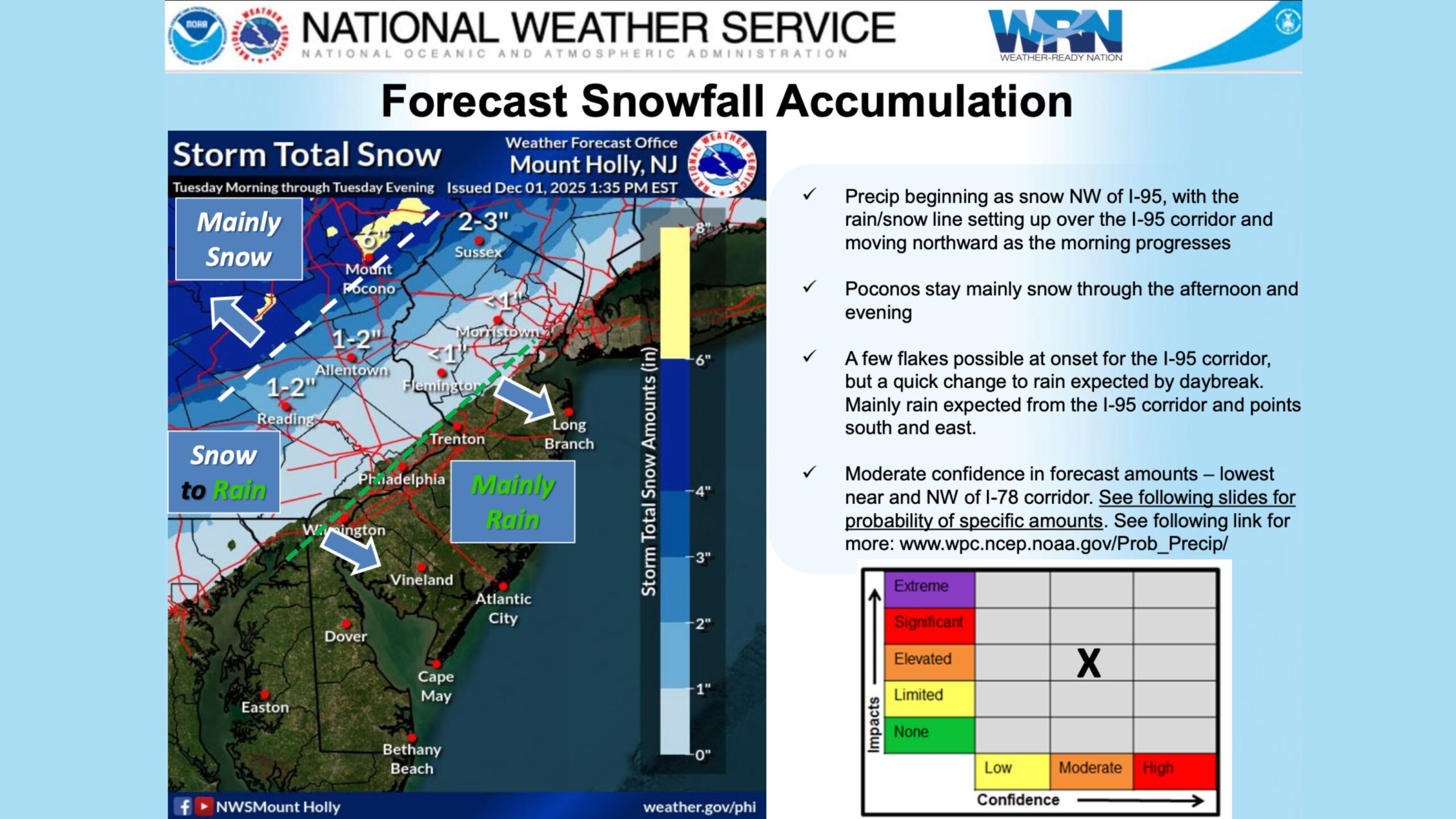
While South Jersey stays mainly wet, areas farther north and west will see accumulating snow and for some, potentially significant snowfall.
 The NWS Snow Totals and Where
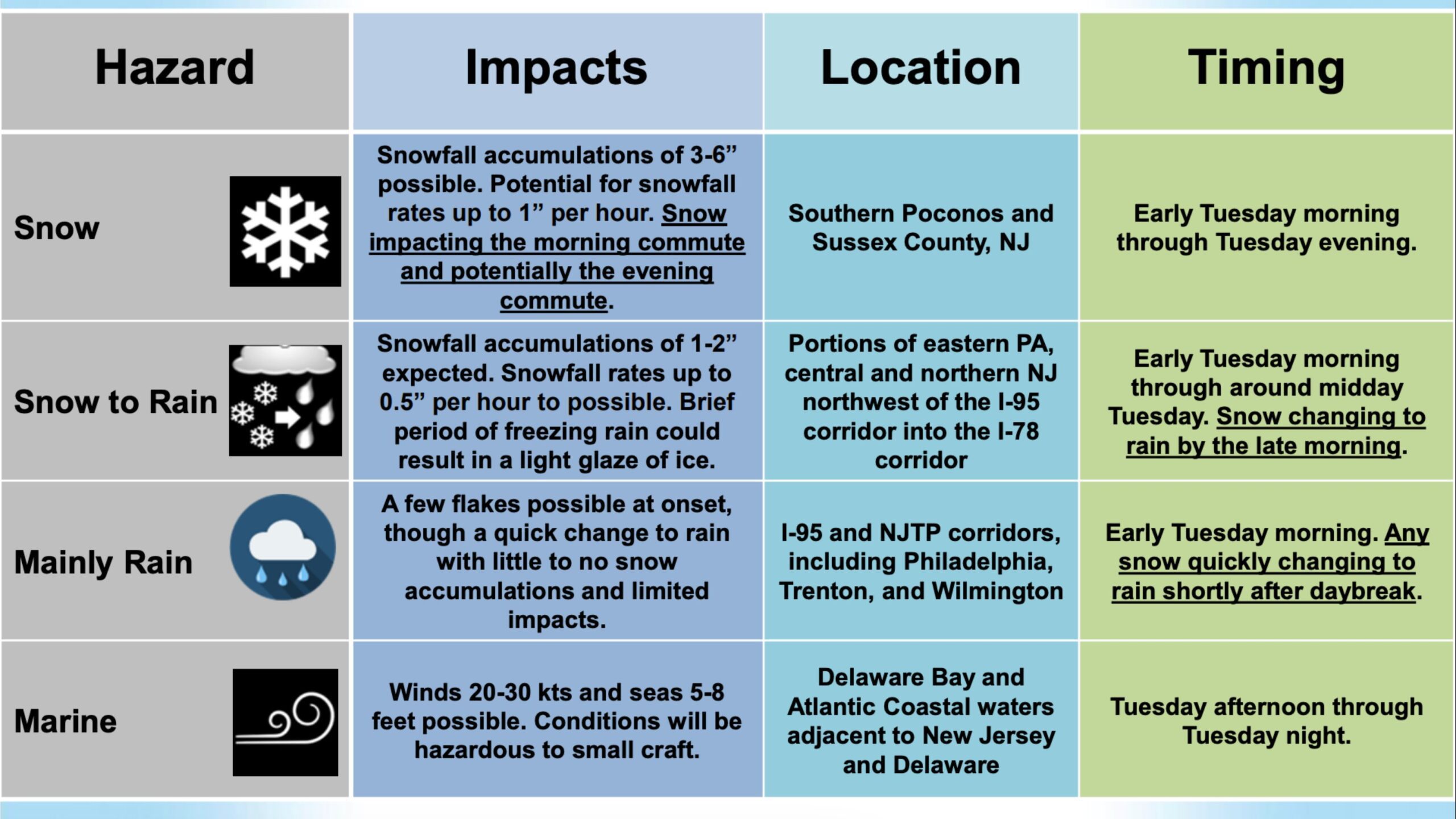
Southern Poconos & Northwest New Jersey
Snowfall of 3 to 6 inches is forecast, with snow falling at rates up to an inch per hour at times These areas will stay mostly snow throughout the entire day.
Northwest of the I-95 Corridor (Including Parts of Central and Northern NJ & Eastern PA)
A 1 to 2 inch coating is expected early, with snow transitioning to rain by late morning or early afternoon
There is also the chance for a light glaze of ice, up to 0.01 inches, during the transition, particularly for untreated surfaces. Philadelphia, Trenton, Wilmington
A few early flakes are possible right at onset, but snow changes to rain quickly soon after sunrise. Little to no accumulation is expected in South Jersey
The briefing shows the snow-to-rain line lifting northward through the morning, confirming the quick transition expected for most of New Jersey.
 Timing the Storm
The storm begins early Tuesday morning, arriving first as snow in the northernmost areas and as a rain/snow mix farther south.
Along the Jersey Shore, precipitation begins as early-morning sprinkles or brief flakes, then quickly transitions to all rain.
By midday, the entire southern half of New Jersey, including all of South Jersey, will be firmly in the rain zone.
Rain continues through the late afternoon before tapering off into Tuesday evening.
Marine Impacts for the Jersey Shore
Marine hazards are among the biggest impacts in South Jersey. According to the NWS marine forecast
- Winds will increase to 20–30 knots Tuesday evening
- Seas will build 5–8 feet
- Conditions remain rough through Tuesday night
This is not a gale-force event, but it will be choppy enough to keep many small craft in port.
 What Does This Means for the Jersey Shore?
For those of us at the shore, this storm is mostly an inconvenience, not a winter wallop:
- No accumulation
- All rain
- No coastal flooding expected
- Gusty evening winds
- Rough ocean conditions
But just a few hours north, it’s a totally different story with plowable snow and slick travel.
This is another classic early-season system where South Jersey stays mild while the northern half of the state taps into colder air.
Final Takeaway
A widespread storm moves through the region Tuesday, but its impacts will vary dramatically depending on location. South Jersey stays rainy, breezy, and chilly, while Northwest New Jersey and the Poconos tackle several inches of snow and a slippery morning commute.
If anything shifts, we’ll update you on the Wildwood Video Archive. Stay dry, South Jersey and for those heading north, drive carefully.