
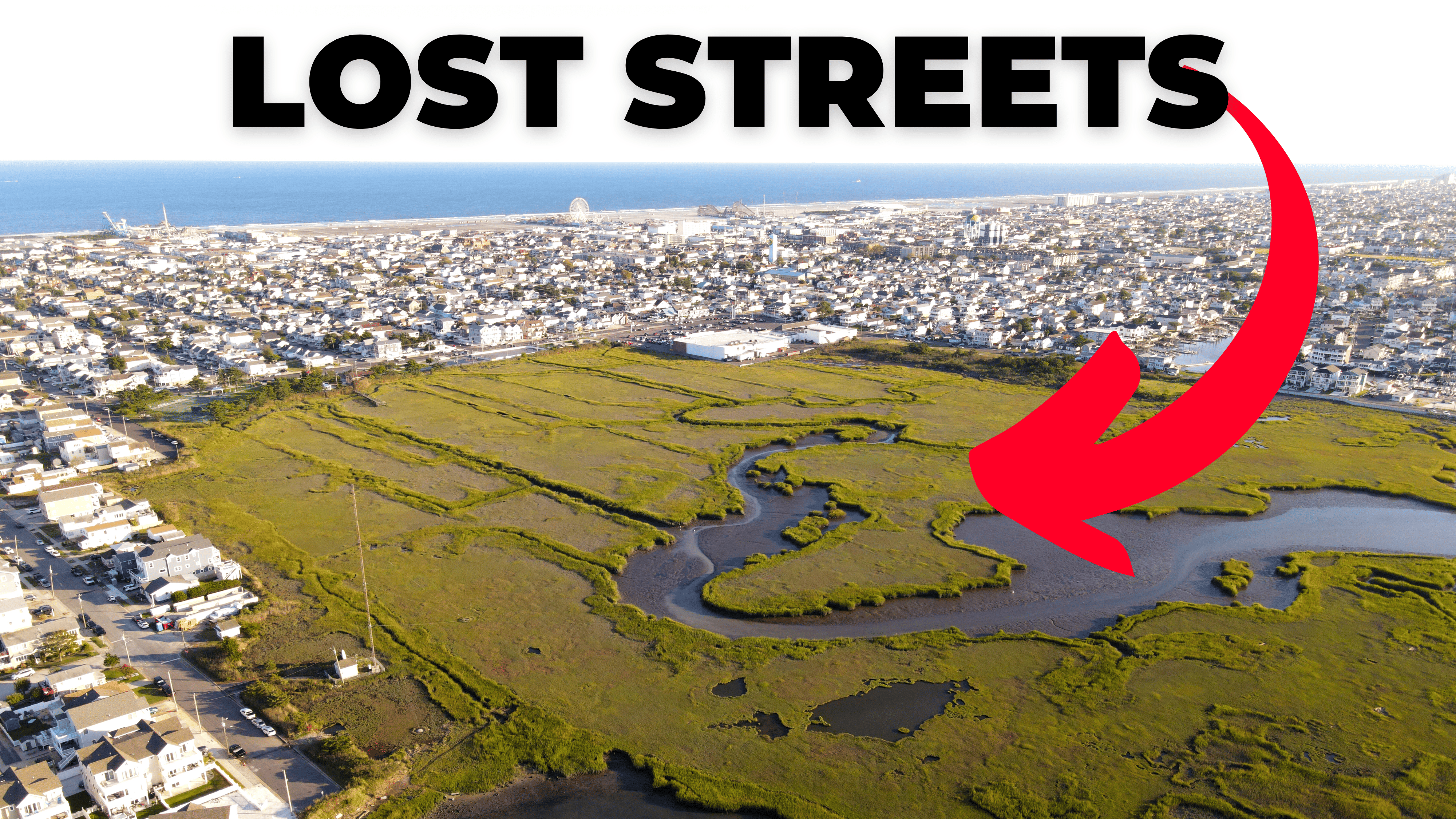
The LOST Streets of North Wildwood
The North Wildwood that we all love today was built off of one man’s dream of creating the perfect island. Its shape, waterways, and beaches were all designed over 100 years ago but, the final outcome was very different than what was planned for.
The Wildwood Video Archive was asked by viewers why the back bays in North Wildwood were never built. This created a two-month deep dive into our history. With the help of North Wildwood’s City Clerk, Scott Jett, we answer this question in a video.
You can watch the video at the bottom of this article.
The LOST Streets of North Wildwood
To understand how we got to today’s North Wildwood we have to go all the way back to the beginning of the island’s history when Anglesea was just a fishing village in the 1880s.
It was then that officials started planning what the rest of the Island could become.
Frederick Swope and a partner had purchased most of the undeveloped land South of Anglesea from Humphrey Cresse.
You might know this name since there is a street dedicated to him.
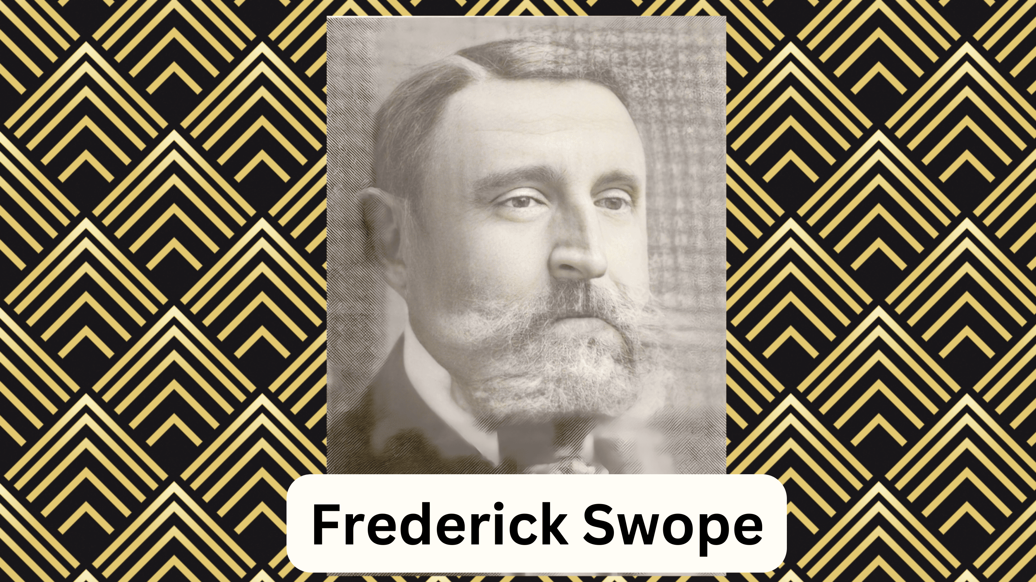 Swope would later start the Five Mile Beach Improvement Company and the Anglesea Railroad to help create the North Wildwood we know today.
Swope brought the trains to the Wildwoods since he knew that a more accessible town would bring more people to visit and buy property.
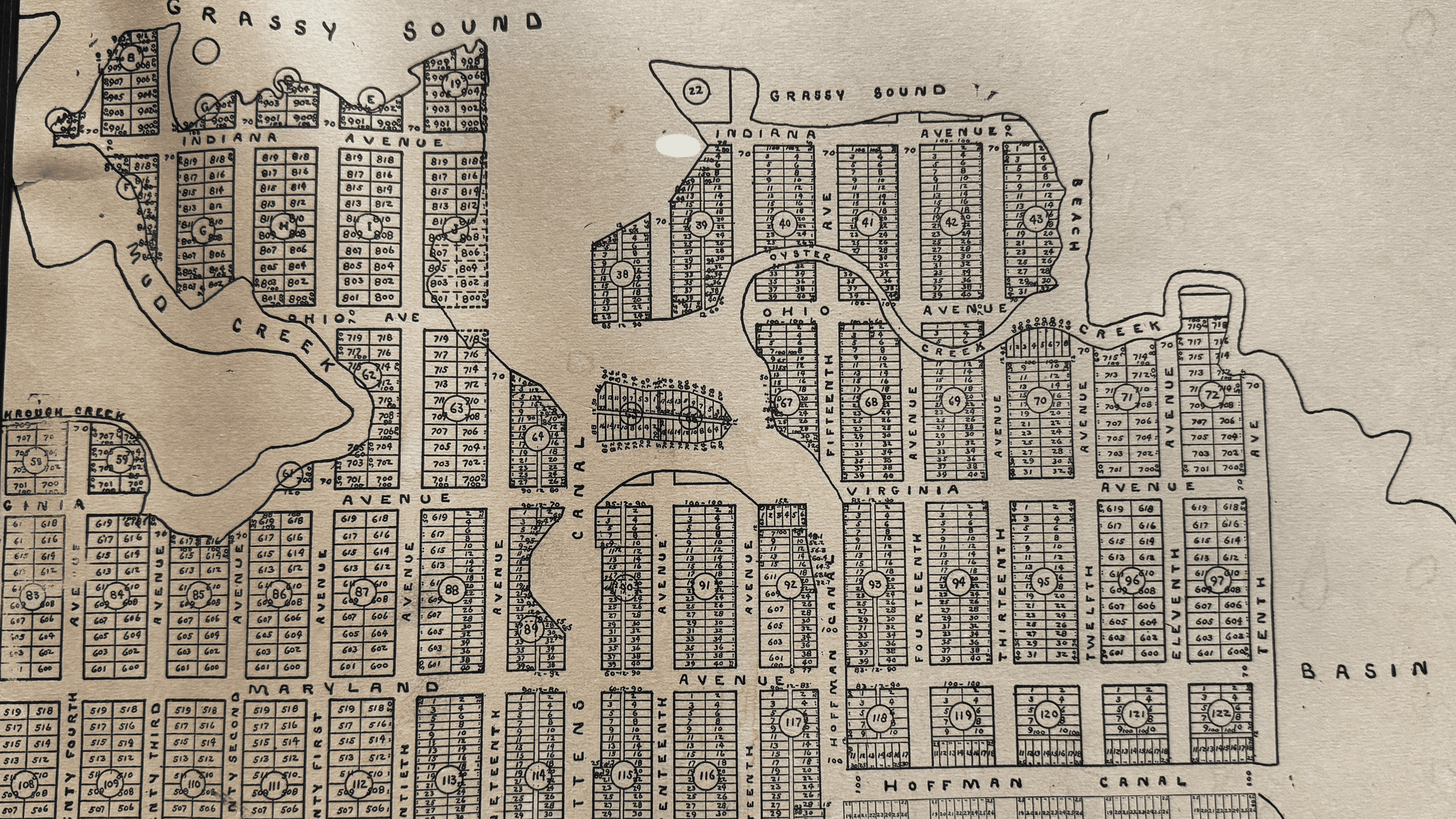
It was his 1879 marketing map that showcased what the town’s grid could look like. This was never filed with the county since it was more or less a map to promote what the island could be.
Consisting of street names not known today and a strange new shape of the island.
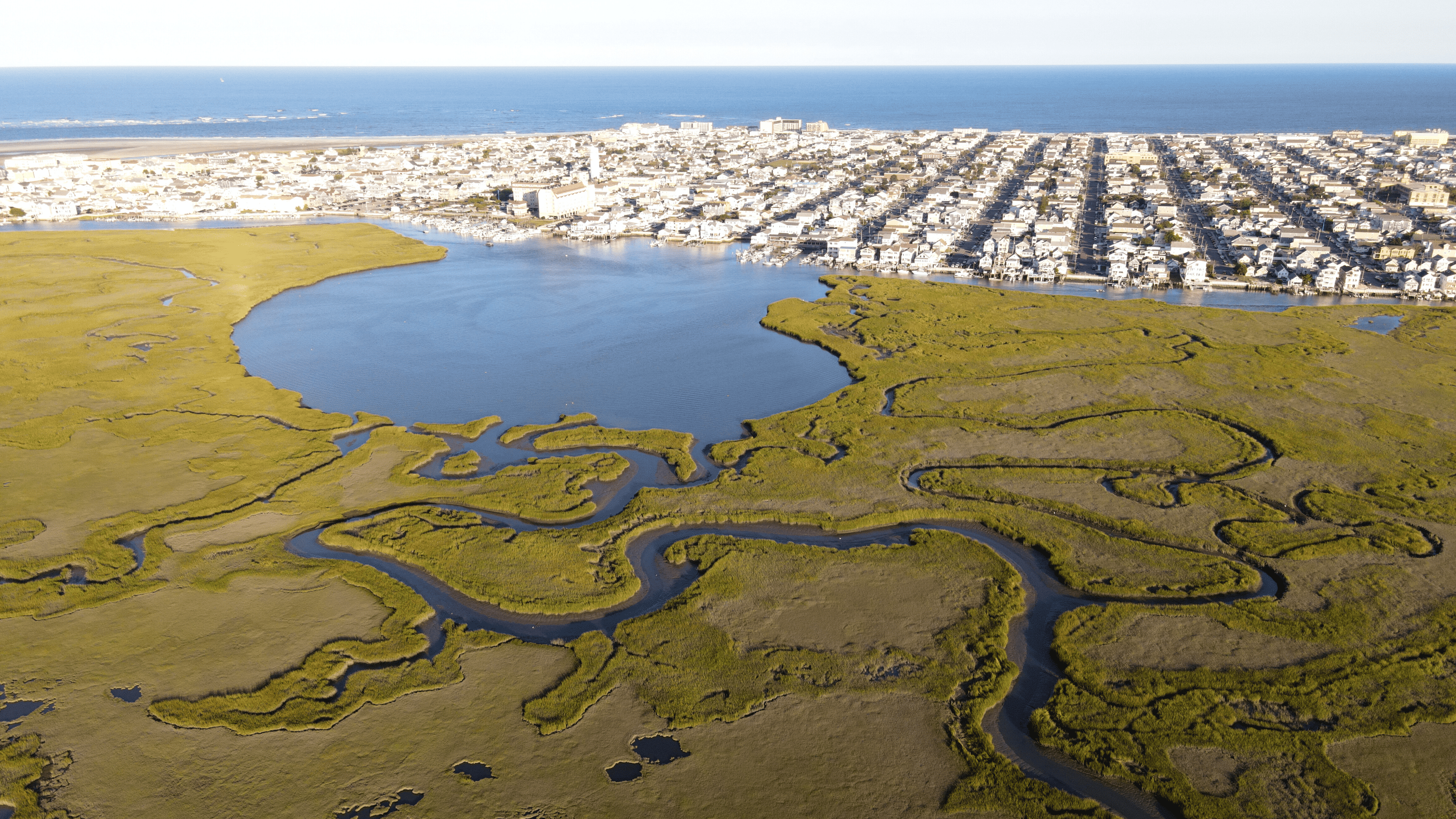
Many of the back bays we see such as the one behind the Albert J. Allen Memorial Park or the massive development behind Delaware Ave between 8th and 15th, were planned to be filled in to become part of the city grid.
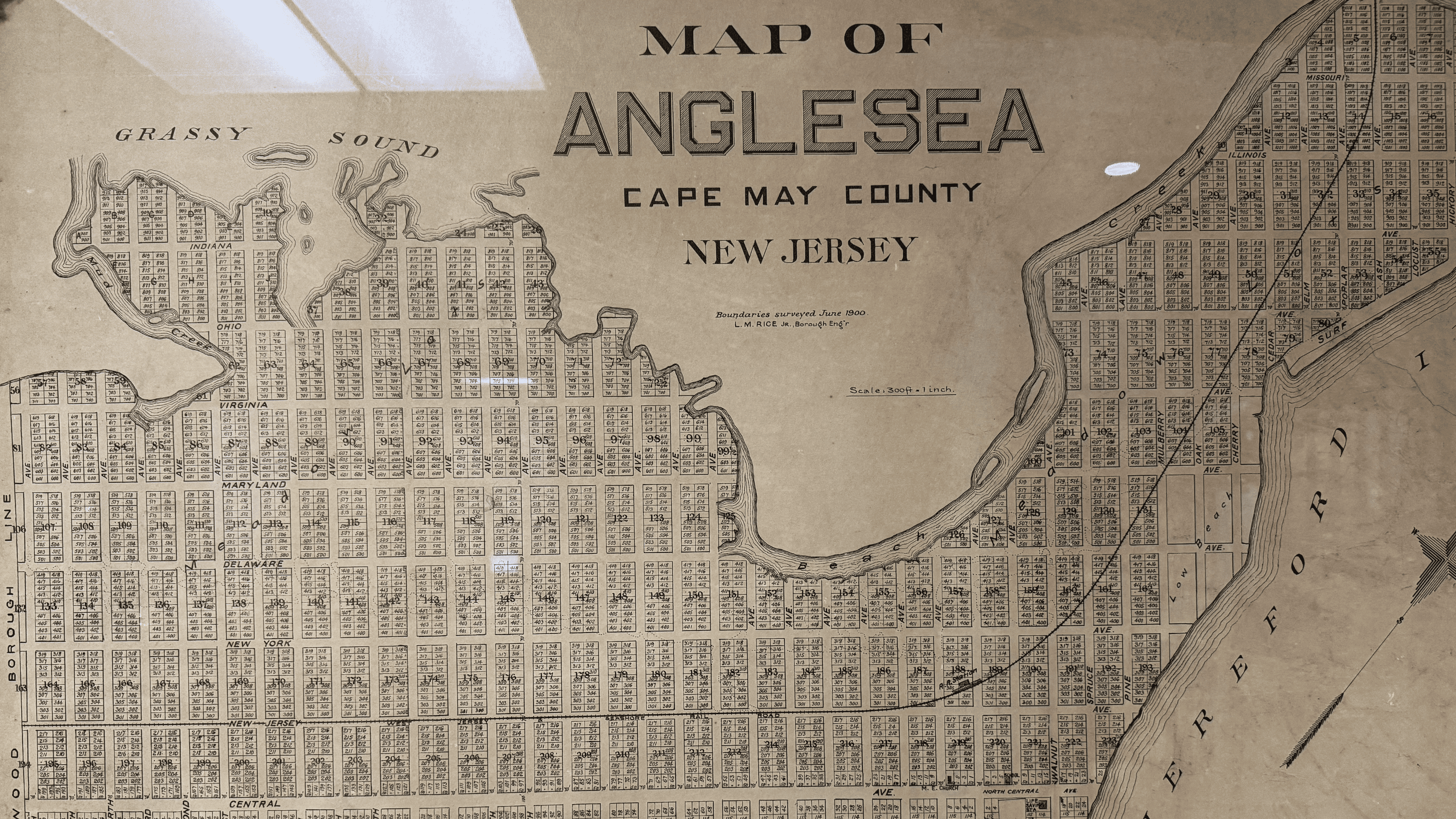 The map explains where many of our street names come from as Swope named most of them after States such as Pennsylvania, NJ, New York, Delaware, Maryland Virginia, Ohio Indiana, and Illinois, some of these streets were never heard from again.
This marketing map worked and people started buying up properties through the North Wildwood Land Company.
Advertisements started popping up in newspapers all across the state and in Philadelphia.
 A 1903 advertisement in the Five Mile Beach Journal explained the new city as “beautifully laid out, with wide hard streets, broad cement sidewalks, a bathing beach, a new trolley road, good train service, pure artisan city water, electric lights, and many handsome cottages.”
As work got underway to start building out the city, crews realized that due to the flooding that took place in those back bay streets, they would need to haul in much material to make any construction possible.
They instead turned to the Ocean Avenue area as the place to build since it was higher than the back bay areas and therefore needed little or no fill to develop.
 As the years went on, some developments in the back bays did take place. Ottens Canal, which was developed under Henry Ottens, was advertised as “one of the island’s Greatest Improvements” which includes 300 new lots where someone could build their dream cottage.
As each new map was being released, the back bay lots started to be dropped.
In the early 20th century, public officials recognized that the Boardwalk/Entertainment areas near the beach would become more crucial to the municipality in the long run then the Back Bay/Hereford Inlet fishing industry.
This realization marked a strategic shift in the municipality’s priorities and would then get us to the city layout we know today.
At that time Surf Avenue, which was originally a beach block, was hundreds of feet away from the water which led the city to build Ocean Avenue and later another street in front which we call JFK today.
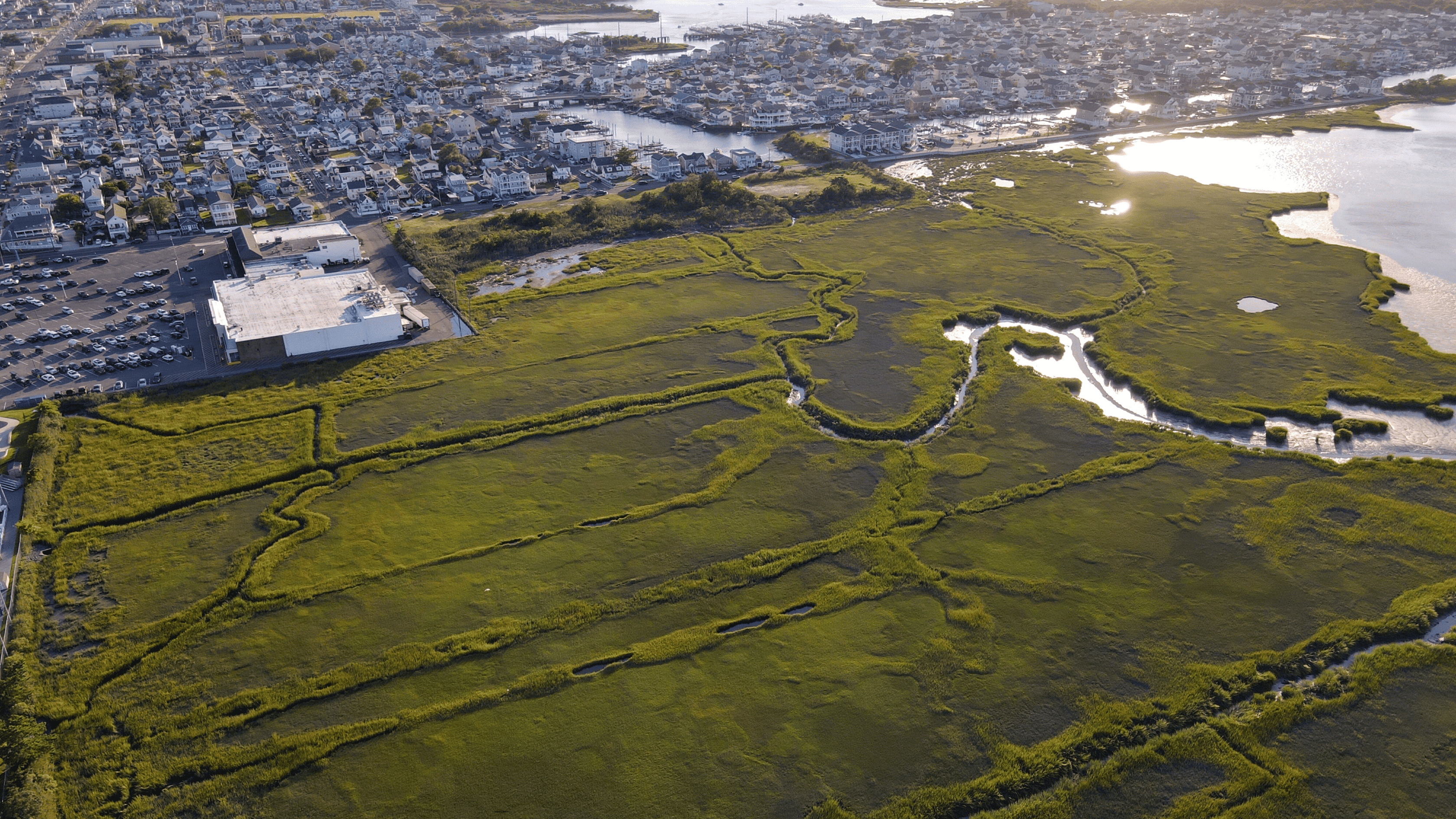 Over the passing years, there were no proposals to develop the back bays, except for the implementation of the Hoffman Canal.
This absence of development has preserved the island’s stunning bay views and provided an additional layer of protection against more severe flooding.
Besides giving us some stunning sunset views, the bay has given us an additional layer of protection against more severe flooding.
The video below breaks down all the maps and progression of the city over time.
Before you watch please consider subscribing to our Youtube channel.