
The Mystery of New Jersey’s Pine Barrens Giant Letters
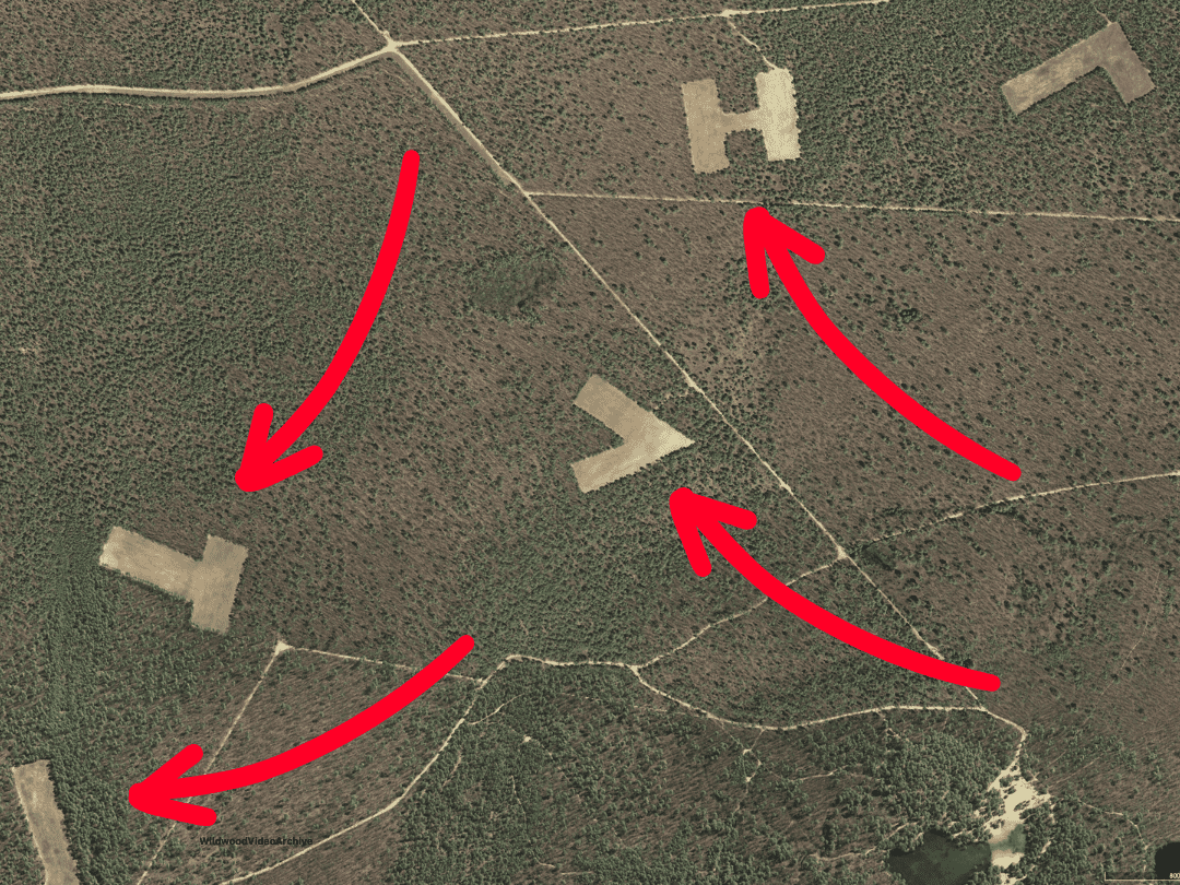
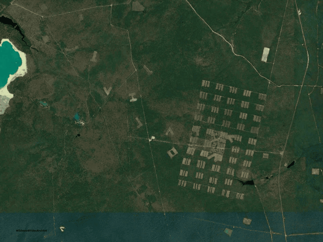
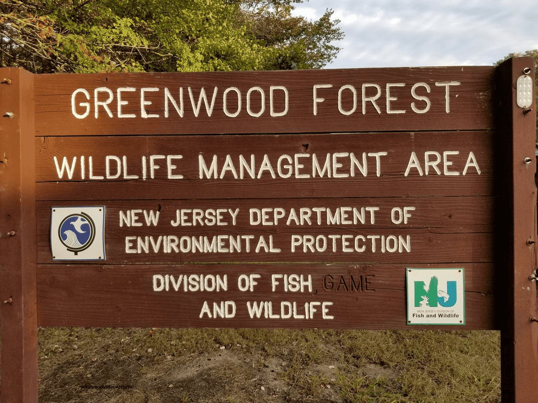
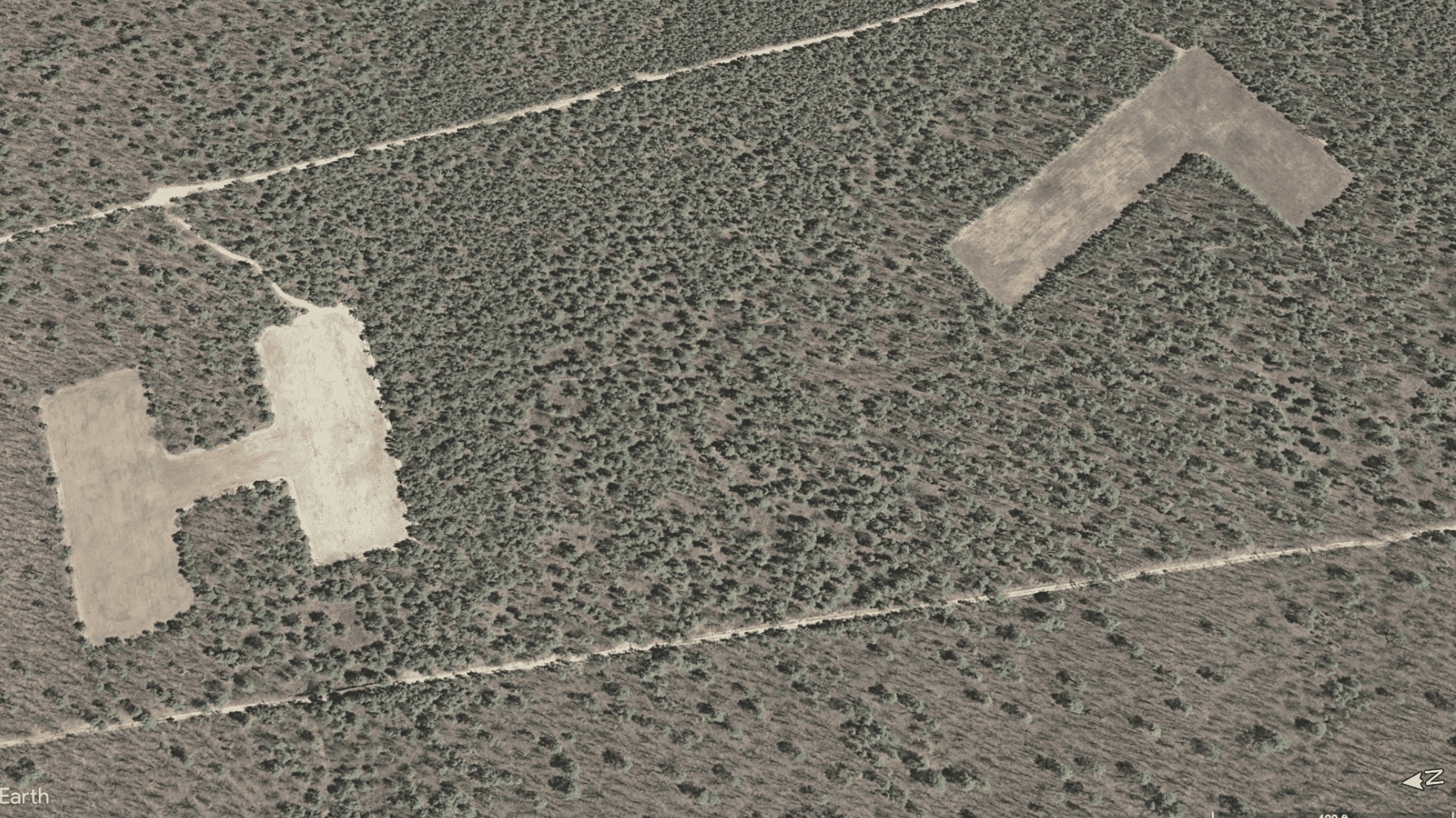
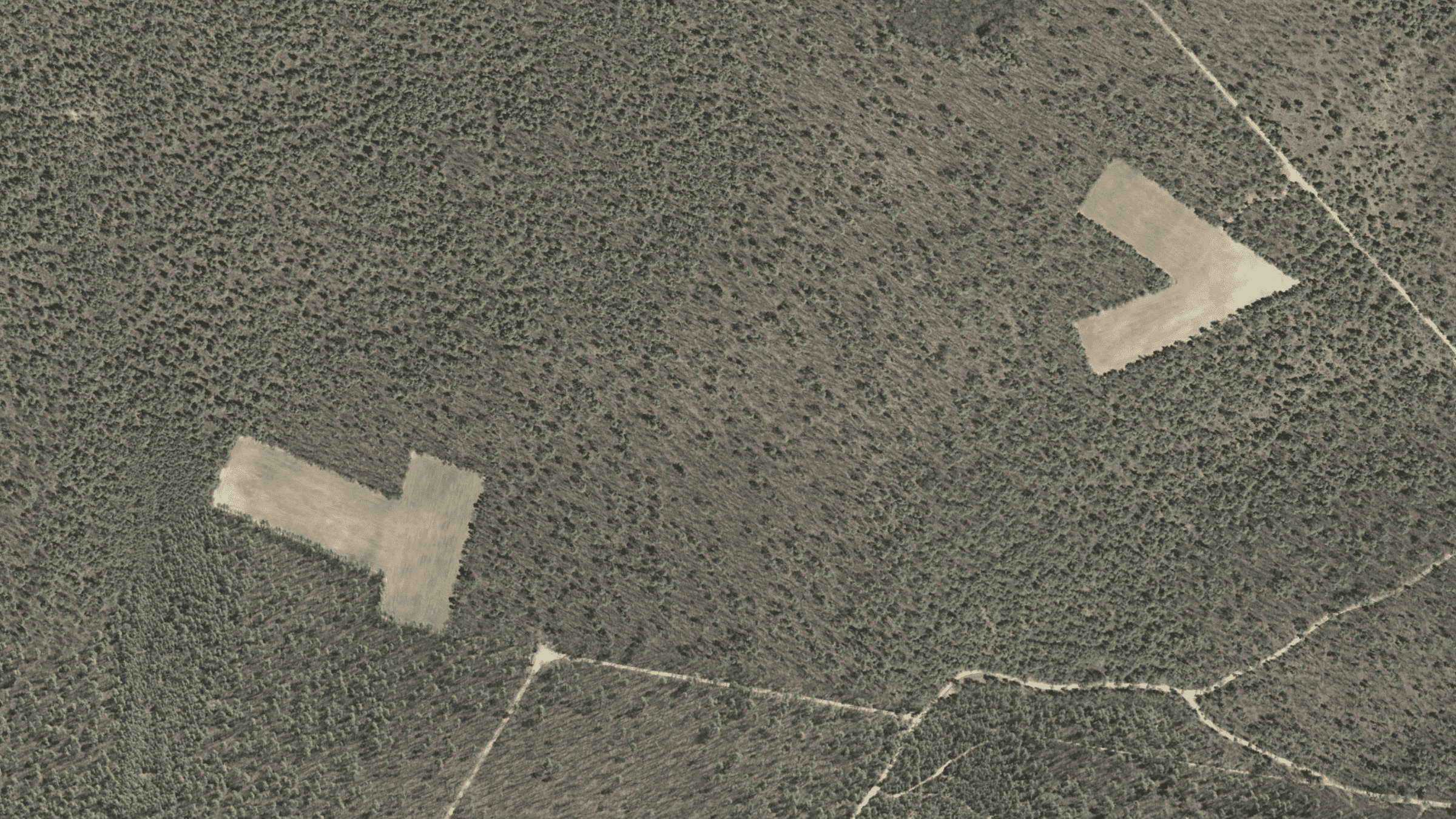
If you ever check out the area near Greenwood Wildlife Management Area in Ocean County, New Jersey on Google Maps or Google Earth, you might notice something strange. In the forest, there are these really big letters carved out, like “L,” “T,” “V,” “O,” “J,” and “H,” with a few of the letters repeating.
The Mystery of New Jersey’s Pine Barrens Giant Letters
They’re about 600-900 feet wide on average and arranged in a grid pattern.
As viewing images on Google has become more popular than ever, people have now taken to social media to see what they’re all about. Was it a joke from Campbell’s soup to advertise their alphabet soup or did someone play a joke for pilots?
Looking at old pictures from the area, these giant letters have been there since the late 1960s/early 1970s and included not only these giant letters but also a grid of cleared land.
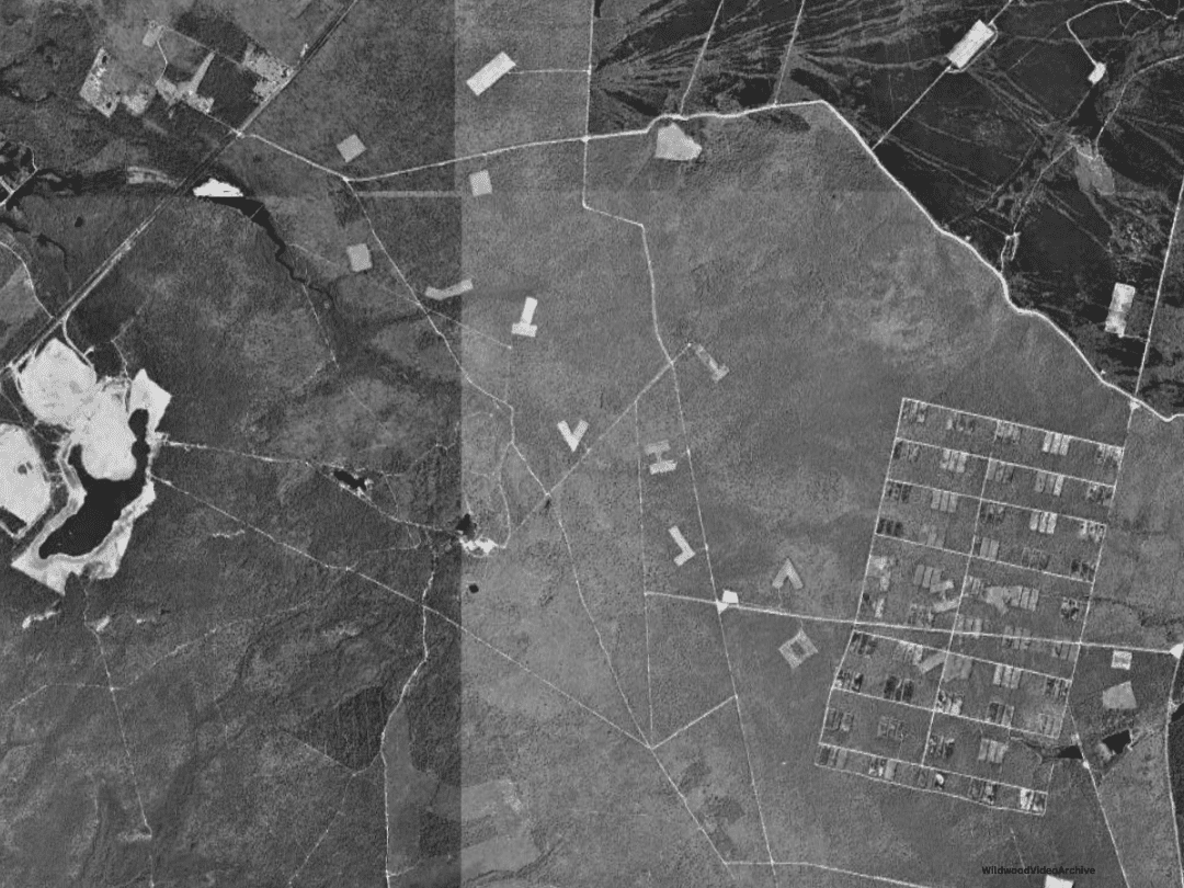 These letters don’t spell out any words nor are they in any particular order. Since these letters are so deep into the Greenwood Wildlife Management Area, it wasn’t something locals knew about until aerial photos and Google Earth.
People who first found these online automatically assumed that they belonged to a World War II training area since much of South Jersey has these types of targets.
Something similar can be found in Millville New Jersey where bunkers and other targets were created to help train the P-51 Mustang pilots to hit certain targets in Europe.
 Since this area was managed by the state, they were the best ones for the answer.
Back in 1963, there were some big wildfires in the Pinelands that burned up a huge chunk of land. It was a really bad day for New Jersey, known as “Black Saturday,” because it destroyed a lot of homes and forests.
It was April 20, 1963, when “Black Saturday,” stuck. Seven lives were tragically lost, and over 400 structures succumbed to the flames, resulting in property losses exceeding $8.5 million.
A staggering 183,000 acres, approximately 4% of the state’s land, fell victim to the infernos as 127 fires ravaged the countryside, with the last embers not extinguished until two days later.
 The ominous signs of disaster loomed as Saturday dawned, with weather conditions portending the impending catastrophe.
The region languished in the grip of a severe drought that had persisted since the autumn of 1962, with rainfall plummeting five inches below normal since March.
Also See: When Does The Wildwood Boardwalk Open?
Under a cloudless sky, relentless winds howled at 25 to 30 miles per hour, gusting up to 45 miles per hour.
By afternoon, the relative humidity plummeted to a mere 15%, exacerbating the perilous conditions. Temperatures soared to 81 degrees Fahrenheit by 2 p.m., surpassing the April norm.
 The stage was ominously set for the unfolding calamity.
According to reports, the first flames ignited in Lebanon Township at 9 a.m., swiftly followed by two larger blazes in Ocean County – one engulfing Jackson Township and the other Berkeley Township.
These fires, triggered by blueberry farmers burning debris, gave rise to three infernos spanning 76,000 acres across Ocean and Burlington Counties.
Ong’s Hat and Presidential Lakes in Pemberton Township, along with the County Lakes area of Browns Mills, were engulfed in the relentless onslaught, with flames devouring Routes 70 and 72.
As the afternoon wore on, an additional 575 acres fell prey to the relentless march of destruction in Medford and Evesham Townships.
 After the fires, people decided to do something to help the area recover. Turns out, those big letters are part of a project to improve wildlife habitats. They’re fields planted with rye in shapes like letters.
These fields help create a special kind of habitat called an edge habitat, where different types of cover meet and make a home for lots of different plants and animals.
The idea is to protect certain plants and help them grow and for over 50 years the state has been doing just that.
Every X amount of years the state burns these areas to keep everything healthy.
This is called a control burn and yearly you can see some of these burns as they advertise them in advance so that people don’t call 911, which they still do.
Whether or not the Pine Barrens needed people to step in, it seems like things like these controlled fires have been good for the local plants and animals.
So, what looked like a big mystery turned out to be a story about people trying to help out nature in their way after a disaster.
Those big letters in the woods aren’t just random–they’re part of a plan to make things better for the environment.