
Tri-State Winter Weather Update
According to the latest reports, a winter storm will be moving into the tri-state (New Jersey, Pennsylvania and Delaware) on Friday, bringing with it a range of precipitation types. While some areas may see heavy snowfall, others can expect more rain or even a mix of both.
Here’s a breakdown of what to expect according to the latest National Weather Service briefing in Mount Holly.
Tri-State Winter Weather Update
Later this afternoon, precipitation will form and mostly fall as rain near and south of the I-95 corridor. However, for the southern Poconos and far NW NJ, the precipitation will begin as snow and persist as snow until Saturday morning.
Also See: Public Hearing on New Jersey Offshore Wind Farm
 In the Lehigh Valley and the rest of northern New Jersey, there will be a mixture of rain and snow this afternoon, which is likely to shift to mostly rain this evening and back to snow tonight.
Monroe county is presently under a Winter Storm Warning, while Lehigh County (PA), Hunterdon, and Somerset counties (NJ) no longer have Winter Weather Advisories in effect. This is a change from their report yesterday.
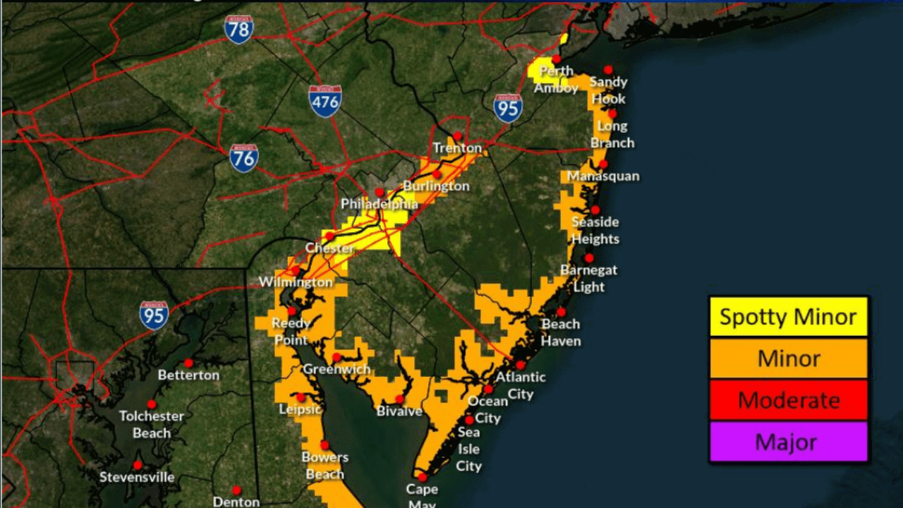
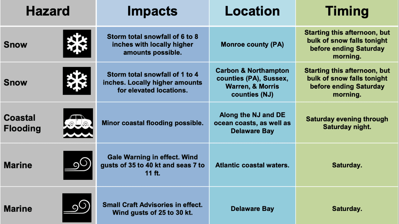 Gale force wind gusts of 35 to 40 kt will develop on Saturday afternoon for the Atlantic coastal waters. Minor coastal flooding is likely behind the departing storm with the high tide cycle Saturday evening into early Sunday morning.
Also See: Kelly’s Cafe To Become Copper Dog
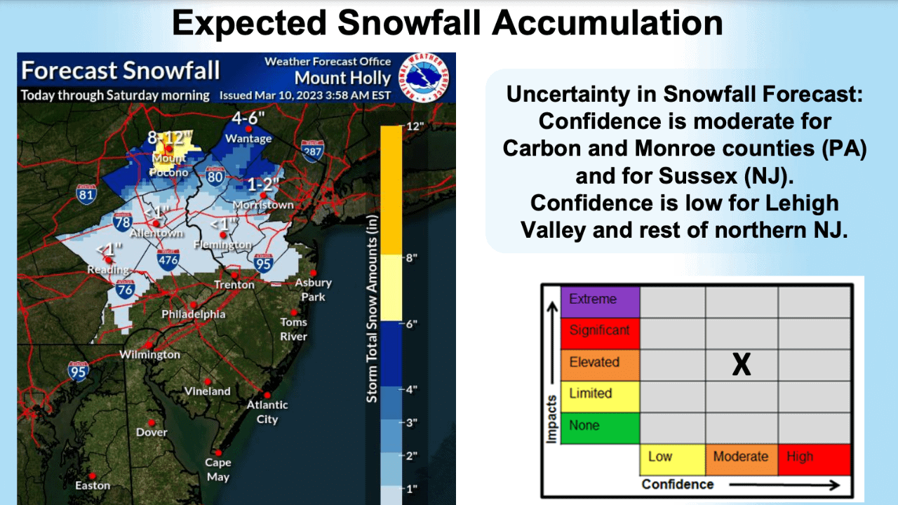
When it comes to snow, South Jersey will mostly see rain. Carbon & Northampton counties (PA), Sussex, Warren, & Morris counties (NJ) will see snowfall of 1 to 4 inches. Locally higher amounts for elevated locations
Monroe county (PA) will be seeing the highest amount of snow ranging from 6 to 8 inches.
Check out these other videos and articles.