What To Expect in New Jersey’s Snow Storm – Sunday Night Update
It is the eve of the first significant snow that South Jersey has seen in about three years. After watching this storm form for over the past three days, here is the latest coming in from the National Weather Service in Mount Holly.

What To Expect in New Jersey’s Snow Storm – Sunday Night Update
I will note that some newscasters do have smaller total then listed in the NWS press briefing from this evening.
Timing and Accumulation
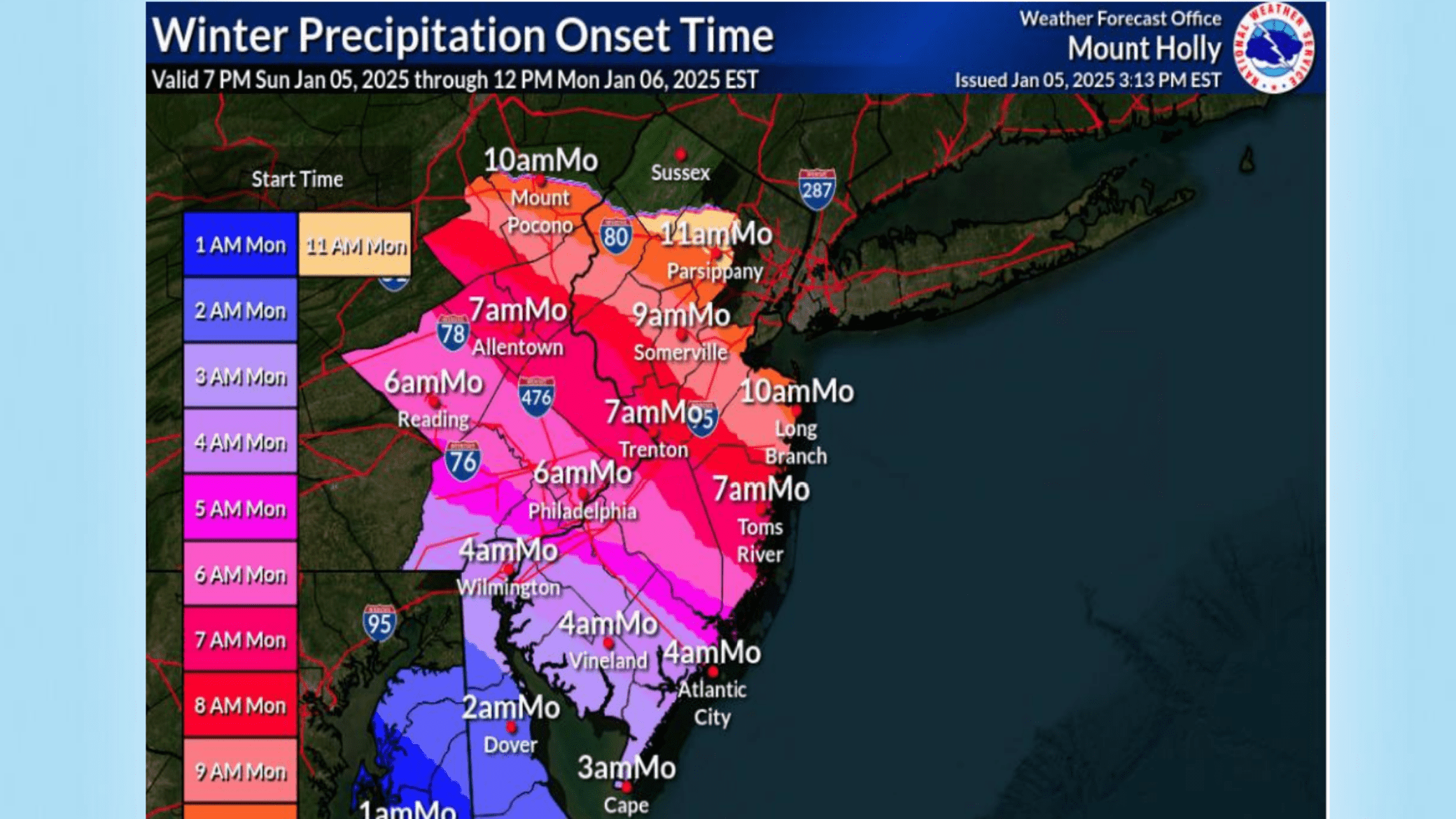
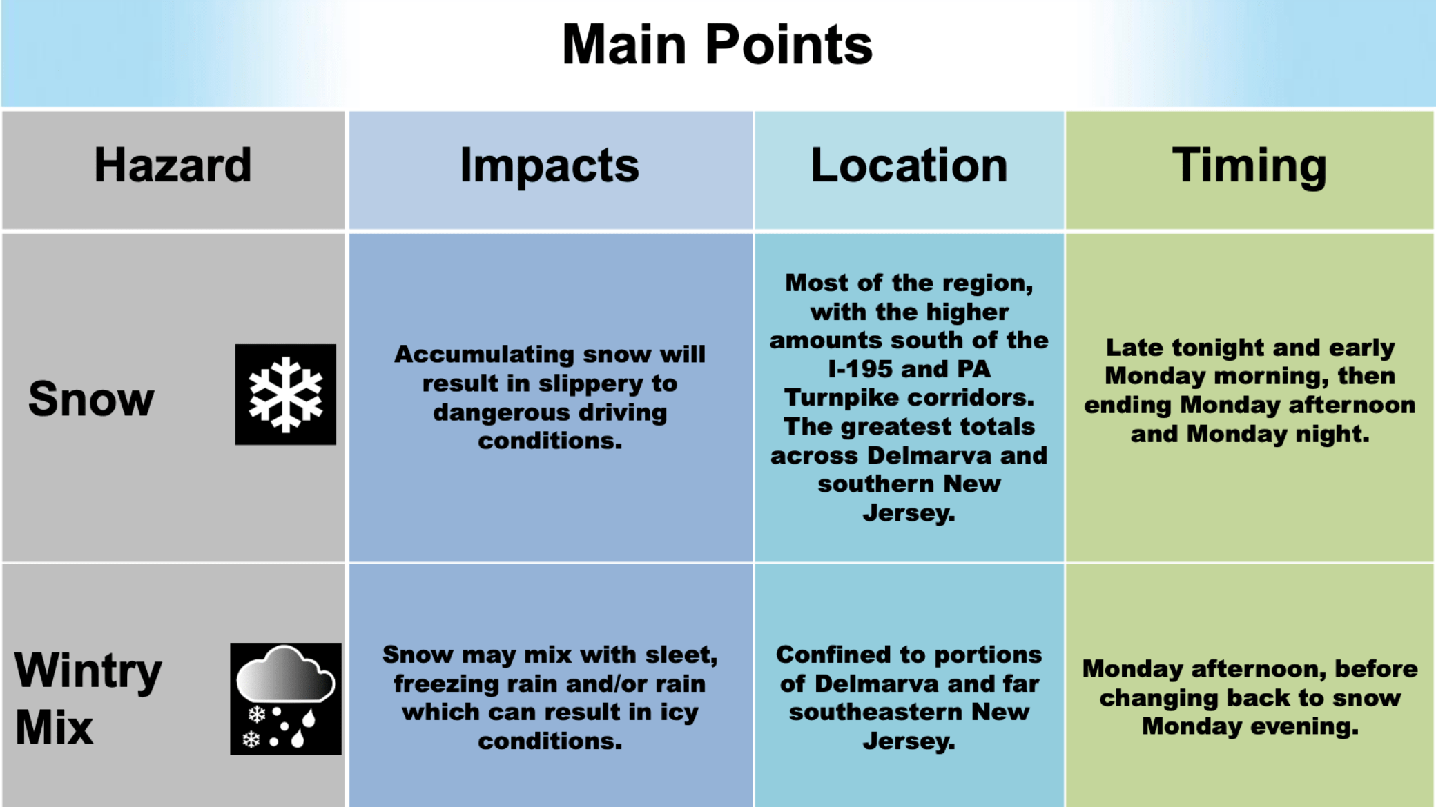
- Snow Arrival: Snow will begin late tonight and early Monday morning, continuing into the afternoon for some areas. The system is expected to taper off Monday night.
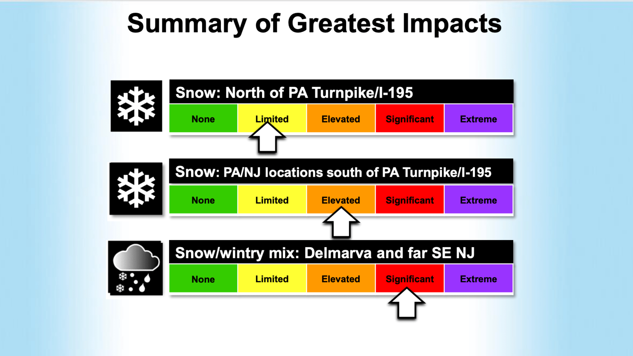
- Accumulation: Cold conditions will cause snow to stick quickly to untreated surfaces. Areas south of the I-195 and PA Turnpike corridor, including Delmarva and southern New Jersey, will see the highest snowfall amounts. Snowfall totals will decrease significantly for areas north of this line.
- Heavy Snow Band: A concentrated band of heavier snow is forecasted to develop across Delmarva and far southern New Jersey Monday morning, with snowfall rates potentially exceeding 1 inch per hour.
 Mixed Precipitation in Southern Areas
- Mixing Possible: In portions of Delmarva and Cape May County, NJ, snow may transition to sleet, freezing rain, and rain during Monday afternoon as temperatures rise just above freezing.
- Return to Snow: As temperatures drop below freezing Monday evening, these areas will see a change back to snow, likely resulting in icy road conditions.
Snow Totals
 The more northern you go, the less snow.
- Philly and surrounding towns : 3-4 inches of snow.
- Wilmington + Gloucester township to the Ocean: 4-6 inches of snow
- South of Vineland to Cape May: 6-8 inches of snow (with a positivity of 12 inches)
 Wind and Blowing Snow
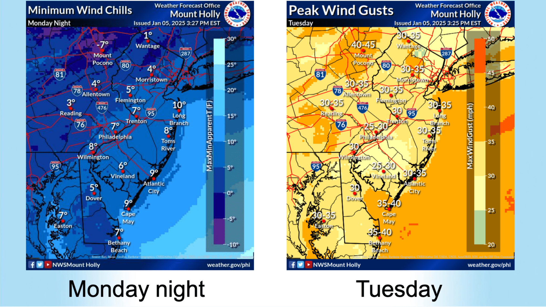
- Gusty Winds: North to northwest winds will strengthen Monday night into Tuesday, with gusts ranging from 30-45 mph. This will lead to areas of blowing and drifting snow, further reducing visibility and complicating travel.
- Wind Chill: Wind chill values will plummet to the single digits and teens Monday night and throughout Tuesday.
Cold Week Ahead
- Subfreezing Temperatures: The region will remain below freezing for most of the week, with nighttime wind chills dipping into the single digits.
 Prepare for Hazardous Conditions
Residents are advised to:
- Monitor road conditions and avoid travel if possible during periods of heavy snow.
- Treat sidewalks, driveways, and roads to reduce ice buildup.
- Secure outdoor objects to prevent wind damage.
- Dress warmly and limit time outdoors due to dangerous wind chills.
Stay tuned to local weather updates and alerts for the latest information.
