What To Expect on Monday’s Snow Storm – Friday Night Update
The National Weather Service in Mount Holly has issued a detailed forecast for the upcoming snowstorm, which is set to impact much of the region starting late Sunday night. Here’s what you need to know:
What To Expect on Monday’s Snow Storm – Friday Night Update
Snow Accumulation
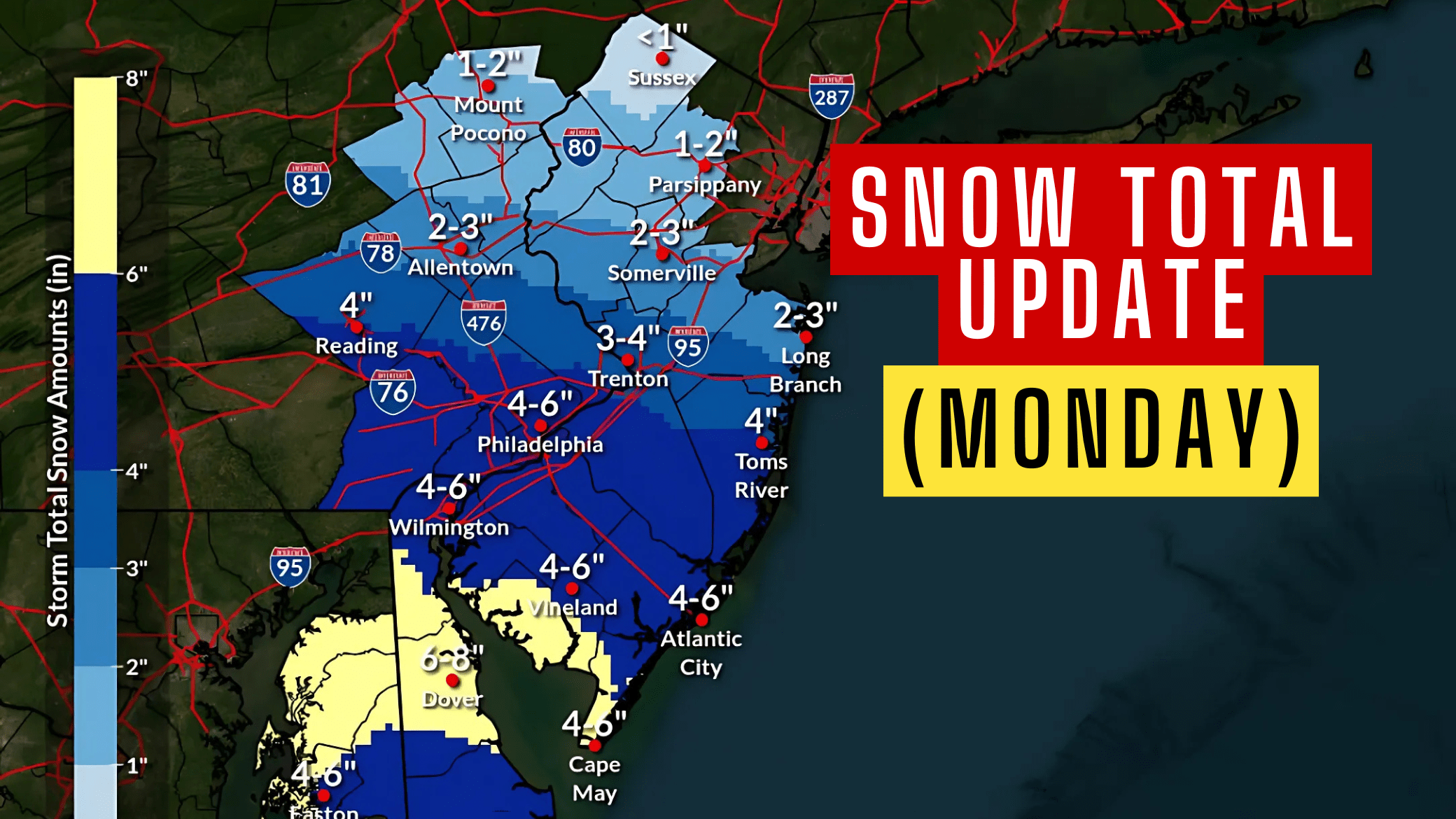
Widespread snow is anticipated, with the heaviest totals south of the Interstate 78 corridor.
South Jersey and Philadelphia can expect 4-6 inches, while Dover, Delaware, may see the highest totals at 6-8 inches.
Additional light snow accumulation is possible Monday night as the storm tapers off.
 Wintry Mix and Ice Risk
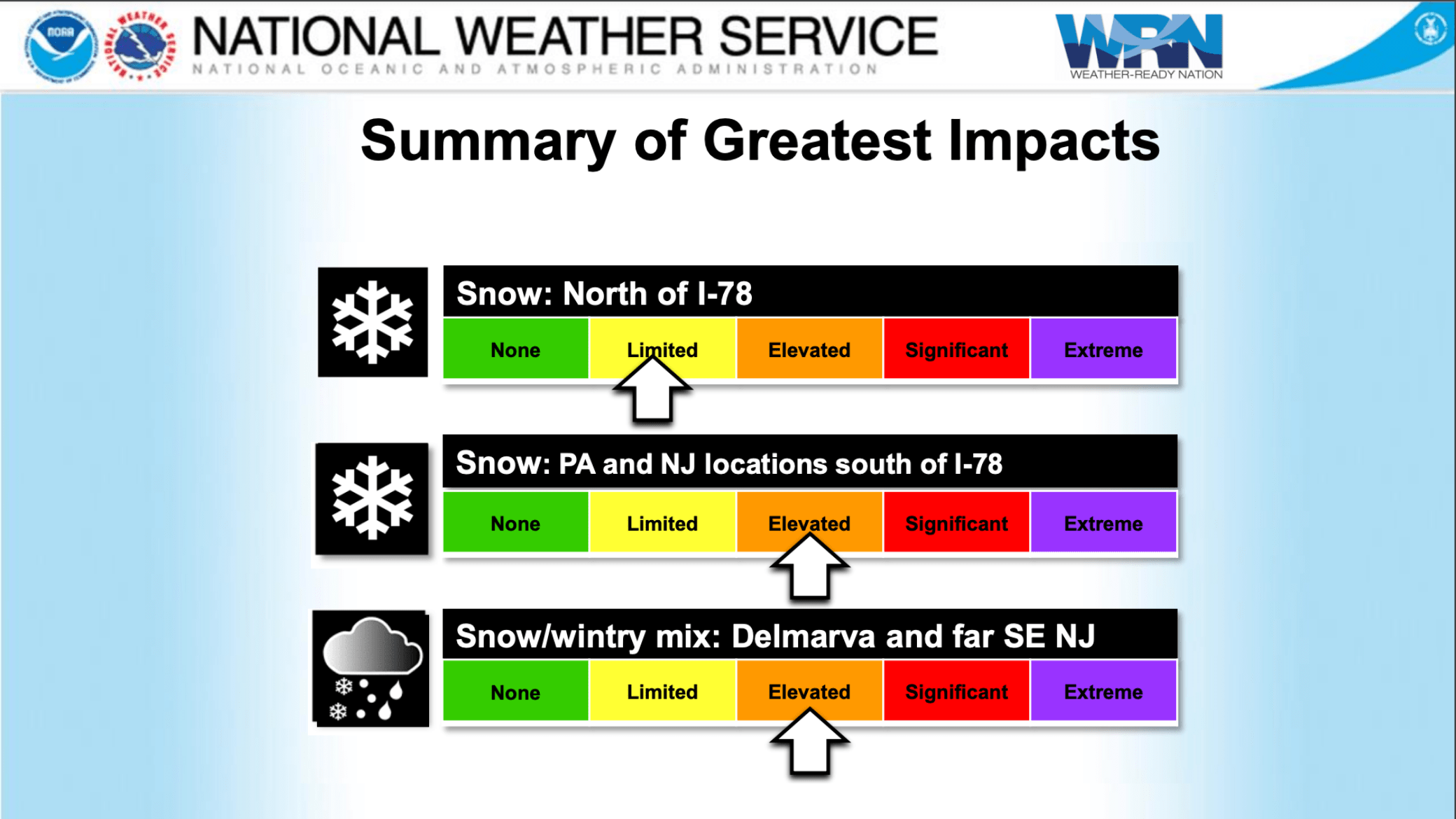
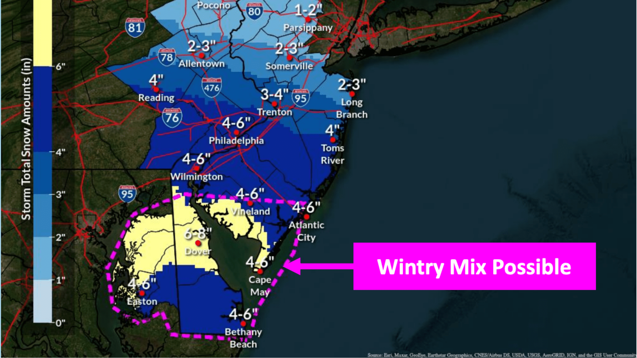
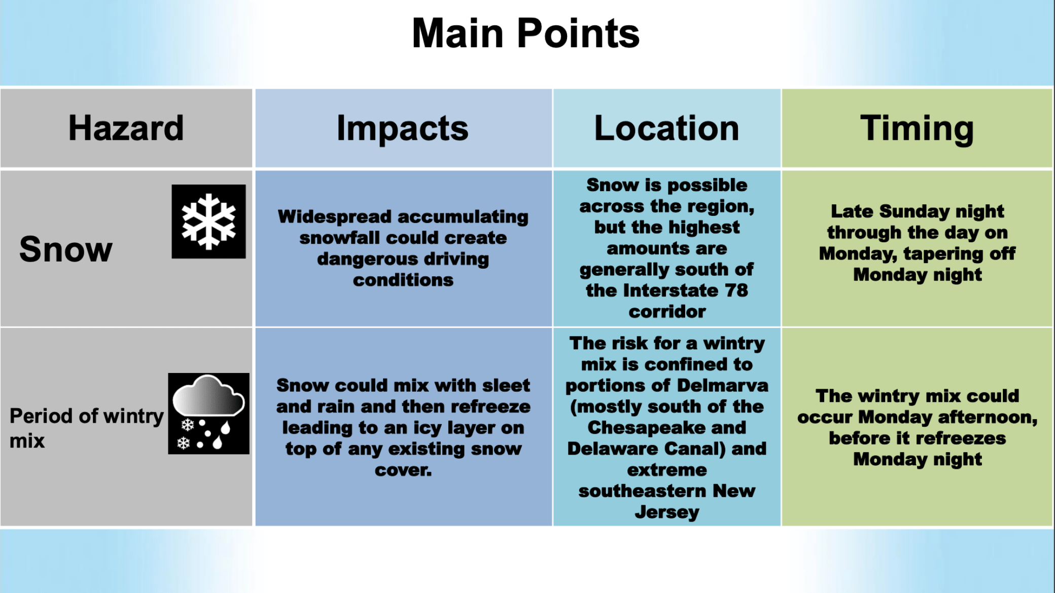
A period of wintry weather is likely for parts of Delmarva and southeastern New Jersey, south of the Chesapeake and Delaware Canal.
Snow could mix with sleet and rain Monday afternoon, refreezing Monday night as temperatures drop below freezing. This could create an icy layer on top of existing snow cover, increasing the potential for hazardous travel conditions.
 Also See: FIRST LOOK: Morey’s NEW Great White Coaster Trains
Wind and Temperature Concerns
While winds are expected to remain below 20 mph for most areas, gusts of up to 30 mph are possible in higher elevations, such as the Poconos and northwestern New Jersey, as the storm exits Monday night.
Temperatures across the region will stay below freezing through at least Friday, prolonging icy conditions.
 What to Expect
Snow is forecast to arrive late Sunday night and continue through Monday. For areas within the pink dotted line on National Weather Service maps, there is higher uncertainty due to the timing and extent of the wintry mix.
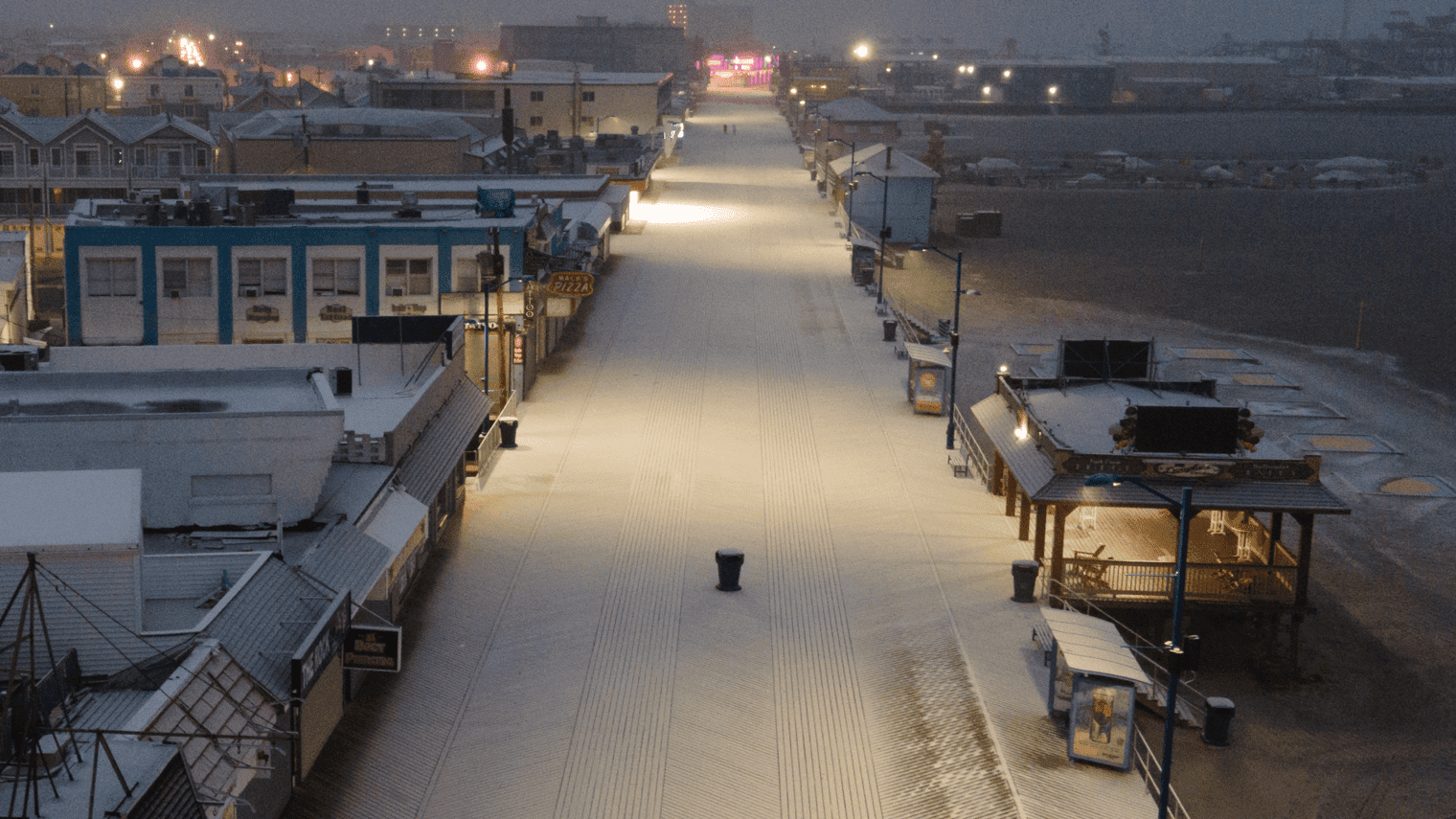
Snow on the Wildwood Boardwalk Via Drone
Preparation
Motorists should prepare for slippery roads, reduced visibility, and challenging travel conditions. Allow extra time for commutes, keep an emergency kit in your vehicle, and stay informed with the latest updates from the National Weather Service.
Changes in Path
There are still chances that this could change. It all depends on what happens with the low front. Things could trend lower which would mean that snow totals could be lower.
Stay tuned for additional updates and advisories as the storm progresses. For real-time weather graphics and further information, visit weather.gov/phi.
