
Winter Storm Set to Blanket South Jersey with Snow
Get ready, South Jersey! A significant winter storm is on the horizon, and this one is expected to deliver the region’s first measurable snowfall of the season.
There are two storms we are watching, one that will hit on Friday evening, bringing flurries and possible snow showers but the larger one is set for Monday. Let’s break them down.
Winter Storm Set to Blanket South Jersey with Snow
The National Weather Service has issued a Winter Weather Advisory for Philadelphia and parts of South Jersey starting at 3 p.m. Friday, running through 10 p.m. that evening. However, the real snow will arrive next week, beginning around midnight on Monday, continuing through late morning and early afternoon.
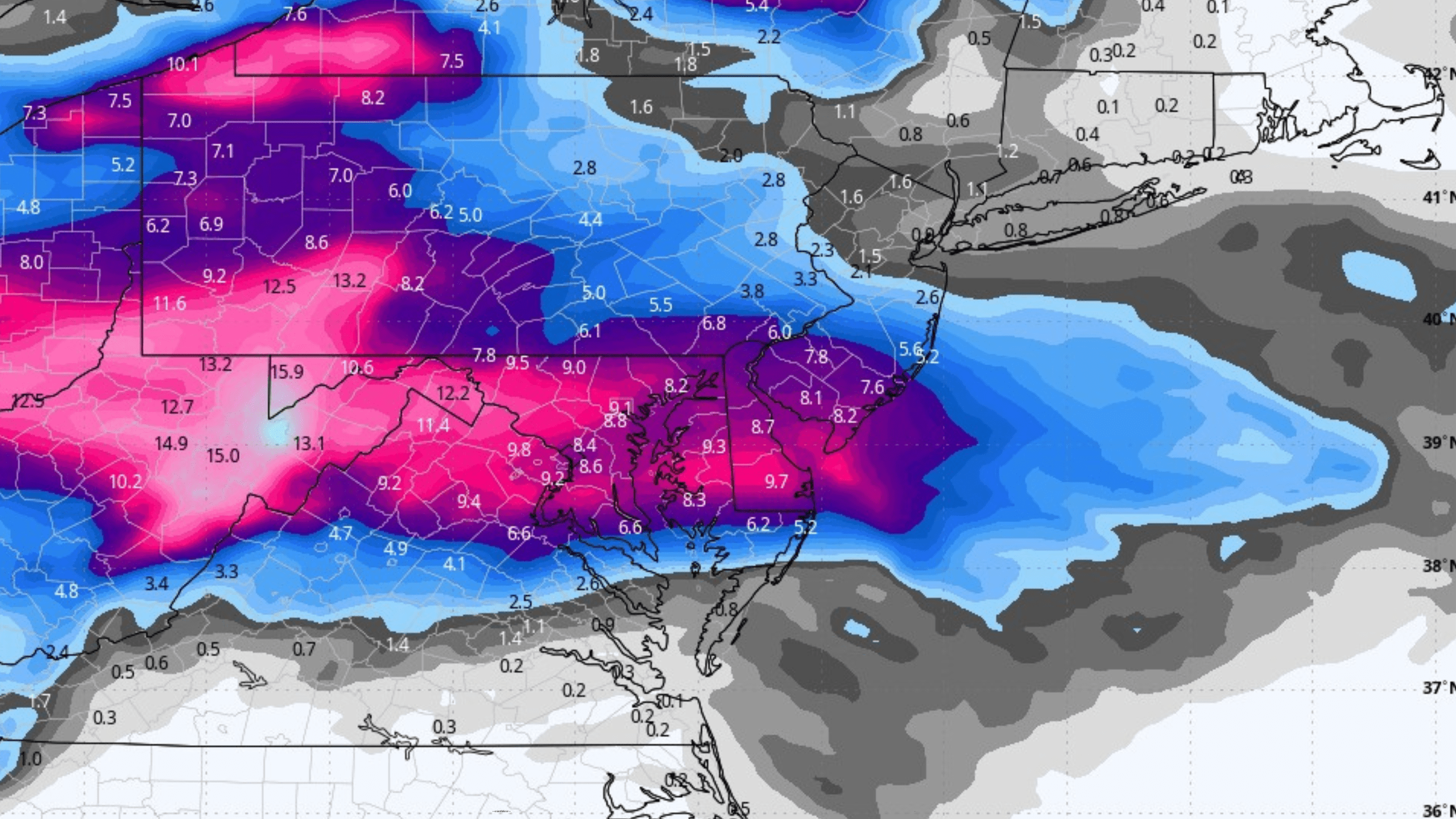
While it’s still early in the forecast, early predictions show the southern part of the region, including Wildwood, will likely see more snow than the mountains. As of Thursday afternoon, these are the expected snow totals for Monday’s snow storm.
- Philadelphia: Around 4 inches
- Wildwood: Nearly 8 inches
- Dover: More than 9 inches
- Poconos: About 3 inch
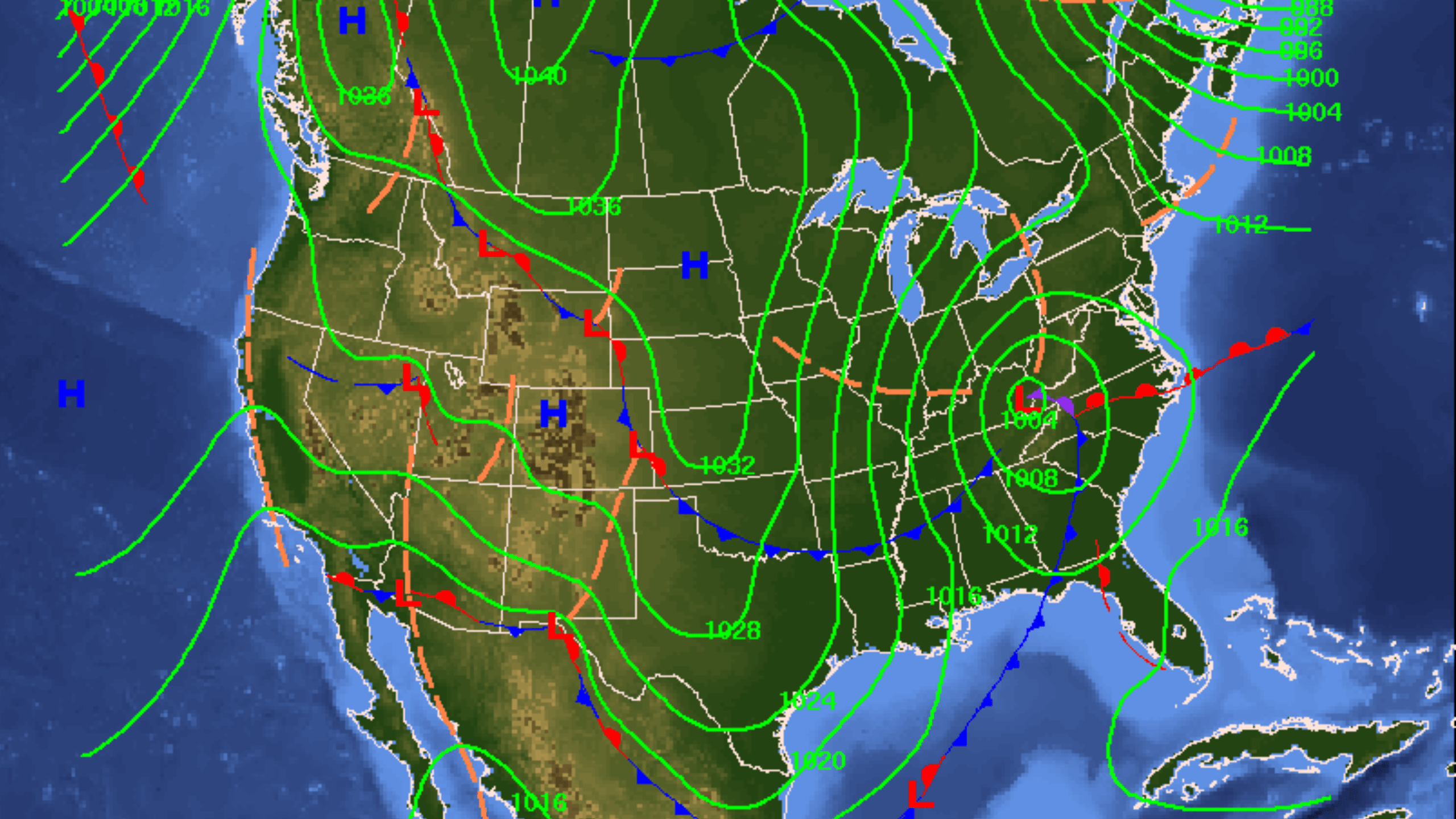 The storm is set to move from south to north, and depending on how the weather patterns evolve, we could see two possible outcomes one with a decent amount and one where some areas won’t see much.
Also see: Madison Resort Wildwood Crest Named USA TODAY’s Best New Hotel
If high pressure is present, it may push the storm track south, bringing only flurries or light accumulations. However, if high pressure eases just a bit, the storm may shift north, bringing heavier snow and potentially plowable amounts.
 We have to keep an eye on the track to see which way it goes. Realistically we need to wait a bit longer before confirming the predicted path and totals.
What is clear though is that Central Jersey and North Jersey won’t really be effected by this storm.
If you do live in South Jersey, be prepared for possible school closings, get your bread, eggs and milk and possibly your sledges ready!
 By tomorrow afternoon, the exact track should be clearer, so if you need to make decisions about salt or snow removal, it’s best to wait until then.
Do you want to see snow in South Jersey?