
Flooding Expected to Worsen Monday Afternoon at the Jersey Shore
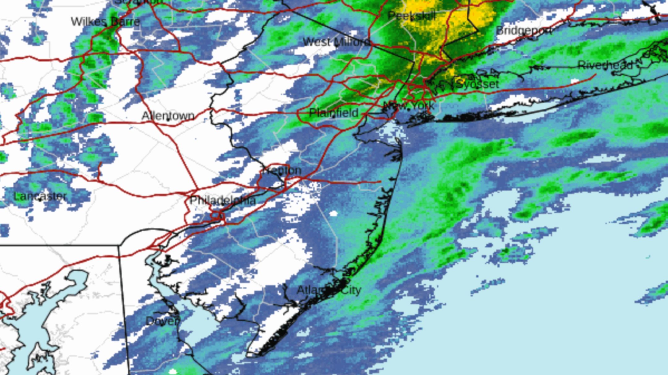
A strong coastal storm continues to batter the Jersey Shore this Monday morning, bringing damaging winds, pounding surf, and ongoing coastal flooding.
While the storm’s winds are expected to ease slightly by Monday afternoon, the worst round of flooding is still ahead expected to arrive with Monday’s late afternoon high tide.

Flooding Expected to Worsen Monday Afternoon at the Jersey Shore
Flooding Expected to Worsen Monday Afternoon
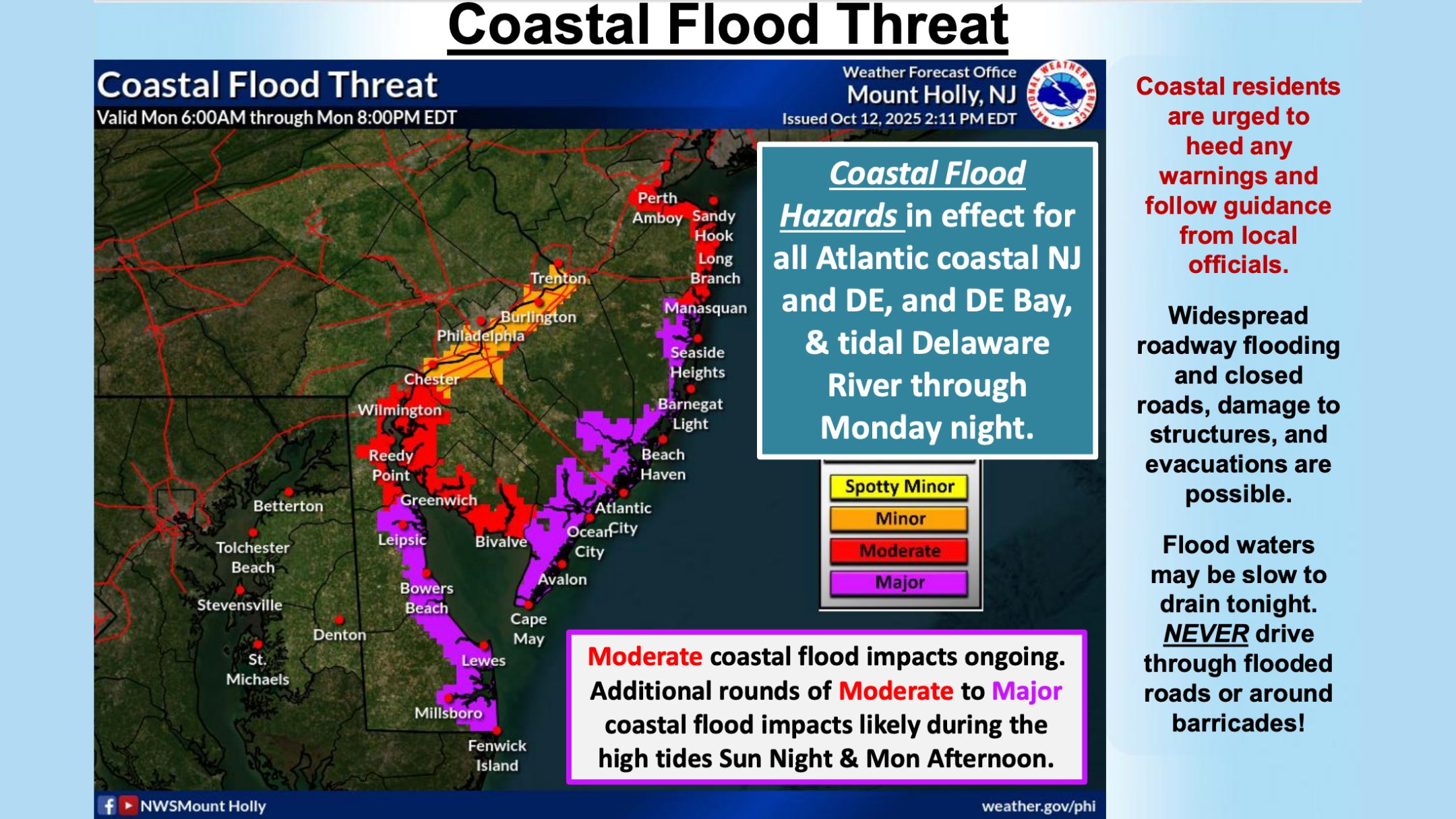
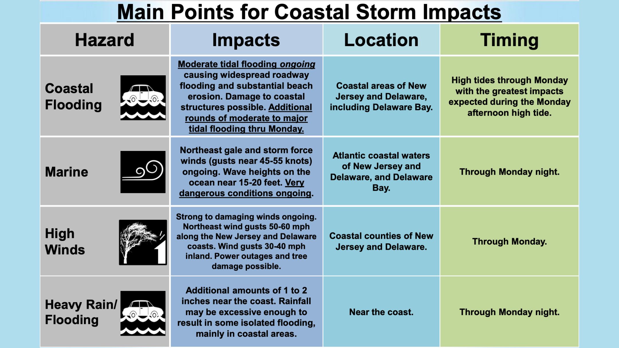
According to the latest update from the National Weather Service, moderate to major coastal flooding will occur again with each high tide through Monday.
The most significant inundation is forecast during Monday afternoon’s high tide, which could exceed levels seen earlier Sunday.
If you are in cape May County this will be between 2PM and 5PM.
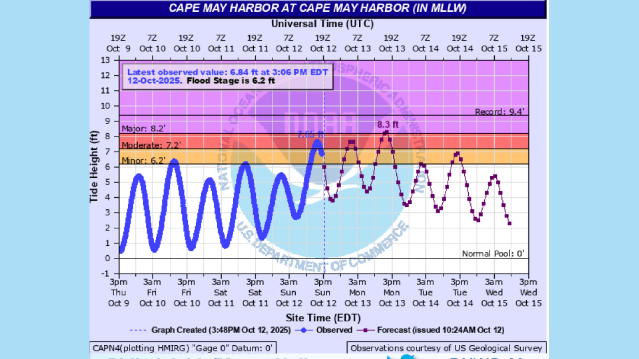 If you experienced flooding on Sunday, forecasters say to expect flooding again, likely at a greater level.
Also See: North Wildwood Boardwalk Reconstruction Officially Underway!
Widespread roadway flooding, impassable streets, and possible inundation of low-lying homes and businesses are expected.
Evacuations remain possible in the most flood-prone areas, and residents are urged to heed local emergency alerts and move vehicles to higher ground.
 Winds and Rain Continue Overnight
Strong northeast winds continue across coastal New Jersey and Delaware, with gusts between 50 and 60 mph along the coast and 30–40 mph inland. These winds are expected to peak overnight and into early Monday morning before gradually diminishing through the day.
Meanwhile, rain will spread inland overnight and continue into Monday, adding another 1 to 2 inches of precipitation near the coast. This rainfall may cause isolated street flooding, especially in poor-drainage areas already affected by the tides.
 Marine and Beach Conditions
Out on the ocean, gale and storm-force winds continue to whip up waves of 15 to 20 feet, making for extremely dangerous seas. The Delaware Bay is also seeing rough conditions with significant wave action.
The combination of high surf and persistent onshore winds is leading to severe beach erosion and likely dune breaching in multiple locations along the coast.
Very dangerous surf conditions will persist through Monday night, and beach access should be avoided until the storm subsides.
 Residents Urged to Stay Alert
This storm has already caused substantial impacts across coastal communities, including power outages, fallen trees, and road closures. With another round of major flooding expected Monday afternoon, residents are advised to:
- Avoid driving through flooded streets.
- Move vehicles and valuables to higher ground tonight.
- Follow local emergency management updates and any evacuation advisories.
The storm is expected to wind down by late Monday night gradually, but recovery from flooding and erosion will likely continue into Tuesday.
The Wildwood Video Archive will be on the ground today to bring you updates. Stay tuned to our YouTube Channel or Facebook page for updates.