Heavy Rain And Isolated Tornado Are Possible In Tri-State
Posted on - Last updated:
Heavy Rain And Isolated Tornado Are Possible In Tri-State
Flood Warning,Gale Warning and Wind Advisory across the state New Jersey today.
Heavy Rain And Isolated Tornado Are Possible In Tri-State
According to the National Weather Service Mount Holly, Showers and isolated thunderstorms are expected this afternoon into early this evening. These showers and storms will be capable of producing damaging winds. An isolated tornado is possible.
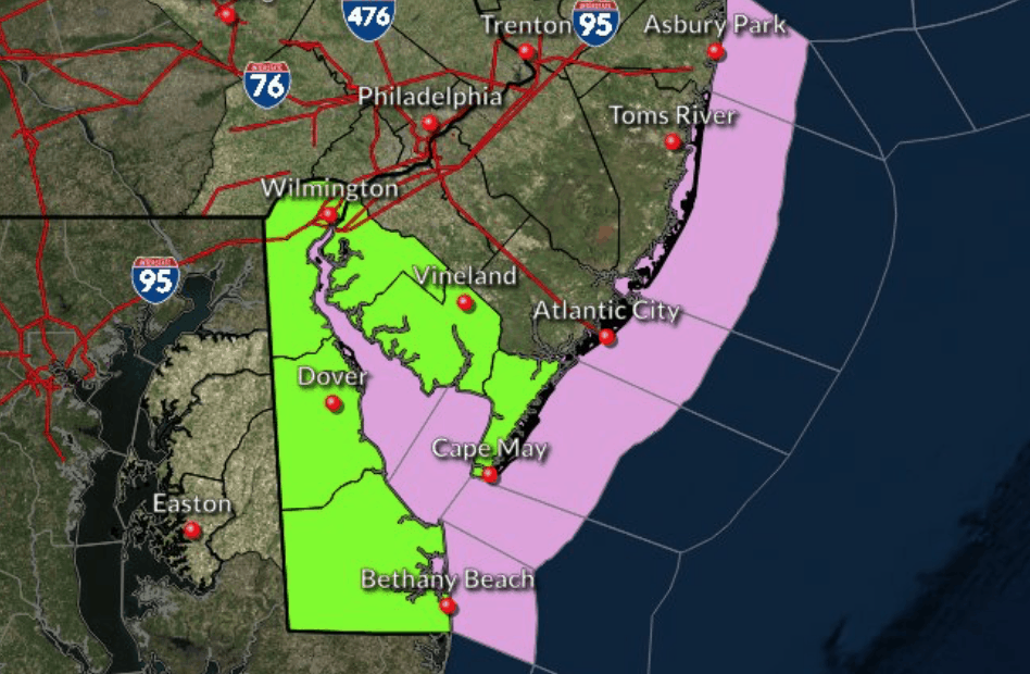
In (New Jersey), Atlantic, Cape May, Ocean, Western Monmouth, Southeastern Burlington and in (Delaware), Inland Sussex, will experience high winds From 6 AM this morning to 6 PM EST this evening.
These winds will be 15 to 25 mph with gusts up to 45 mph in certain areas. Gusty winds could blow around unsecured objects.Tree limbs could be blown down and a few power outages may result.
The strongest winds are expected from mid morning through mid afternoon. Please secure any temporary outdoor decorations.
Coastal Flood Advisory is in effect for portions of Cape May and Cumberland Counties in New Jersey until noon. The most widespread flooding is expected along the shores of Delaware Bay and adjacent back bays and tidal water ways.
Tune back later for updates.
Check out these other Wildwood Videos and Articles