It’s time for another weather update! For those who don’t know, a big storm is about to hit the state of New Jersey and Pennsylvania (Wednesday into Thursday).
Heavy snow, mixed precipitation, and rain will affect the region. Snow amounts will be significant near and north of the I-95 corridor. Snowfall rates could reach 1 to 2 inches per hour for a time late day Wednesday into Wednesday night, causing significantly reduced visibility and potentially crippling travel impacts in places.
Very strong winds expected near the coast and over the marine zones with gusts potentially reaching 40 to 50+ mph. This could result in power outages. Inland, gusts could reach as high as 30 to 40 mph, exacerbating visibility restrictions in snow.
Coastal flooding is likely and could reach widespread moderate levels Thursday morning along the Atlantic coast and Delaware Bay.
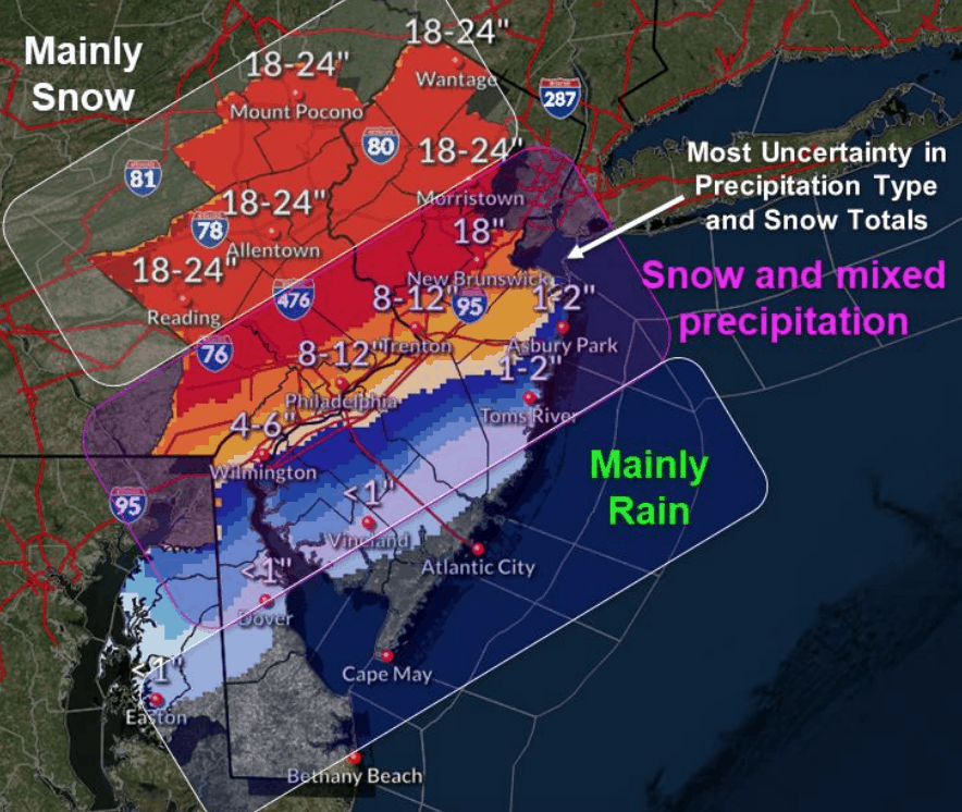
Snow Totals
Snow totals vary depending on where you live. Cape May County will mainly receive rain. Philadelphia is looking at 5-10″ of snow. That I-95 line really divides the snow totals. North of it could see 12-24 while south of it would see 2-12 BUT south of I-95 the NWS says that the precipitation is uncertain at the moment.
Check back later after 6pm for a new update on the storm.
Check out these other Wildwood videos and articles