
Snow Advisory For Most of New Jersey – Jan 19th
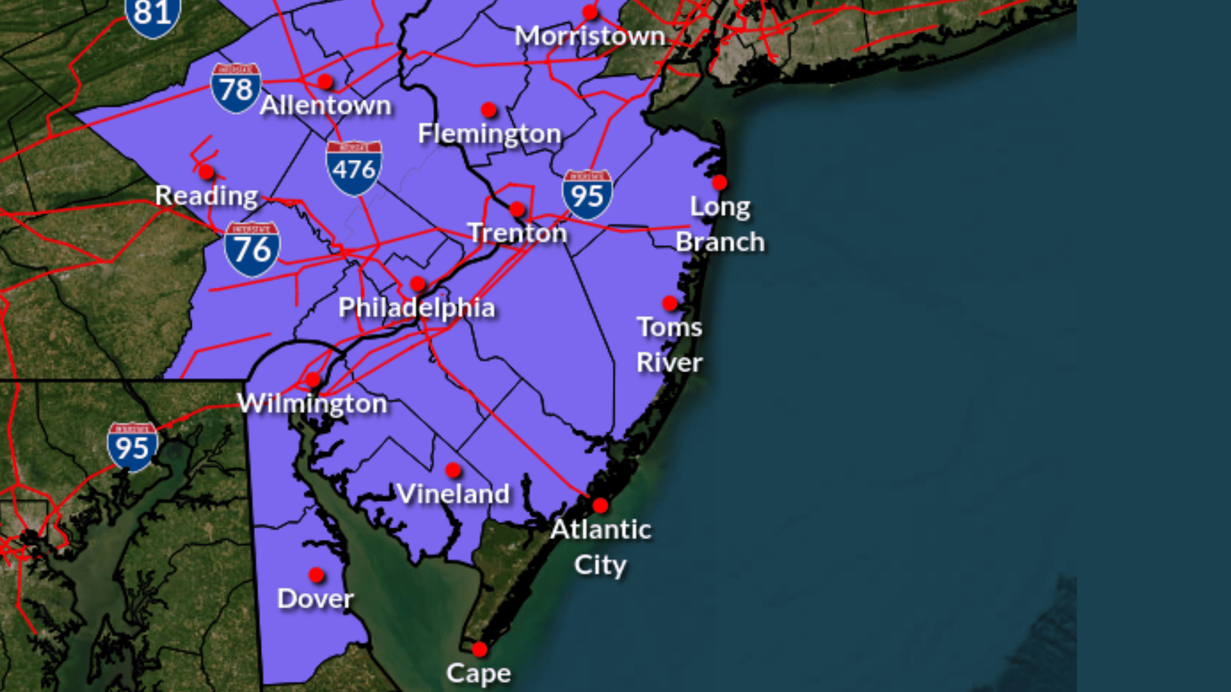
As winter tightens its grip, the National Weather Service has sounded the alarm for 15 New Jersey counties, signaling an imminent battle with snow and ice.
From Atlantic to Warren, a winter weather advisory is set to unfurl its wintry embrace from the stroke of midnight Thursday until 7 p.m. Friday.
Snow Advisory For Most of New Jersey – Jan 19th
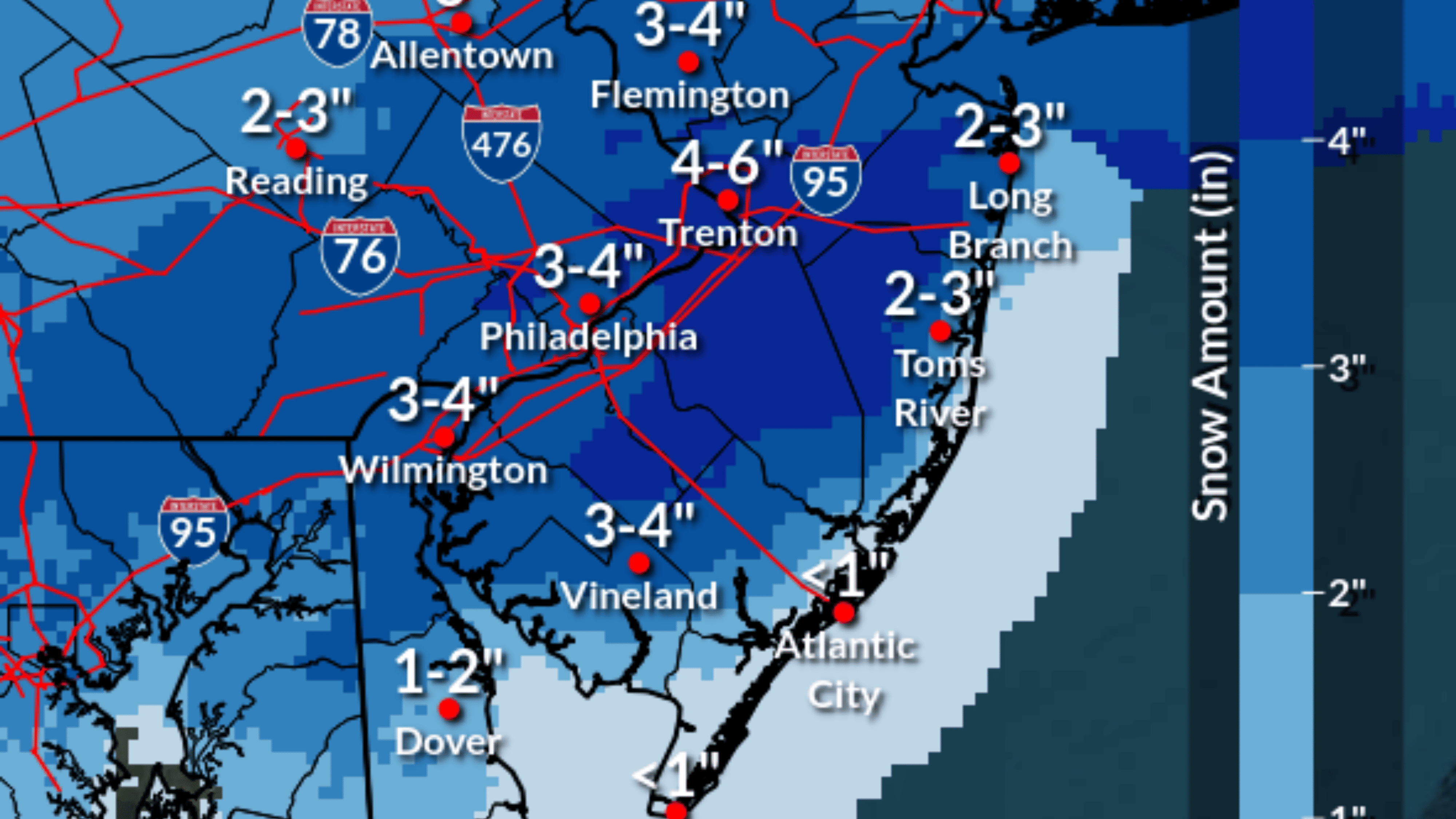
Anticipate varying snowfall across the state, with northern and southwest regions expecting three to four inches, while the far northwest and Jersey Shore forecast two to three inches.
Following the recent storm on Monday and Tuesday, coupled with frigid temperatures from an Arctic air mass, the Weather Service warns of potential icy roads leading to “significant travel disruptions” on Friday and Saturday.
As temperatures plummet into the teens late Friday night, untreated roads pose a risk of becoming icy and hazardous.
Snow Advisory For Most of New Jersey – Jan 19th 2024
This impending storm marks the fifth in a series, whether rain or snow, impacting New Jersey in less than three weeks.
The National Weather Service’s New York office, responsible for northeastern New Jersey, projects two to three inches of snow in Bergen, Essex, Hudson, Passaic, and Union counties. However, these estimates are subject to change based on the storm’s strength and proximity to the coast.
Also See: North Wildwood’s Gateway Entrance and Gold Star Families Memorial Moves Forward
The path and strength of a prolonged low-pressure system moving south of the area on Friday will significantly influence the positioning and duration of snow bands.
The NWS highlights that a low-pressure system nearer to the coast may bring increased snowfall to the New York metro region, whereas a track farther from the coast could result in minimal to no accumulation.
This means no stroll on the snow-covered boardwalk like we had earlier this week. (Which you can watch at the bottom of this article)
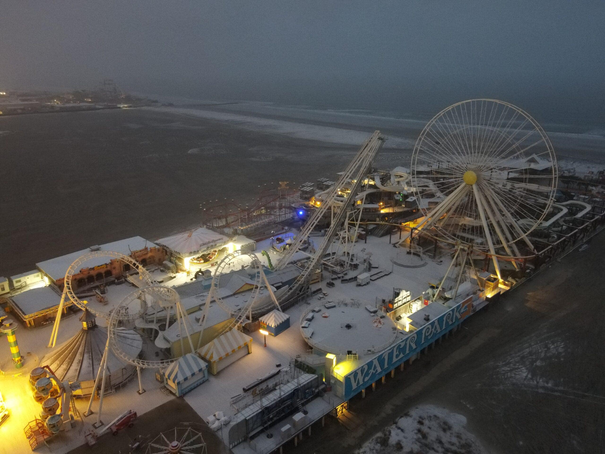
Snow on Morey’s Mariners Pier
New Jersey finds itself in the grip of a deep freeze, with frigid Arctic air causing temperatures to dip into the single digits in northwestern sections and lingering in the 20s across the state. This weekend will see temperatures feel more like 10 degrees with the windchill.
If the cold is bothering you, the National Weather Service did indicate that things will start warming up next week, with temperatures currently projected to get above normal by Tuesday with a high of 55 later in the week.