
The Hereford Inlet Sees Major Sand Shift
If you have been following the Wildwood Video Archive for any amount of time, you know that Hereford Inlet is one of the most unpredictable stretches of coastline in all of New Jersey.
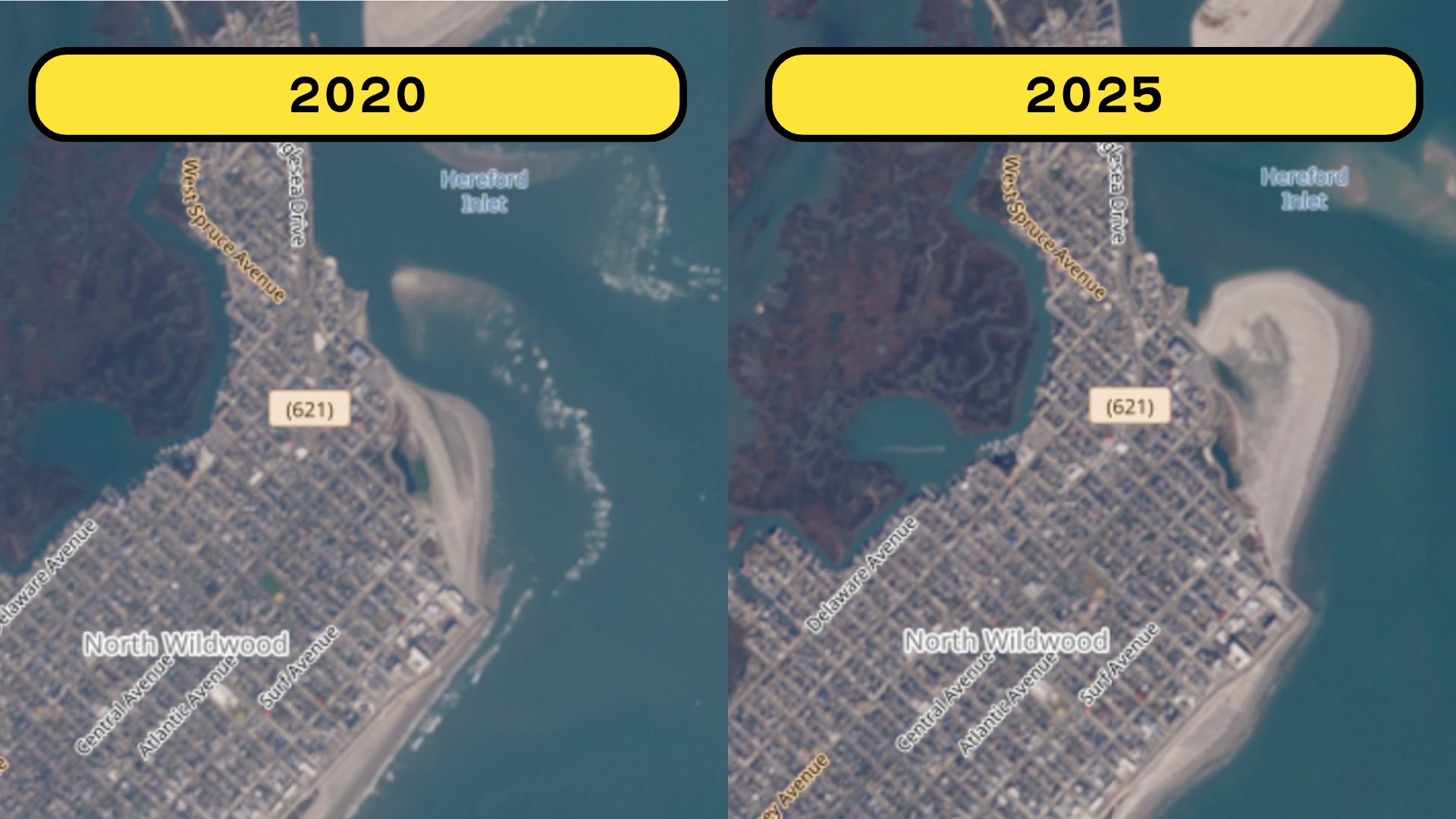
A quick look at satellite images from 2020 and 2025 shows the inlet transforming in ways that seem almost unbelievable.
Massive sand spits appear, disappear, and re-form in entirely new places. The inlet throat widens and narrows. Beaches that once looked stable suddenly collapse into the water.

The Hereford Inlet Sees MAJOR Sand Shift
What you are seeing is not an error in the satellite data. This is exactly how Hereford Inlet behaves when it is left to nature. But this time, something more may be at play. North Wildwood has not been able to complete its scheduled dredging and beach nourishment projects for several years.
Also See: Massive New Bar & Restaurant Coming to North Wildwood
That gap in maintenance is allowing natural forces to reshape the coastline faster and more aggressively than usual.
Let’s break down what is happening.
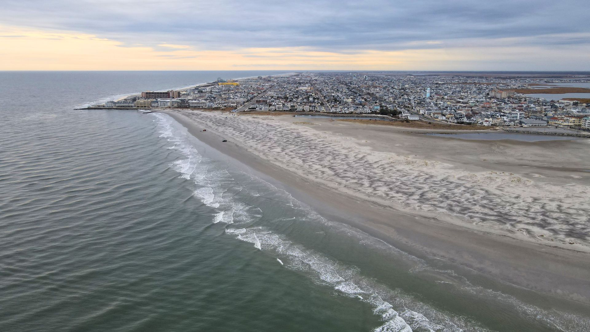
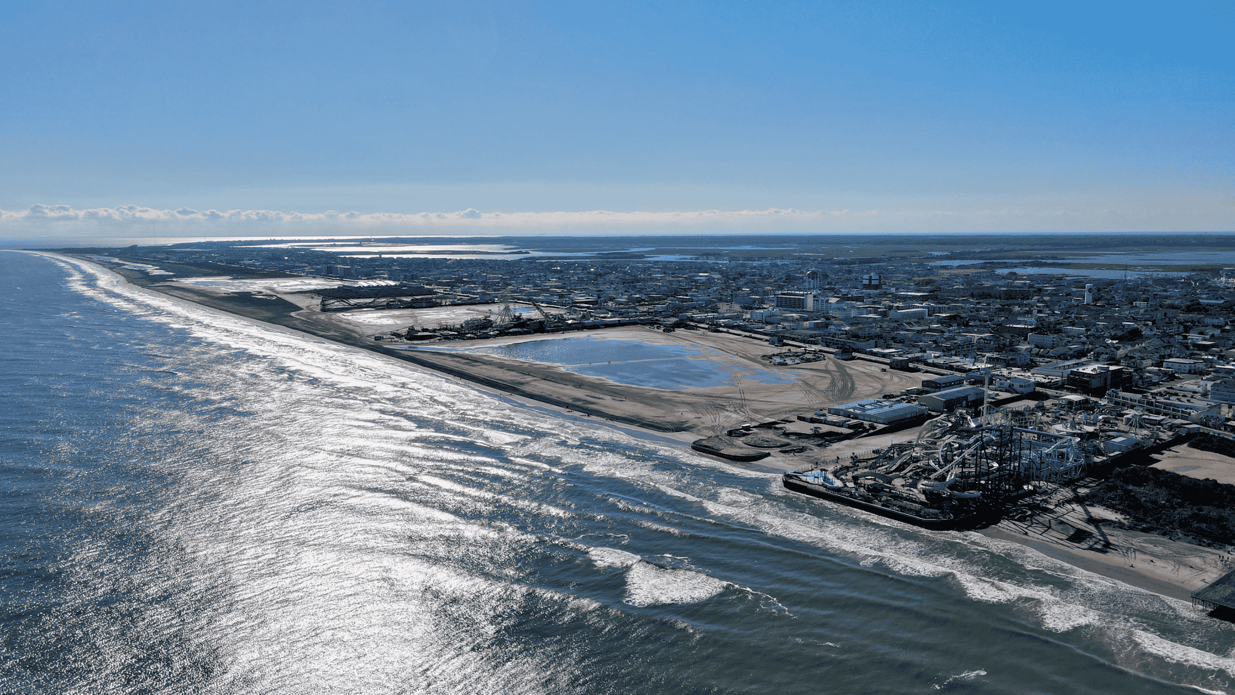
Before we dive in, we filmed an entire drone video showcasing what the inlet looks like as of December. You can watch that video at the bottom of this article.
 A Naturally Fast Moving Inlet
Hereford Inlet operates very differently from most inlets along the Jersey Shore. Its daily tidal exchange is extremely powerful.
Twice a day, millions of gallons of water rush through the inlet, picking up sand, spinning it around, and depositing it wherever the currents slow down.
Strong currents like these can move entire sandbars in a matter of weeks, not years.
Unlike other inlets protected by long jetties, Hereford has almost no hard structures holding its shape in place. This allows the inlet to drift naturally.
In some years the sand forms long spits curling into the inlet. Other years it gets carved away entirely, leaving a steep and unstable shoreline.
This is the geological nature of barrier islands. They migrate. They shift. And Hereford is one of the most extreme examples on the East Coast.
 Years Without Dredging Are Making Things Worse
While the inlet has always been unstable, the recent lack of dredging has amplified everything.
For more than seven years, North Wildwood has been unable to secure the state and federal approvals needed to dredge Hereford Inlet and rebuild its beaches. Each year that passes without replenishment, the inlet gains even more freedom to reshape itself.
Normally, dredging removes built up sand from the inlet channel and places it back on North Wildwood’s eroded beaches.
This not only protects homes and roads but also helps stabilize how the inlet behaves. Without dredging, sand piles up in places where it never used to be, forcing the tidal currents to carve new pathways.
Those new flow channels then pull even more sand off the beaches and push it deeper into the inlet, creating the dramatic changes we are now seeing on satellite imagery.
In short, the inlet is doing what it wants because nothing is pushing back.
 Nor’easters Have Accelerated the Movement
Inlet migration always speeds up during stormy seasons, and the past few years have delivered several strong nor’easters.
These storms generate powerful waves that strike the beachfront at angles that enhance erosion. Once sand is ripped away, the inlet currents take over and pull it into their natural circulation.
This combination of storms and no dredging means the point of North Wildwood is now changing faster than local officials have ever documented.
 A Sand Supply Problem For North Wildwood
The natural movement of sand along the coast already works against the island. The Wildwoods sit in a zone where sand drifts from south to north.
That means North Wildwood is constantly losing sand to Hereford Inlet, while Stone Harbor often gains it. When dredging cannot occur, that sand loss becomes almost impossible to slow down.
Every year without nourishment allows the inlet to claim more of the island.
This begs the question, since this part of the inlet is growing will this be the beach everyone is going to want to hang out at this summer?
 Looking Ahead
Until long delayed federal approvals are finalized, North Wildwood will continue to watch the inlet reshape the island on its own terms.
The 2020 and 2025 satellite comparison shows just how dramatic that natural migration can be. Entire landforms are shifting in only a few seasons.
For a community that depends on stable beaches to protect homes and support tourism, these changes are more than just a curiosity on Google Maps.
They are a reminder of how urgently this island needs its beach replenishment work to move forward.
Below is our drone video, before you watch please consider subscribing!