
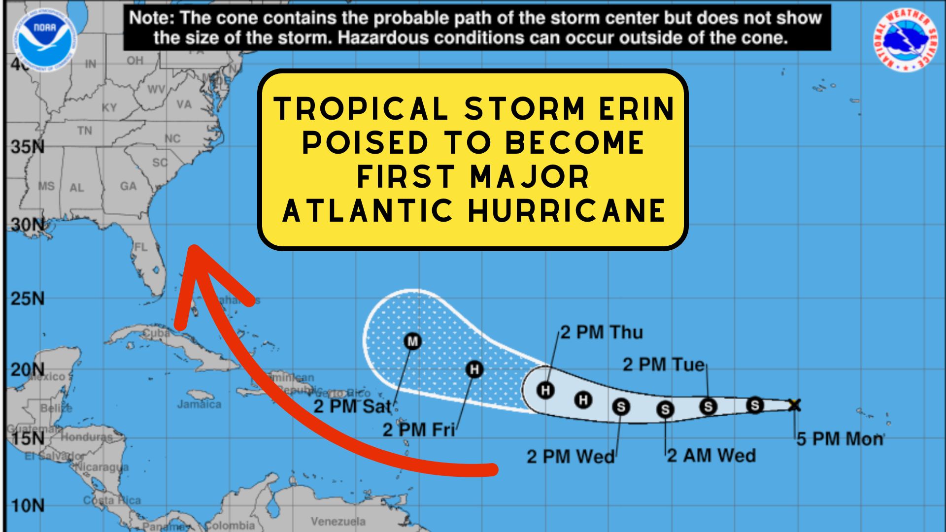
Tropical Storm Erin Poised to Become First Major Atlantic Hurricane of 2025
The 2025 Atlantic hurricane season has officially shifted into high gear with the formation of Tropical Storm Erin in the eastern Atlantic.
According to forecasters and the National Weather Service, say the storm is on track to become both the first hurricane and the first major hurricane of the season, potentially influencing weather along the U.S. East Coast next week.
Tropical Storm Erin Poised to Become First Major Atlantic Hurricane of 2025
From African Coast to Atlantic Powerhouse
Erin began as a tropical disturbance last week after clusters of thunderstorms rolled off the African coastline.
Over the weekend, the system passed near the Cabo Verde Islands, delivering torrential rainfall up to 8 inches in just five hours. The flooding proved deadly, with at least six fatalities reported and others still missing.
The storm quickly gained strength and was officially classified as Tropical Storm Erin.
Conditions in the Atlantic, marked by warm ocean waters, low wind shear, and minimal Saharan dust are expected to allow for rapid intensification.
Forecast models suggest Erin could reach hurricane status by midweek and develop into a major hurricane shortly afterward.
 Projected Path and Early Impacts
Erin is currently tracking westward but is expected to begin a gradual turn toward the northwest later in the week.
This adjustment should keep the storm’s center north of the northeast Caribbean islands, though rough surf, strong rip currents, and occasional squalls may still affect areas including Puerto Rico, Hispaniola, and the Windward Islands.
Bermuda and the Bahamas are being advised to monitor the storm’s progress closely, as Erin’s path could bring it within range to produce hazardous marine conditions and potentially damaging winds over the weekend.
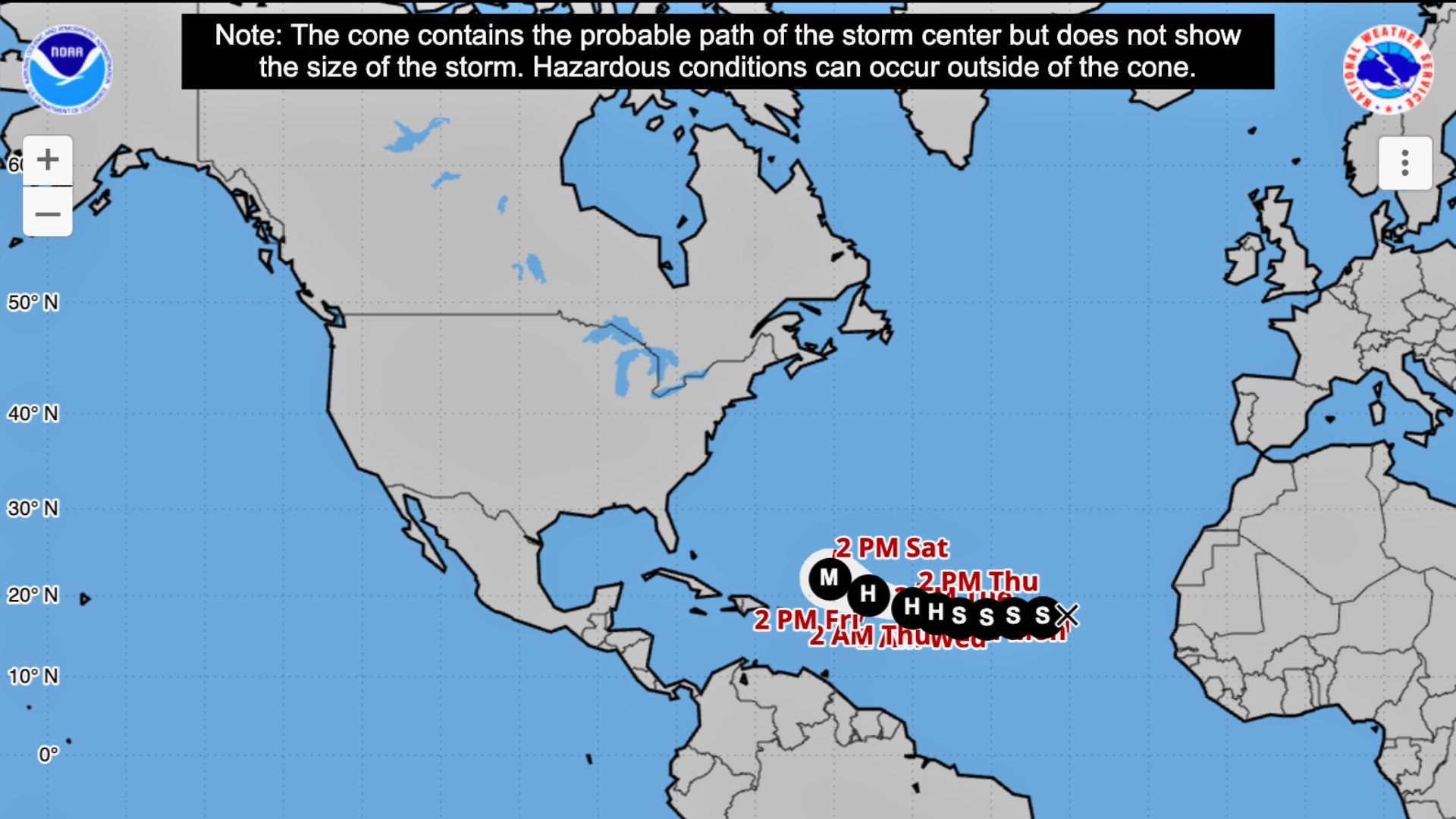 The eventual track of Erin depends heavily on the strength and position of the Bermuda High, a dominant high-pressure system over the central Atlantic.
If the high remains relatively compact, the storm will likely curve northward before reaching the U.S. mainland.
However, if the high extends farther west, Erin’s path could shift closer to the East Coast, increasing the risk of direct impacts, particularly from the Carolinas northward.
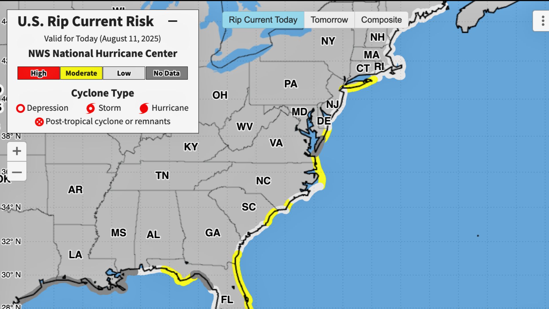
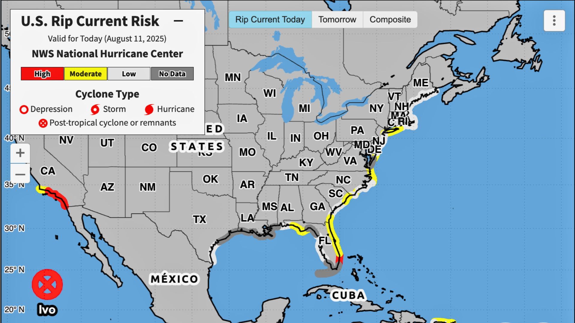
Even without making landfall, Erin is expected to generate dangerous surf, rip currents, and large swells along much of the East Coast starting late this week and continuing into the following week.
 This could coincide with late-summer vacation travel and beach visits, making safety precautions especially important.
A major hurricane passing within 100 miles of shore can still produce tropical-storm-force winds, rough seas, and heavy rain for coastal communities.
Potential areas of concern in the U.S. include eastern North Carolina, Long Island, Cape Cod, and coastal New England.
In Canada, Nova Scotia and Newfoundland may face more direct impacts if Erin tracks farther north.
Also See: How to Catch Monster Crabs in the Wildwoods
 Other Systems on the Radar
While Erin is the most significant system at the moment, forecasters are also tracking several other areas for possible tropical development.
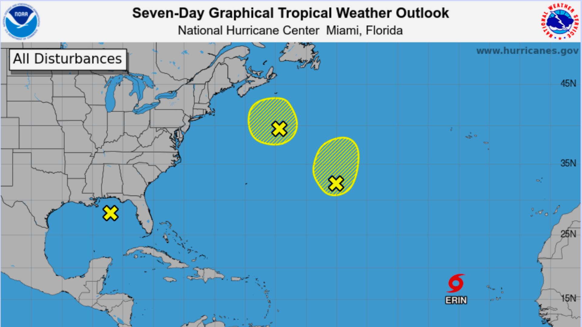
In the northern Gulf of Mexico, clusters of thunderstorms have developed, producing heavy rainfall along the Florida Panhandle, Alabama, and Mississippi coasts.
Warm waters and low wind shear create a short-term opportunity for tropical development, but any system that forms is expected to move inland by midweek.
Three additional areas in the Atlantic are under observation:
- A low-risk disturbance over the central Atlantic that is moving northward away from land.
- A system near Atlantic Canada, originating off the Carolina coast, which is expected to bring rainfall to Nova Scotia by midweek.
- A tropical wave forecast to emerge from Africa later this week, which could pose a long-range threat to the Caribbean.
We will be sure to keep you in the loop on the storm and how it could effect us here in New Jersey, so please be sure to sign up for our newsletter.