
Wildfire Smoke and Dangerous Heat Expected Across New Jersey
If you’ve looked outside yesterday or today and noticed the sky looking a little hazy, you’re not imagining it.
Smoke from hundreds of wildfires burning across Canada is once again making its way into New Jersey, and the National Weather Service in Mount Holly say the smoky conditions could linger through the rest of the week.
Wildfire Smoke and Dangerous Heat Expected Across New Jersey
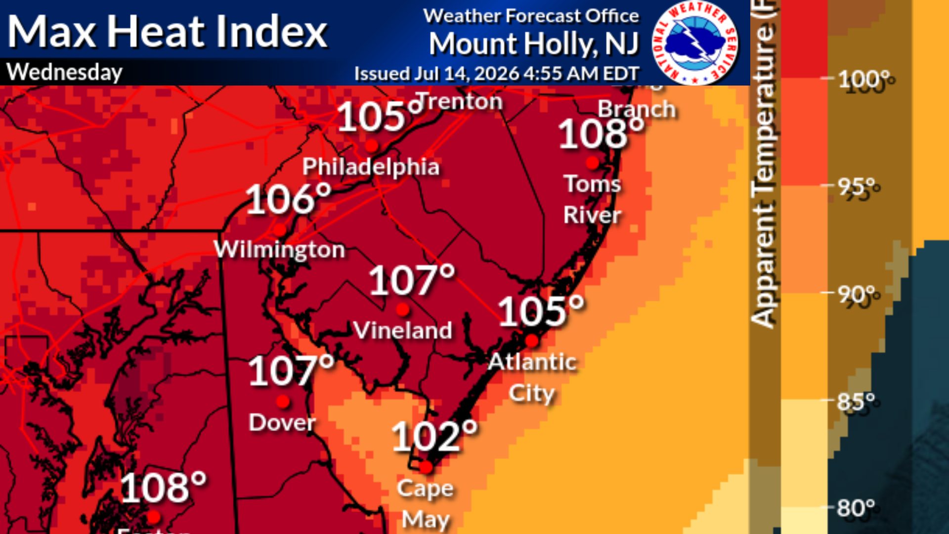
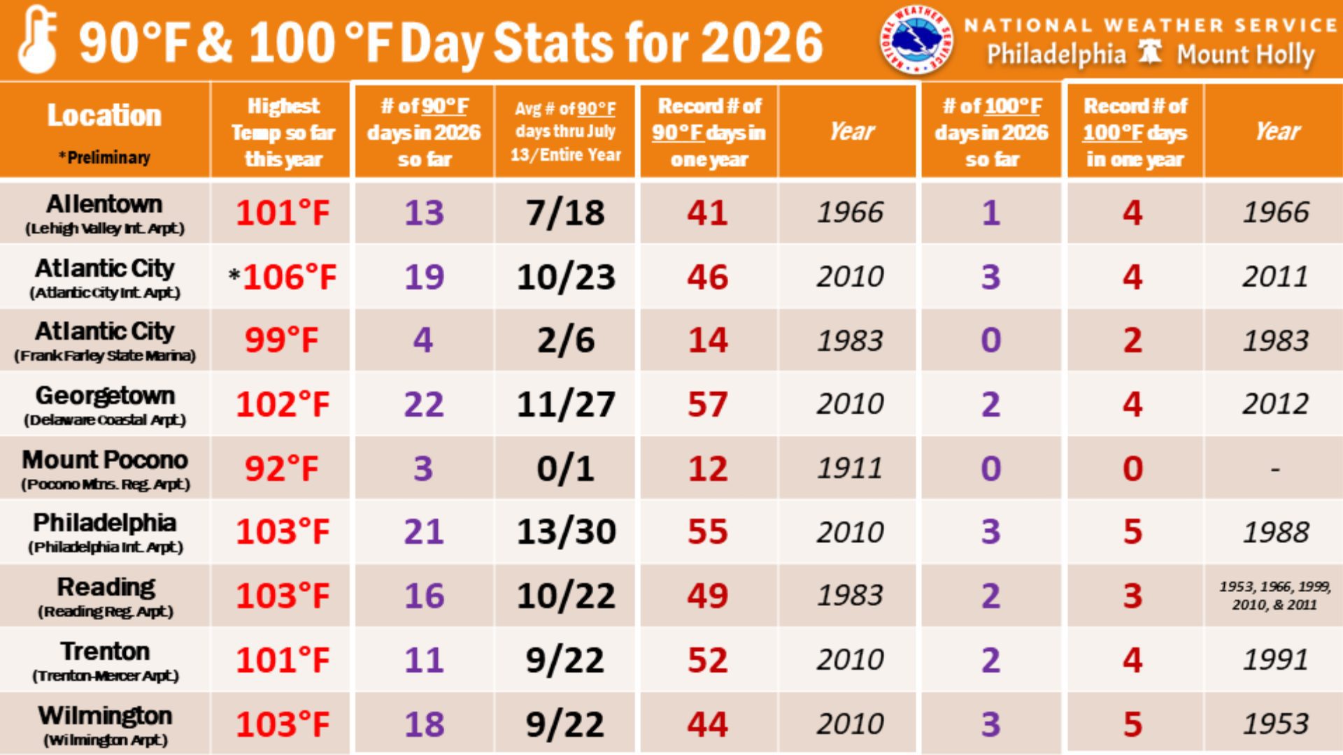
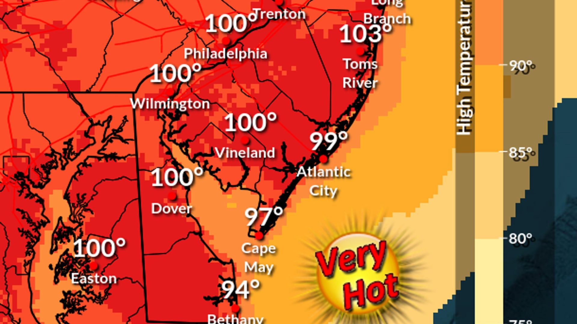
At the same time, us in New Jersey will also be dealing with dangerous heat today (Wednesday).
The National Weather Service says smoke began drifting into the region earlier this week.
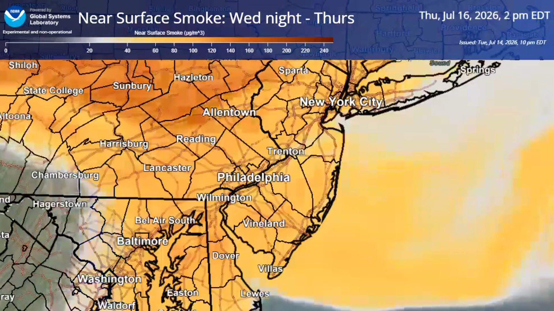 The smoke is coming from an active wildfire season in Canada, where more than 800 wildfires are currently burning, many of them still considered out of control. Additional fires in northern Minnesota have also contributed to the smoky conditions spreading across parts of the Midwest and Northeast.
While much of the initial smoke remained higher in the atmosphere, smoke closer to the ground is expected to move into South Jersey, bringing a greater impact on air quality.
That is that haze we had mentioned.
 Also See: Why Jersey Shore Beaches Keep Closing After Rain
Because of that, the New Jersey Department of Environmental Protection has issued a Code Orange Air Quality Alert for Cape May and Atlantic counties on Wednesday, July 15.
A Code Orange means air pollution levels may become unhealthy for sensitive groups, including children, older adults, and people with asthma, heart disease, or other lung conditions.
 Health officials recommend avoiding strenuous outdoor activity, especially during the afternoon and evening hours, if you’re in one of those groups. So no running outside during that time.
Adding to the concern, the National Weather Service has also issued a Heat Advisory for Cape May, Atlantic, Cumberland, and Salem counties from 10 a.m. until 8 p.m. Wednesday.
Forecasters say heat index values could reach 106 degrees, which means you should be at the beach.
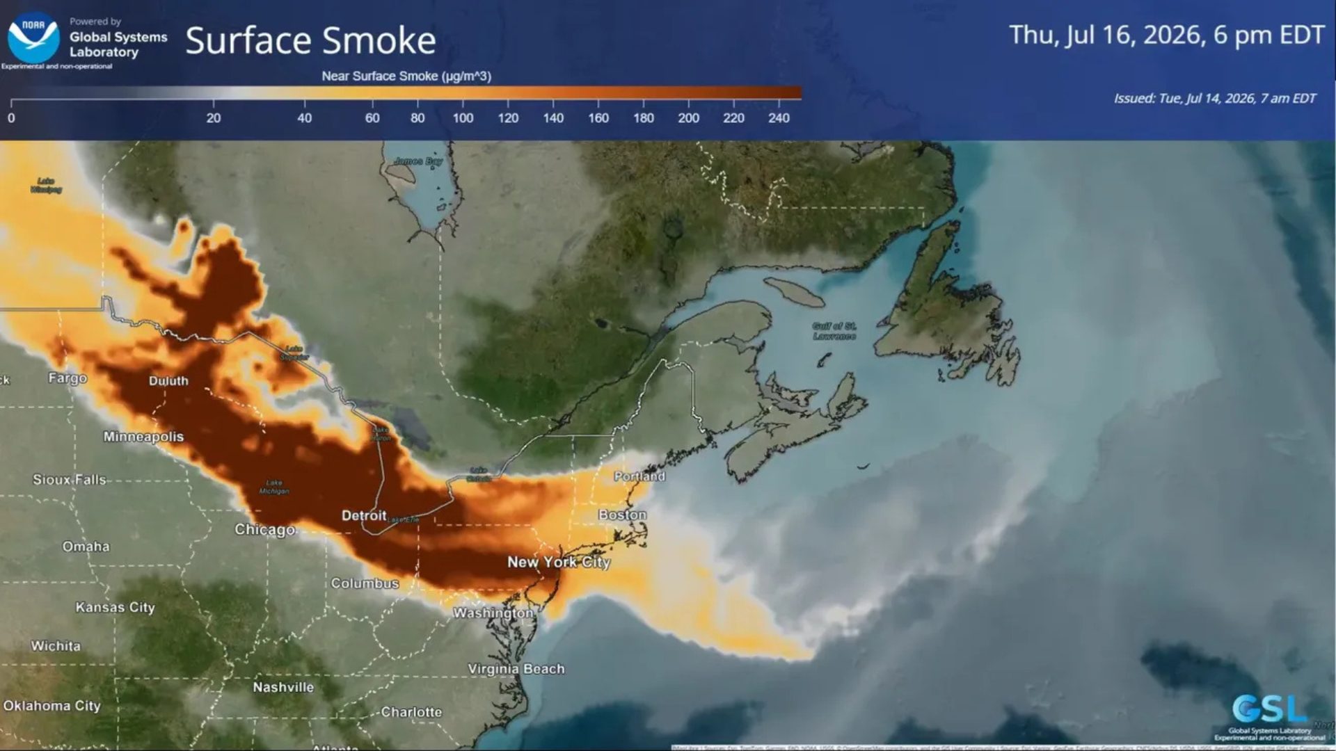 The combination of high heat and smoky air can make conditions especially difficult for people with respiratory or cardiovascular conditions, so it’s a good idea to limit prolonged outdoor activity if you begin experiencing breathing problems or irritation.
Many New Jersey residents will remember the Canadian wildfire smoke event in 2023, when skies turned orange and air quality reached hazardous levels across much of the state. While this week’s event is not currently expected to be as severe, the smoke and heat together could still create uncomfortable and potentially unhealthy conditions.