
State of Emergency Declared for NJ – Hurricane Erin
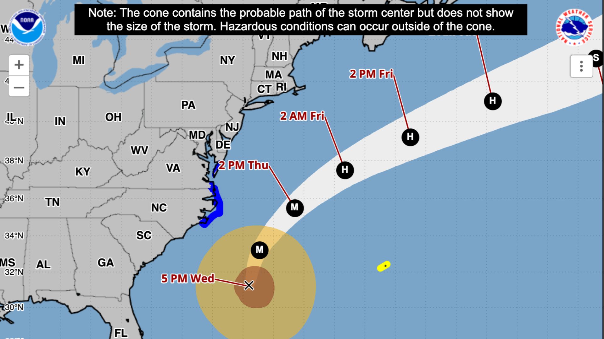
Hurricane Erin is passing offshore of the East Coast today, Thursday, August 21, and while the center of the storm will remain well out to sea, its impacts are being felt strongly along the Jersey Shore and Delaware beaches.
Watch the video at the bottom of this article to see what the conditions are in Cape May County.
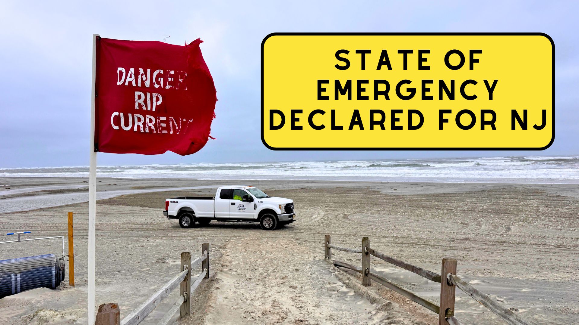
State of Emergency Declared for NJ
NOTE: After this article was written, the Office of Emergency Management sent out this push notification saying, “Cape May County OEM: Hurricane Erin will bring dangerous surf and coastal flooding.High tides Thu 8:30 PM and Fri 8:42 PM. Waves 7-8 ft and strong rip currents expected. Winds 25-35 mph, gusts to 50 mph. Stay out of the water, secure outdoor items, avoid floodwaters, move cars to higher ground.”
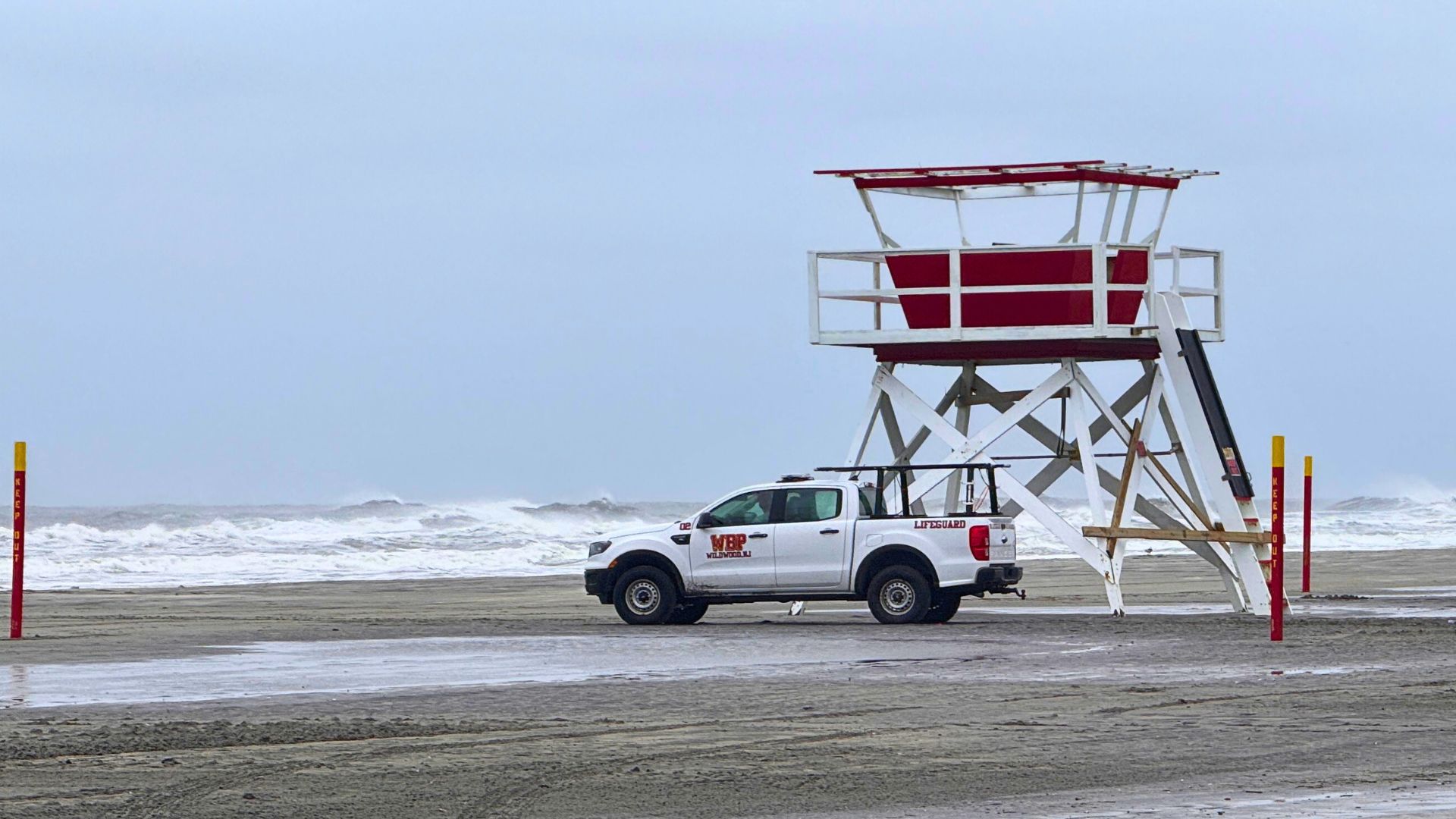
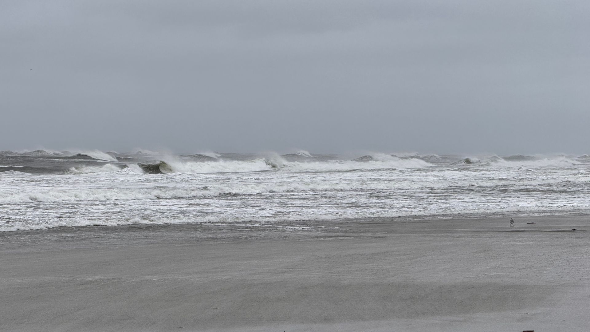
A weather Alert by the National Weather Service in Mount Holly was issued for coastal communities as conditions worsened throughout the day. The main threats are coastal flooding, strong wind gusts between 40 and 50 miles per hour, and powerful surf, with offshore buoys recording waves between 10 and 14 feet.
 Those swells are producing large breaking waves as they reach the surf zone, making beach conditions dangerous.
Rip currents remain life-threatening, and officials are urging swimmers and surfers to stay out of the ocean until the storm fully passes.
AKA, stay out of the ocean
The highest risk for flooding comes this evening between 7 p.m. and 9 p.m., aligning with the high tide cycle. Areas especially vulnerable include Cape May County and Cumberland County in New Jersey, and Kent and Sussex counties in Delaware.
 Water levels are expected to rise enough to flood low-lying streets, back-bay neighborhoods, and barrier island roadways.
Local emergency managers are warning residents to prepare for possible detours and temporary road closures.
Also SEE : How Banner Planes Work – Behind the Scenes of Aerial Advertising
Already today, gusts of up to 45 miles per hour have been reported along the shore. The combination of wind and surf is pushing water inland, and forecasters expect flooding to peak tonight before slowly easing on Friday.
However, lingering effects of the storm, including rough seas, strong currents, and occasional flooding during high tide, will continue into the weekend.
 Although Erin is not making landfall, its broad circulation is wide enough to affect much of the Mid-Atlantic coast.
This is a reminder that tropical systems can create serious hazards even when they remain hundreds of miles away. Local officials stress that just because the storm is “offshore” does not mean communities are in the clear.
In preparation for the impacts, Governor Phil Murphy declared a State of Emergency for New Jersey on Thursday afternoon.
The order allows the state to coordinate resources and respond quickly if conditions worsen.
 Residents and visitors are advised to follow any evacuation guidance that may be issued by local authorities, particularly in flood-prone areas.
The National Weather Service has issued a Coastal Flood Warning through early Saturday morning for the Jersey Shore and Delaware beaches.
Forecasters expect the worst flooding during the Thursday evening high tide, but caution that water levels will remain elevated through multiple tide cycles.
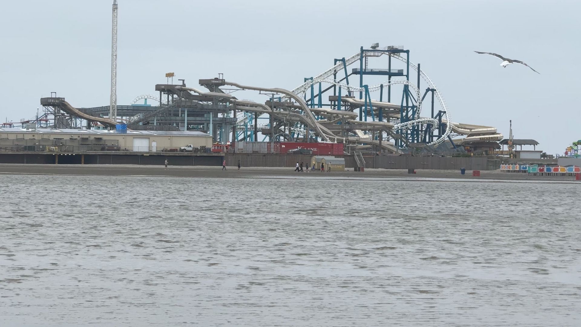
Here in Wildwood and Cape May County, the risk is focused on the back bays and low-lying streets that often see tidal flooding during strong storms.
Combined with the elevated surf on the ocean side, beach erosion is possible, and boardwalk areas may experience flooding at access points closest to the sand.
Even as Erin tracks farther east into the Atlantic, its impacts will be felt locally for days. Residents are encouraged to stay alert, avoid unnecessary travel during high tide, and keep clear of the ocean.
The Wildwood Video Archive will continue to provide updates as conditions change.
Before you watch our video below, please do consider subscribing to our YouTube channel.