
Coastal Flooding, Strong Winds and Dangerous Surf Expected Along Jersey Shore
If you’re heading down the Shore over the next few days, you’re going to want to keep an eye on the weather as we could be looking at some pretty rough conditions through the weekend.
The National Weather Service in Mount Holly released its latest coastal and marine briefing Thursday afternoon, and while we have a much better idea of what to expect through Friday, there are still some big questions about what happens this weekend.
Coastal Flooding, Strong Winds and Dangerous Surf Expected Along Jersey Shore
Right now, the biggest concerns are coastal flooding, strong winds, dangerous surf and beach erosion.
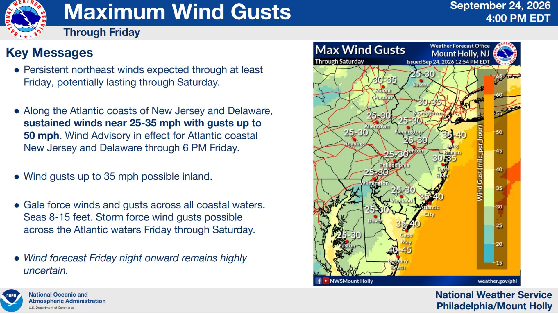
Along the Atlantic coast of New Jersey, northeast winds are expected to continue through at least Friday and potentially into Saturday. Sustained winds could reach 25 to 35 mph with gusts as high as 50 mph.
A Wind Advisory remains in effect through 6 p.m. Friday, and a High Wind Watch has been issued for Friday night through Saturday. Even away from the immediate coastline, wind gusts could reach around 35 mph.
 Coastal Flooding Continues to Be a Concern
The other big issue is the water.
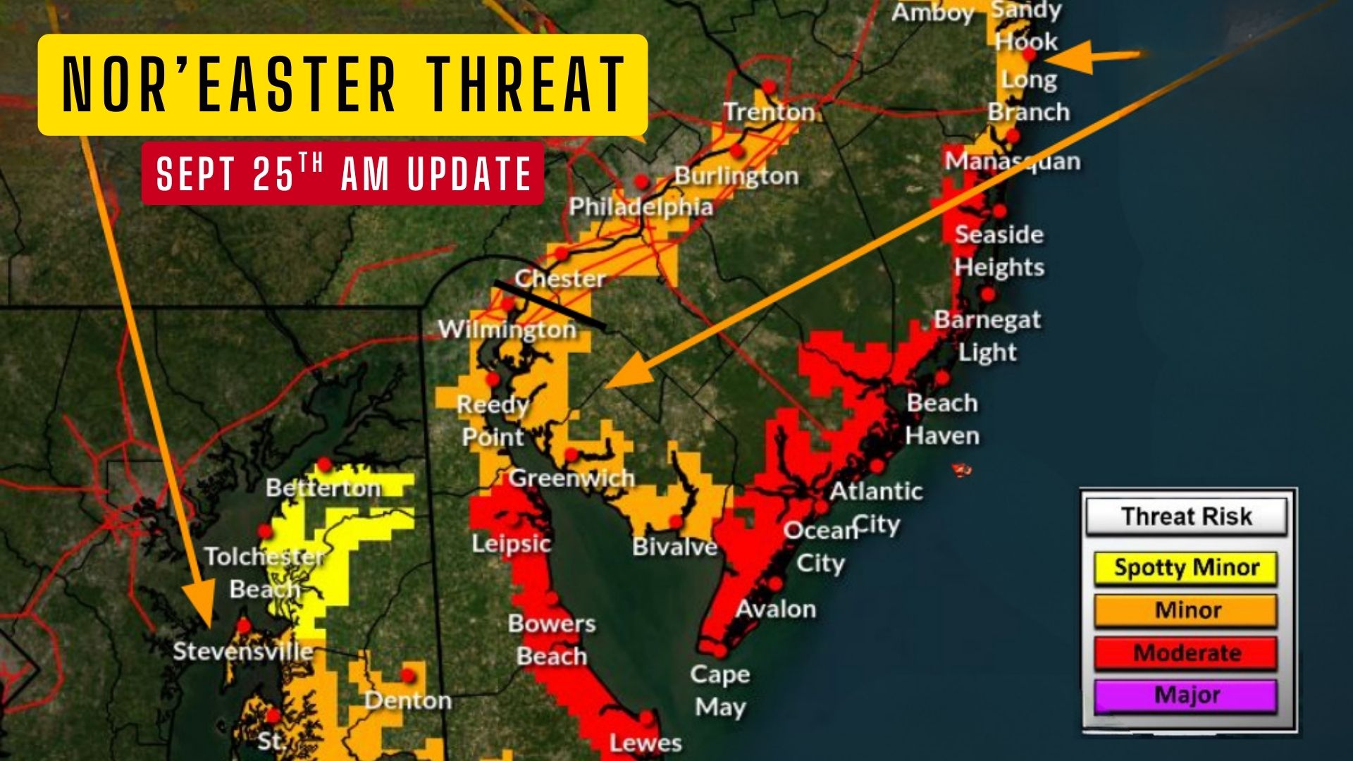
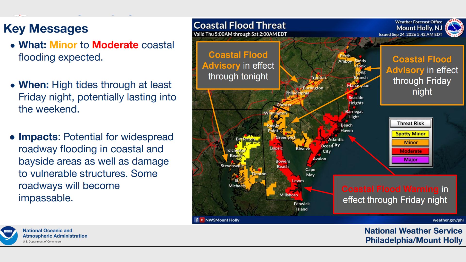
The National Weather Service is expecting minor to moderate coastal flooding during high tides through at least Friday night, and those problems could continue into the weekend.
This isn’t just some water coming over the bulkhead, either.
The Weather Service says widespread roadway flooding is possible in coastal and bayside communities, with some roads potentially becoming impassable. There is also the possibility of damage to vulnerable structures.
Also See: The Rook Wildwood Listed for Sale for Nearly $4 Million
Multiple rounds of tidal flooding are expected across portions of the Atlantic coast, Delaware Bay, southern Raritan Bay and the tidal Delaware River.
Back-bay communities will be especially important to watch because water can have a harder time draining out when strong northeast winds continue pushing it toward the coast. The National Weather Service specifically highlighted Barnegat Bay and the Shrewsbury River as areas where some of the more significant impacts could occur.
 Beaches Could Take a Beating
The ocean is going to be extremely rough.
There is a high risk of rip currents through Saturday, and the National Weather Service is warning of dangerous surf along the coast.
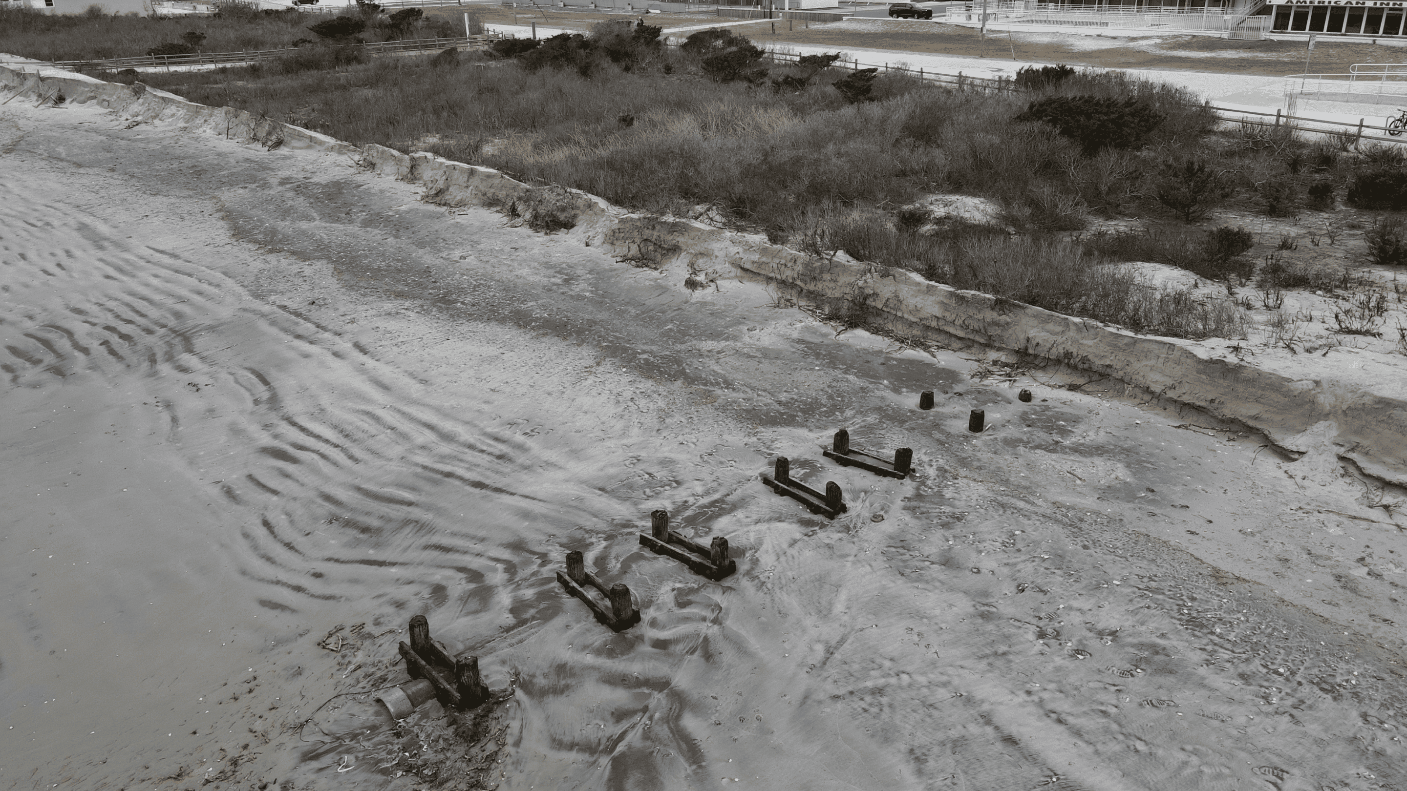
More importantly for our beaches, significant beach erosion is likely and dune breaching is possible.
Anyone who has spent time at the Jersey Shore knows that several days of persistent northeast winds and rough surf can really move a lot of sand around, so this is something we’ll be watching closely.
Conditions offshore will be even worse.
Gale-force winds are expected across the coastal waters, with seas reaching approximately 8 to 15 feet. There is also the potential for storm-force wind gusts over the Atlantic waters Friday through Saturday.
 The Big Question Is What Happens This Weekend
This is where things get interesting.
A low-pressure system is developing off the coast, but forecasters still aren’t completely sure where it will ultimately track.
That track is going to make a huge difference.
If the storm stays closer to the New Jersey coast, we could see significant coastal and marine impacts continue into the weekend, along with additional rain and wind that could reach farther inland.
If it tracks farther out to sea, the impacts would be more limited, although we could still be dealing with lingering tidal flooding — especially in the back bays — along with high seas and gusty winds along the coast.