Tropical Storm Isaias To Bring Heavy Rain And Wind To NJ

Tropical Storm Isaias To Bring Heavy Rain And Wind To NJ
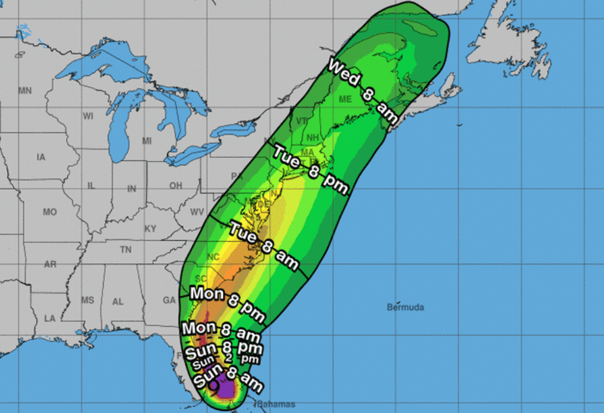
As Tropical Storm Isaias inches further north, we will be bringing you updates on how it will affect our area. This is our second update on Isaias and we will have another update tomorrow (Monday) morning!
According to the National Weather Service, Tropical storm conditions (sustained winds of 39 to 73 mph) are possible, primarily for coastal locations and the adjacent waters, Tuesday into Tuesday night.
Along with the wind, heavy rains totaling 4 inches will lead to flash flooding possible from Monday night through Tuesday night, and is the primary concern with this storm.
Confidence remains high that increased swells and rip current risk along the Delaware and New Jersey coasts will begin to arrive today, Sunday and will continue through at least Wednesday. This would mean keep an eye out for rip currents before and after the storm.
Coastal flooding due primarily to heavy rain, especially around the time of high tide on Tuesday, is also possible especially if the worst of the storm occurs near high tide. Beach erosion could take place during this storm.
A change in the path of this storm, either to the east or to the west, will affect how far inland tropical storm force winds will extend.
Be sure to;
-
Bring in anything that would fly away in high winds.
-
Tie down trash cans (and lids)
-
Move your car to higher grounds (in flooded areas)
