Here is a summary of the weather we will receive here in New Jersey and surrounding areas from March 1st to March 4th
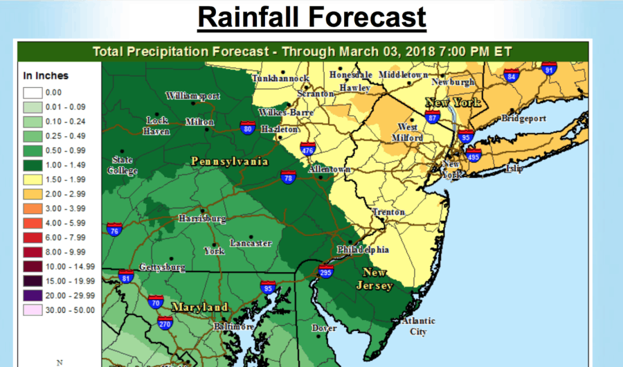
Generally 1 to 2 inches of rain (lesser amounts in Delmarva), with locally higher amounts possible north of I-78.
Urban/poor-drainage flooding, followed by possible stream and river flooding into the weekend.
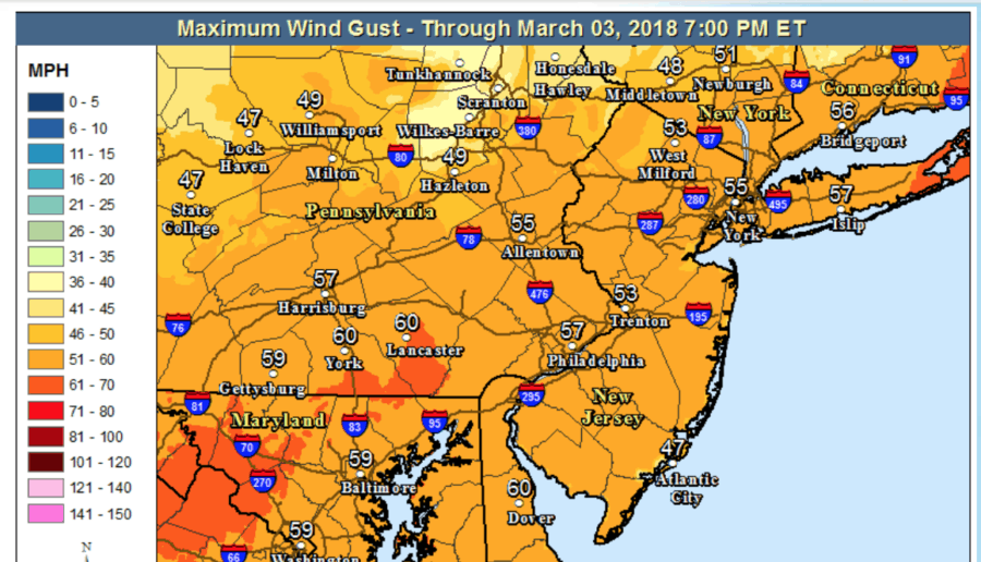
Northwest winds increase rapidly Friday morning to 25 to 35 mph with gusts 50 to 60 mph through Friday evening, before diminishing Friday night and Saturday. Downed trees and power lines are expected, especially given the saturated ground.
Rain changes over to heavy snow in the Poconos and northwest NJ Friday morning with hazardous conditions. Changeover to snow will gradually spread southeast into the Lehigh Valley and northern New Jersey during Friday before ending later Friday night. Strong winds will create whiteout conditions at times in falling snow.
Minor to locally moderate coastal flooding on the New Jersey coast during high tide Friday, with moderate (spotty major flooding possible Saturday morning) on the NJ/DE Atlantic coast and the coast of Delaware Bay Saturday. Beach erosion expected Friday through Saturday.
Dangerous winds and seas on the NJ/DE Coastal Waters including Delaware Bay
Make sure you keep checking back to our page as we will have updates, live streams and other information for you!