It’s only been days since our last snowfall and yet again according to the National Weather Service we are expecting starting tomorrow.
NJ + PA Winter Storm Warning Details
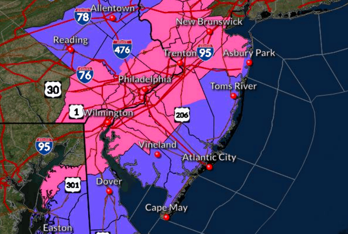
Currently the state of New Jersey and parts of Pennsylvania have snow warnings and snow advisories.Let’s break down most recent news brief detailed.
According to the National Weather Service Mount Holly, afast moving coastal low will bring impacts to our region starting early Sunday morning through Sunday afternoon.
Snow rates of 1 to 2 inches per hour are possible in the heaviest snow bands on Sunday morning, which may create treacherous traveling conditions quickly.
Snow Amounts
Near the Interstate 95 corridor, heavy snow and amounts of 4 to 7 inches is possible. Locally higher amounts will be possible along a narrow corridor where banding sets up.
For the Lehigh Valley, Berks County, southern Poconos, and far northwest New Jersey, snow amounts up to 5 inches are possible.
In coastal portions of southern New Jersey and Delaware, a wintry mix is possible, but significant snow accumulations are not expected.
Winds
Winds near gale force are possible on the Atlantic coastal waters adjacent to Delaware, Delaware Bay, and southern New Jersey on Sunday
Flooding
Significant coastal flooding is not expected with this system.
Tune back later for more details
Check out these other Wildwood Videos and articles