Tropical Storm Isaias has regained hurricane strength just before it hit the Carolinas. This hurricane will drop in speed by the time it hits out area and become a tropical storm.We will be up all night monitoring it and keeping you informed.
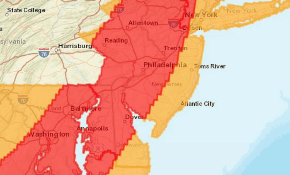
As per the National Weather Center, A Tropical Storm Warning continues for areas along and southeast of the I-95 corridor and northwest New Jersey with the greatest impacts expected early Tuesday morning into Tuesday evening.
There are two primary concerns with Isaias, including heavy rain leading to flash flooding and strong to damaging winds. Stream flooding and some river flooding is possible, but flooding is not expected along the main stem of the Delaware River.
The most likely time of arrival of tropical storm force winds along and southeast of I-95 is mid to late Tuesday morning. However, this area could see Tropical Storm Force Winds as early as daybreak Tuesday.
Rainfall forecasts for New Jersey has decreased to 2-4 inches of rain. Philadelphia could see up to 6 inches of rain.
There is a potential for 1 to 3 feet of storm surge inundation for shore towns. This could create beach erosion. Increased swells and rip current risk will continue along the coast through at least Wednesday.